
New forecast maps show a large area of England is set for snow on December 25th with flakes settling across much of the north
23:46, 11 Dec 2025Updated 01:11, 12 Dec 2025
 The UK is set to see snow over Christmas(Image: PA)
Brits are set for a white Christmas in some areas, according to latest weather charts, with nine counties in England, as well as parts of Scotland, facing a -4C Arctic blast.
The normal interpretation of a white Christmas is whether there is any snow in the UK at all – quite a low bar – but the last time every weather station reported snow was in 2010. This year there does look like there will be a significant amount of snow falling but it is unlikely to be as widespread as 15 years ago.
Through most of December there are low pressure systems in control bringing unsettled conditions in from the Atlantic. It means that there is plenty of wind and rain in the run up to Christmas and some cold spells where it meets cold Arctic air.
READ MORE: Russia could invade other European countries within five years, Nato chief warnsREAD MORE: Ryanair plane smashes into Stansted Airport fence with 181 passengers onboard
Latest WXCharts show that, on Christmas Day there will be a high pressure system over the north of the UK, set to bring icy conditions. The nine English counties currently set to see snow by midday on December 25th are Yorkshire, Lincolnshire, Essex, Cambridgeshire, Durham, Northumberland, Derbyshire, Cumbria, and Lancashire, according to the new charts.
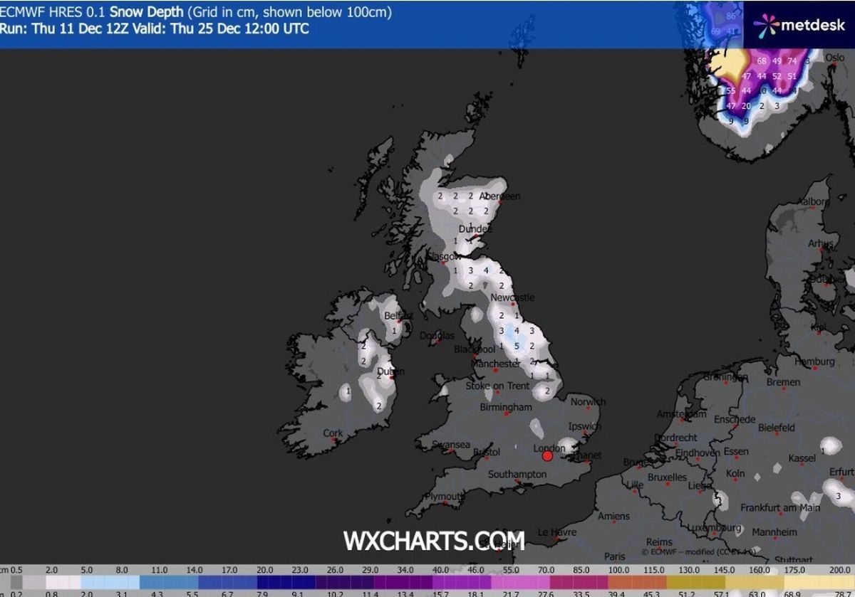 WXCharts latest forecast for midday on Christmas Day shows snow(Image: WX CHARTS)
The vast majority of Scotland is also set to see snow, with only the north and west of the country missing out. At midday on December 25 most of Scotland is expected to be below zero with -4C in the east of the country. In northern England it could drop to -3C and be similarly cold in Wales while the mildest parts of the country will be in the south of the UK, though temperatures will be still close to zero.
The Met Office long range forecast for between December 16 and 25 states: “Unsettled at first with spells of rain affecting the UK at times. Some heavy rain is possible anywhere, but it is likely to be heaviest and most persistent in the west and northwest, with sheltered parts of the east and southeast typically drier. Any snow will probably be confined to high ground in the north.
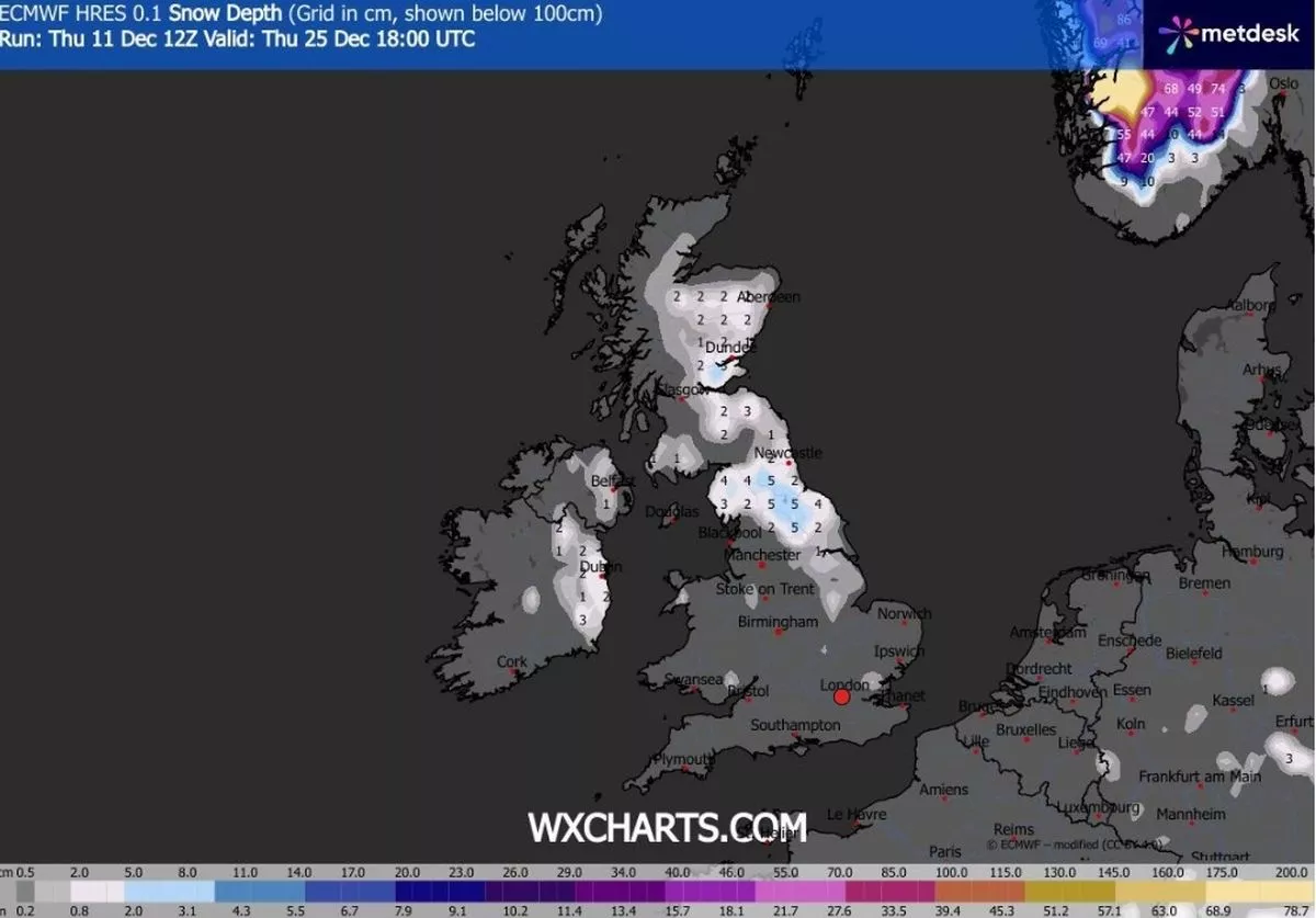 The WXCharts forecast for Christmas Day at 6pm(Image: WX CHARTS)
“Strong winds are possible at times with a risk of gales, especially along coasts and over higher ground. Temperatures are likely to be above normal overall. Later in the period, conditions may start to become a little more settled, with rainfall amounts decreasing and drier weather becoming more prevalent, especially in the south. This may mean an increasing amount of overnight fog and frost.”