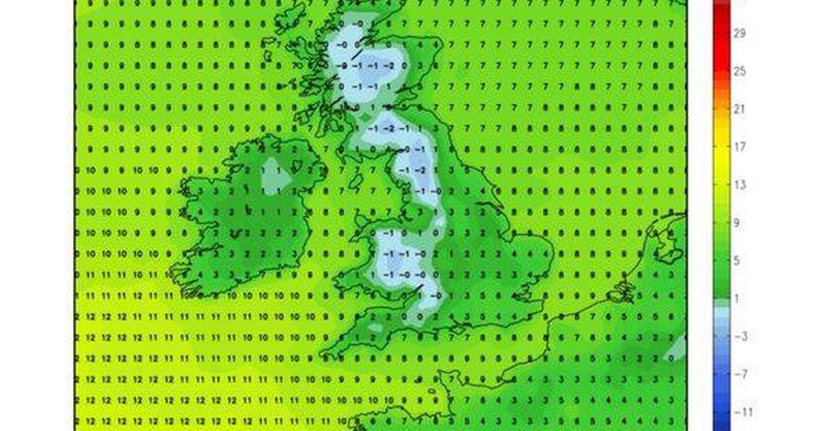
This weekend the heat is expected to give way to subzero temperatures, including in the West Midlands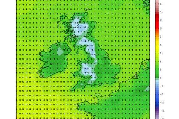 Temperatures are set to plunge on Monday(Image: (Image: WXCharts))
This week’s unexpected mini-heatwave could be followed by a return to chilly and wintry conditions across the UK, according to new weather maps.
Parts of Britain are predicted to hit 28C on Wednesday, April 30, as a scorching mini-heatwave takes hold – but keen sun-lovers may have to put their sunglasses away next week, as subzero temperatures make a comeback.
In a dramatic temperature drop, regions including West Midlands, will see temperatures plunge from the high 20s to potentially below 0C on Monday, May 5.
Read more: Birmingham bins strike latest
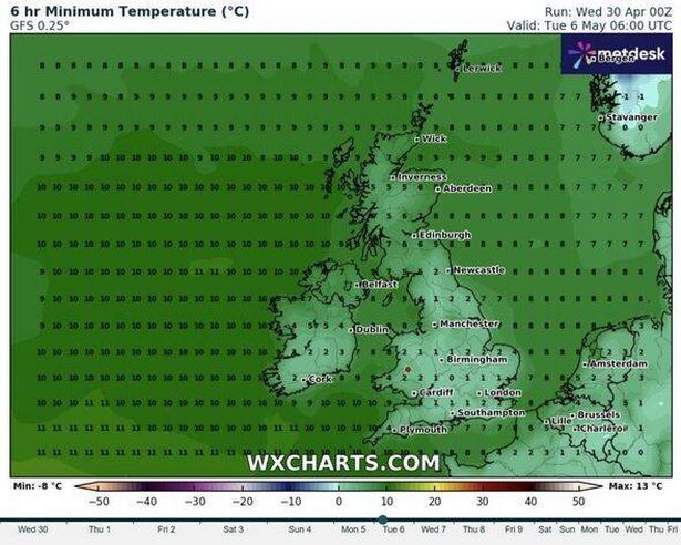
Other areas could experience average temperatures of between 0C and 3C, as per maps from WXCharts using MetDesk Data. The stark shift in climate will persist into next week, with most of England hovering around the 1C mark on Tuesday, May 6 – although parts of Scotland could climb to 6C at around the same time.
A large band of rain is also predicted to sweep across north western England, Northern Ireland and the northernmost tip of Scotland by 6am on May 6.
The easterly weather front will continue to lash parts of the northern coast until midday, with drizzle across the UK and sporadic snow in Scotland expected for the remainder of the week, reports the Express.
The return to cold and rainy weather will signify a dramatic shift from the unseasonal highs experienced by most of Britain this week. The Met Office confirmed that Tuesday, April 29, was the hottest day of the year so far after temperatures hit 24.7C in London.
The weather expert has indicated a drop in temperatures starting Friday, with the early part of May shrouded in “uncertainty” due to an approaching low-pressure system from the south.
The Met Office’s outlook for the next five days is as follows:.
 The low temperatures are likely to continue into next week(Image: (Image: WXCharts))
The country can expect very warm conditions with plenty of sunshine. Scotland and Northern Ireland may experience scattered showers amidst the sunny spells.
Britain is set to enjoy more sun and dryness, with a slight chance of mist patches forming at daybreak. The north could see some scattered rain.
Most regions will bask in another warm and radiant day, although they should brace for a heightened prospect of afternoon thunderstorms. A cooldown is on the horizon for northern locales.
Come Friday, thunderous showers could strike, yet the forecast for most areas remains predominantly dry and luminous. Temperatures are poised to descend by up to 10 degrees Celsius, aligning with the seasonal norm over the weekend.