A new snow forecast for the UK shows almost half of England is set for significant snowfall along with the majority of Wales, Scotland and Northern Ireland
22:30, 24 Dec 2025Updated 22:32, 24 Dec 2025
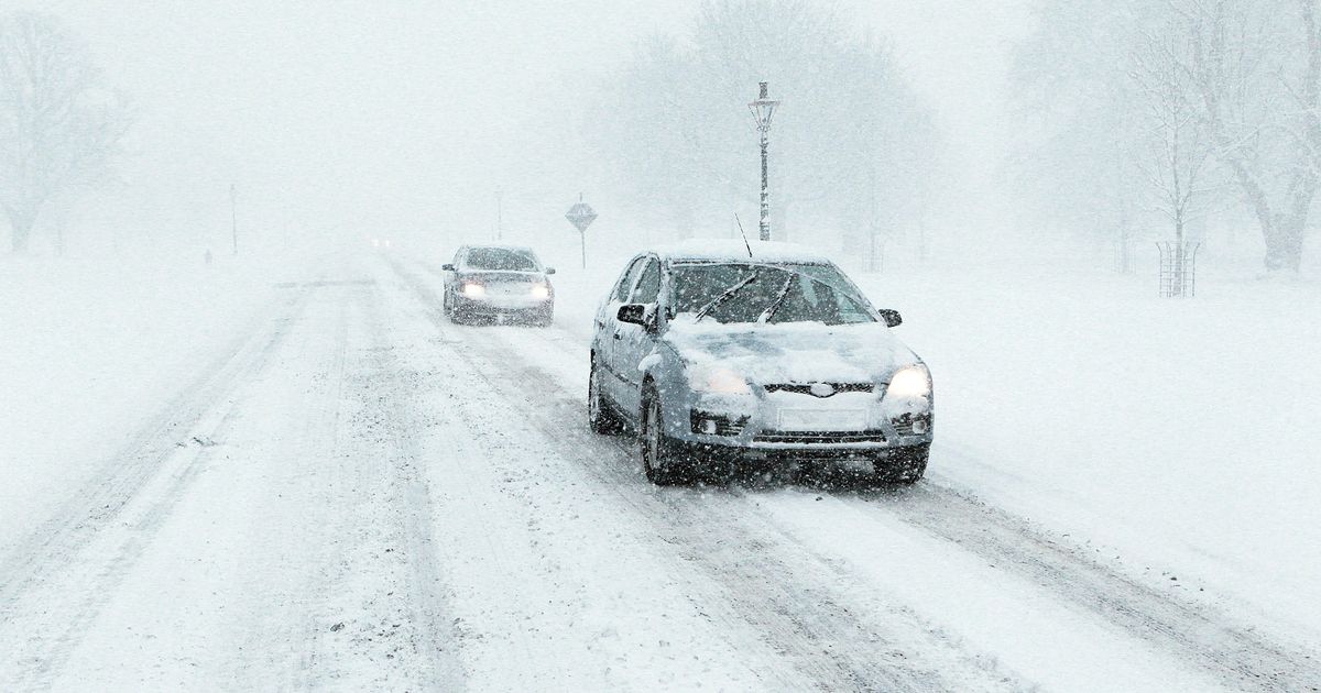
 Snow is set to bury parts of the UK, according to a new forecast(Image: PA)
Blizzards are set to sweep across England in days with significant amounts of snow due to settle, a new forecast shows.
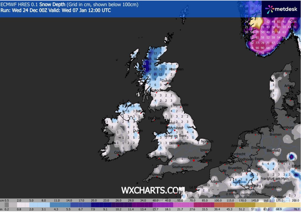
New maps from WXCharts, generated on December 24 using Met Desk data, show huge swathes of the country as well as the majority of Wales, Scotland and Northern Ireland are set for snow by noon on Wednesday, January 7.
Snow will start to fall in England from around 6am on Tuesday, January 6, with blizzards gradually spreading out across the country until at least the night of Thursday, January 8.
Regions set to be hit include North West England, North East England, Yorkshire and the Humber, West Midlands and East Midlands, with the South West and South East set for smaller flurries.
According to the maps, the largest amount of snow is set to settle to the west of Manchester where up to 8 inches of snow is forecast to have arrived by noon on Wednesday, January 7.
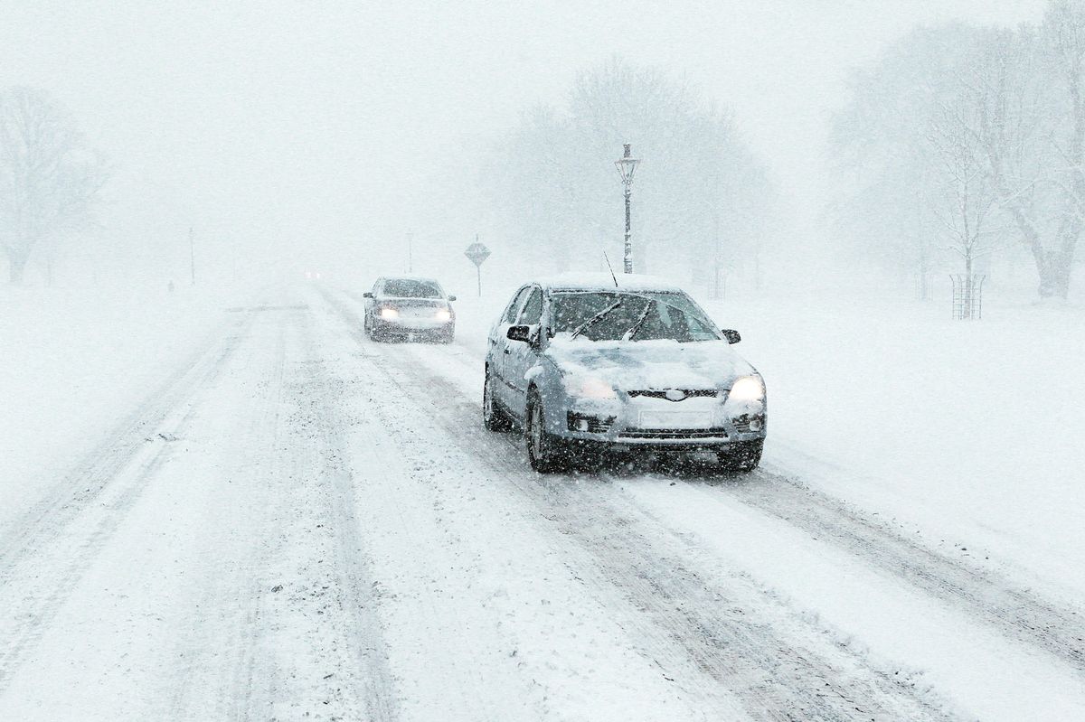
 The latest forecast from WXCharts shows blizzards are set to hit the UK in January
Also set for a significant amount is the Humber Estuary to the west of Hull where up to 7 inches is expected. Further north at this time, the North West of Scotland is forecast to be buried under up to 22 inches.
The worst of the snow in Northern Ireland will be in the north while, in Wales, the Aberystwyth area, could see up to 5 inches by noon on Wednesday, January 7, according to WXCharts.
The Met Office long range forecast for the period from Monday, December 29, to Wednesday, January 7, says: “High pressure is likely to dominate across the UK through to the end of the year, centred to the west over the North Atlantic. This will likely maintain relatively settled conditions at first, but with a few showers possible along some coasts exposed to the northerly wind.
“Towards the first weekend of January, high pressure is likely to shift a little farther away from the UK, allowing a greater chance of more changeable conditions to develop.
“This will bring an increased risk of some rain or showers at times which, with cold air close to the UK, may bring some wintry hazards to some places. Temperatures will probably be near or slightly below average for this period overall.”