New weather maps show Scotland will be hit by heavy snowfall on January 8, with up to one inch per hour falling across a 713-mile strip spanning major UK cities.Liam Doyle and Ambarish Awale Trainee Trends, Showbiz and Lifestyle Writer
22:50, 26 Dec 2025
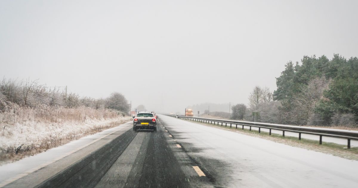
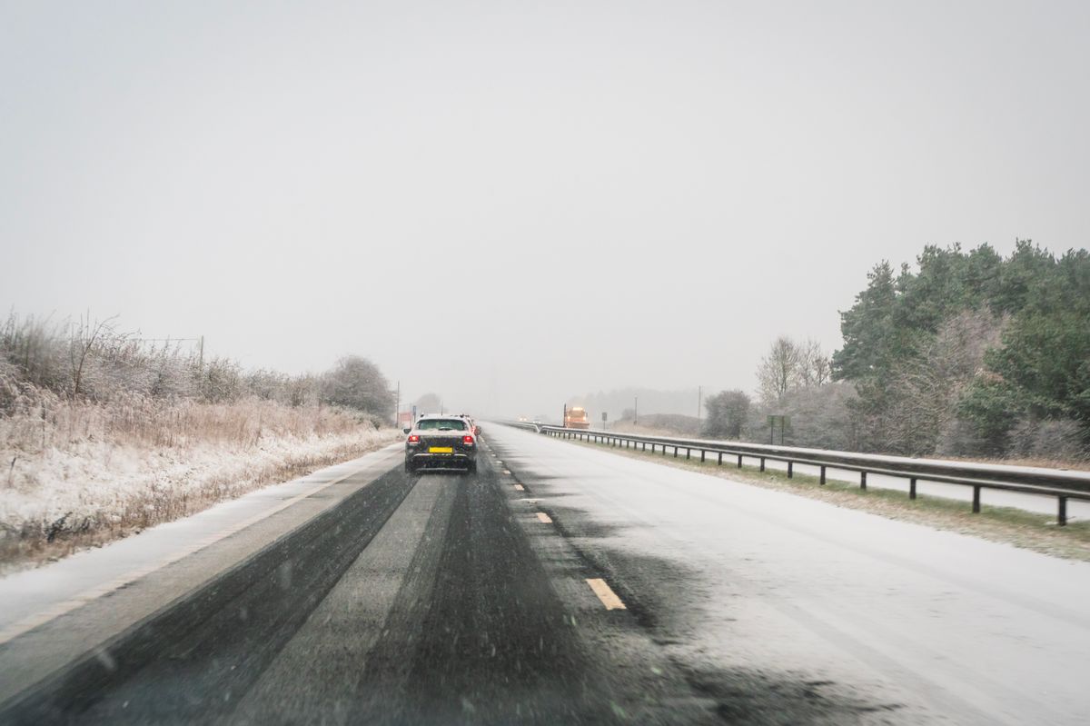 New weather maps show Scotland facing a severe cold snap, with heavy snow and ice expected to hit multiple regions as the New Year begins.(Image: Getty Images)
New weather maps have revealed a colossal, nationwide snow bomb set to unleash flurries of up to an inch per hour in various cities across Scotland.
The previously mild weather of December has come to an end, giving way to biting cold in certain parts of the country that have left several regions in the grip of a severe freeze. This is expected to intensify in the new year, according to the latest weather maps, which depict a potentially harsh mix of snow and ice for Scots.
Millions living in a 713-mile stretch across the entire UK will greet the first significant snowfall of 2026 early on, and they could be blanketed in settled totals of more than an inch.
Maps from Ventusky, a weather charting service that utilises public datasets from major organisations like the National Oceanic and Atmospheric Administration (NOAA) and DWD (German Weather Service), show the UK and rest of Europe being hit hard on January 8 next year.
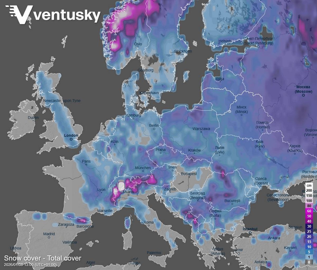 Ventusky charts show the UK and much of Europe are set to be hit by widespread heavy snowfall at the same time.(Image: Ventusky)
The heavy snowfall appears set to commence in the early afternoon around 1.30pm, and deposit between 1cm and 5cm across the wide several-hundred-mile area, reports the Mirror.
The snow extends from Eastbourne on England’s south coast to Mellon Udrigle on the Scottish northeast coast, with the most substantial snow impacting areas on the western end of the stretch. These areas include major cities like London, Oxford, Reading, Birmingham, Manchester, and Glasgow, as well as the entirety of the Lake District National Park.
Residents in communities surrounding those regions look set to experience approximately 2.5cm to 3cm of snowfall every hour, amounting to roughly an inch throughout the afternoon.
Simultaneously, charts from WXCharts indicate a harsh chill moving in, with minimum temperatures hitting 0C in the snowfall zone and maximums reaching just 5C.
The Ventusky charts reveal the UK will be affected by broadly widespread snowfall across Europe, with the remainder of the continent blanketed in heavy snowfall at the same time.
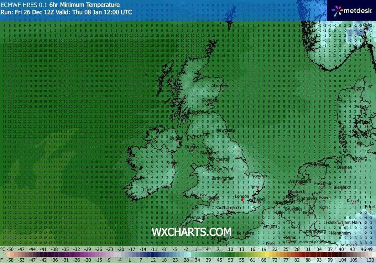 WXCharts show a sharp cold snap, with temperatures dropping to 0C in snowfall areas and highs of just 5C.(Image: WXCharts)
The majority of other European countries will witness a comparable amount of snow, with mountainous regions receiving up to 200cm – an enormous six feet.
Whilst the Ventusky forecast anticipates substantial snowfall for the UK, the Met Office, Britain’s official forecaster, makes no mention of approaching wintry conditions beyond “colder and drier” weather.
The outlook, which spans December 31 to January 9, explains: “High pressure is likely to be centred to the west or northwest over the North Atlantic through this period with low pressure to the east.
“Slowly evolving weather patterns are therefore most probable through this time.
“However, around the turn of the year, an area of low pressure may move through the North Sea bringing a period of wetter and windier weather, especially to the north. With cold air close to the UK, some wintry hazards are possible in places.
“Into January more settled conditions with colder and drier than average conditions are most probable.
“There will however be some periods of rain or showers and windier spells. Temperatures will probably be below average for this period overall and so wintry hazards remain a possibility in places.”