After a calm spell of weather over Christmas, the New Year is bringing a change with wintry hazards in the forecast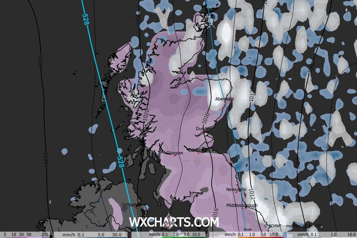 Weather maps show Scotland covered in snow in the New Year(Image: WXCharts)
Scotland is set to experience five days of snow in the New Year as the recent benign conditions are edged out. Scots have enjoyed cool but calm conditions over the Christmas period.
And while that is set to continue for the remainder of 2025, the start of 2026 will see a change. Weather charts from WXCharts show snow showers developing over northern parts from January 1, with the chance of snow as far south as Fife.
January 2 will bring heavy snow to the northeast, including Aberdeen, on January 2, if the maps are correct. More snow is forecast across the Highlands, with heavy snow in the northwest coast.
Snow showers are forecast to continue over the weekend, moving into southern parts and on Monday, January 5, Glasgow is set to see snow fall, according to the maps. Much of the country could see snow cover, with Edinburgh also covered.
READ MORE: Why is Scotland getting sunnier as Met Office offers possible explanation for long-term trend
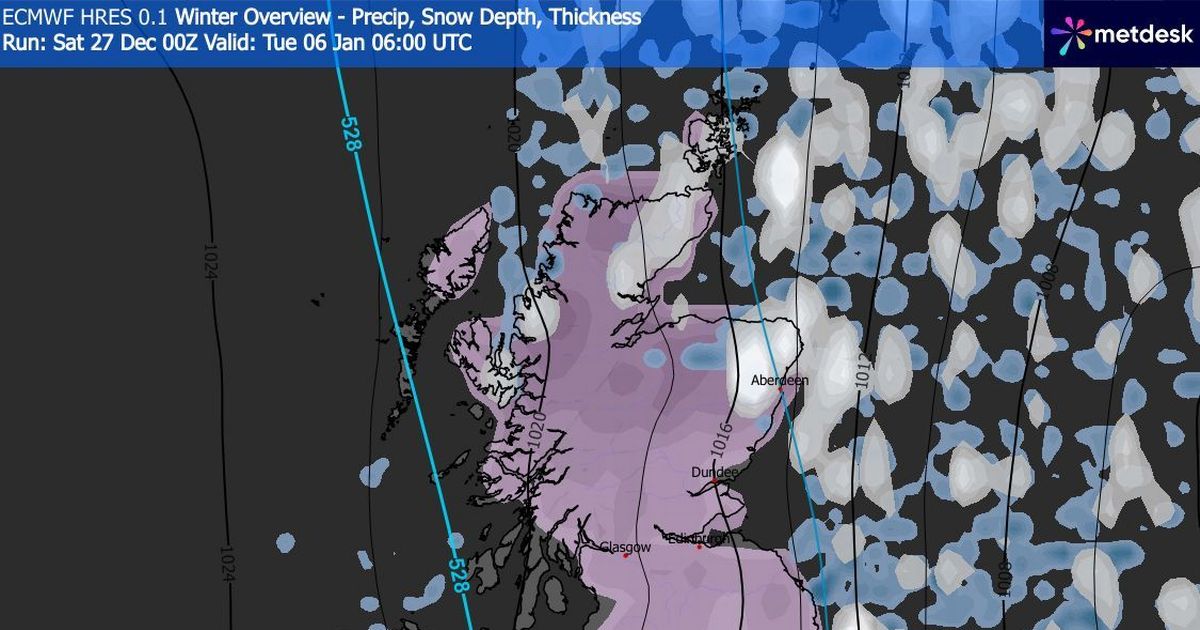
By Tuesday, January 6, WXCharts shows all but isolated parts of the west coast blanketed by snow. Temperatures could dip to a bone-chilling -8C in the Cairngorms over the period, with -6C also possible in parts of the Highlands.
Even in Lanarkshire, the mercury could fall to -5C while Glasgow and Edinburgh will see -2C on January 5. The usually cautious Met Office also does not rule out the possibility of wintry hazards over the New Year period.
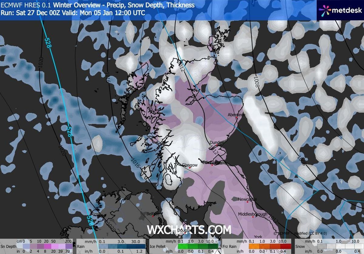 Glasgow will experience snow on January 5, according to WXCharts
Its long-range forecast for the period between Wednesday, January 31 and Friday, January 9 says that “slowly evolving weather patterns” are “most probable through this time” with high pressure to the west or northwest, and low pressure to the east.
At the turn of the year, an “area of low pressure may move through the North Sea bringing a period of wetter and windier weather, especially to the north”. It adds: “With cold air close to the UK, some wintry hazards are possible in places.
“Into January more settled conditions with colder and drier than average conditions are most probable. There will however be some periods of rain or showers and windier spells. Temperatures will probably be below average for this period overall and so wintry hazards remain a possibility in places.”
For more news, follow us on Facebook and X but never miss the latest top headlines and sign up to our daily newsletter here.