Met Office said the yellow warning for snow and ice meant “frequent and heavy snow showers may lead to some travel disruption”.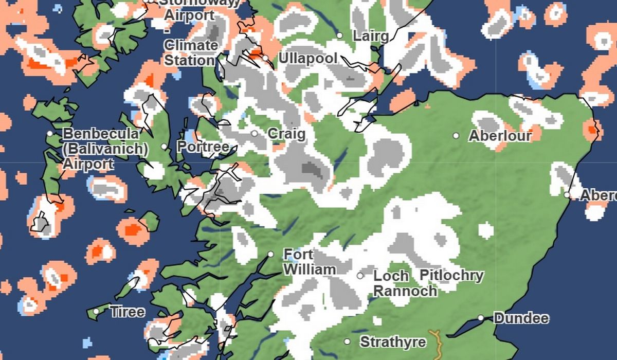 UK snow maps show England turning white as 30cm flurries bury Britain
Heavy snow showers are on the way across parts of the UK, according to Met Office snow maps. The Met Office said the yellow warning for snow and ice meant “frequent and heavy snow showers may lead to some travel disruption”.
By Friday morning, the Met Office is predicting 2-5cm of snow, with 10cm in certain local areas and 10-20cm in some areas above 200 metres. 30cm could hit through the period, the forecaster adds.
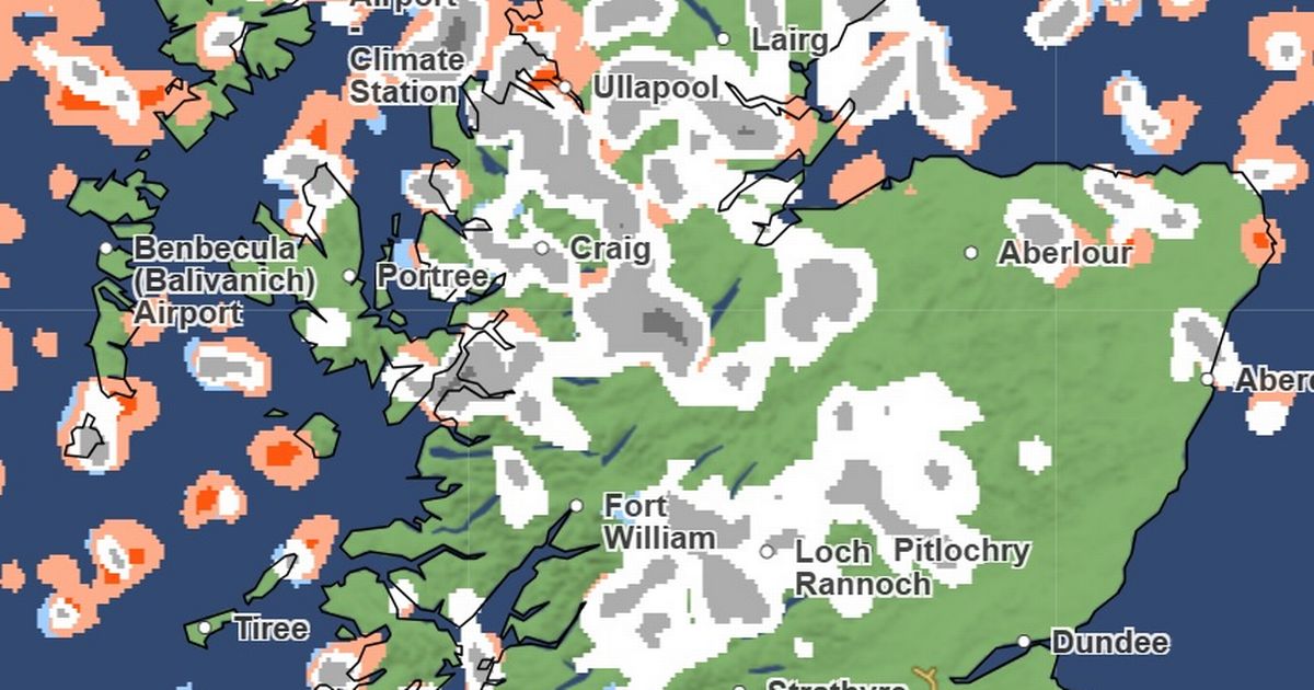
That is 12 inches of the white stuff. Maps and charts from the Met Office snow swathes of the Highlands, and northern Scotland, hit with snow on New Year’s Eve on December 31.
READ MORE New £12,000 cash ISA cap could leave savers £300,000 better off
Maps show Ullapool, Fort William, Loch Rannoch, Pitlochry, Aberlouf, Aberdeen, Portree, Craig, Stornoway and Wick all covered in the white stuff.
In northern England, isolated parts of Greater Manchester and Lancashire – most notably Blackburn, Blackpool, Preston and Bolton – also face a dusting.
North Walws will also be hit on January 1 and into January 2. Colwyn Bay and Bala look most at risk. There could also be flurries in Ballymena, Belfast and Cookstown in Northern Ireland, as well as Stranraer in Scotland, Newton Stuart in Scotland and Kendal in England.
The Met Office forecast from January 2 onwards explains: “Cold northerly winds, initially across Scotland are now expected to become dominant across the whole UK in the first week of January.
“These will bring wintry showers (often of snow) to many coastlines (and areas just inland of these) that are exposed to onshore winds.
“Subtle day-to-day changes in wind direction from northeast to northwest will change the places most exposed to the showers, but many inland locations across central and southern areas will remain mostly dry but cold.
“There are likely to be some more coherent bands of rain, sleet and snow working south, and these may bring a risk of more prolonged wintry precipitation affecting some inland areas.
“Towards the second half of this period, slightly milder conditions will attempt to move in from the west.”