The Met Office has warned that weather warnings could be issued as a cold start to the New Year is expected to bring snow to Wales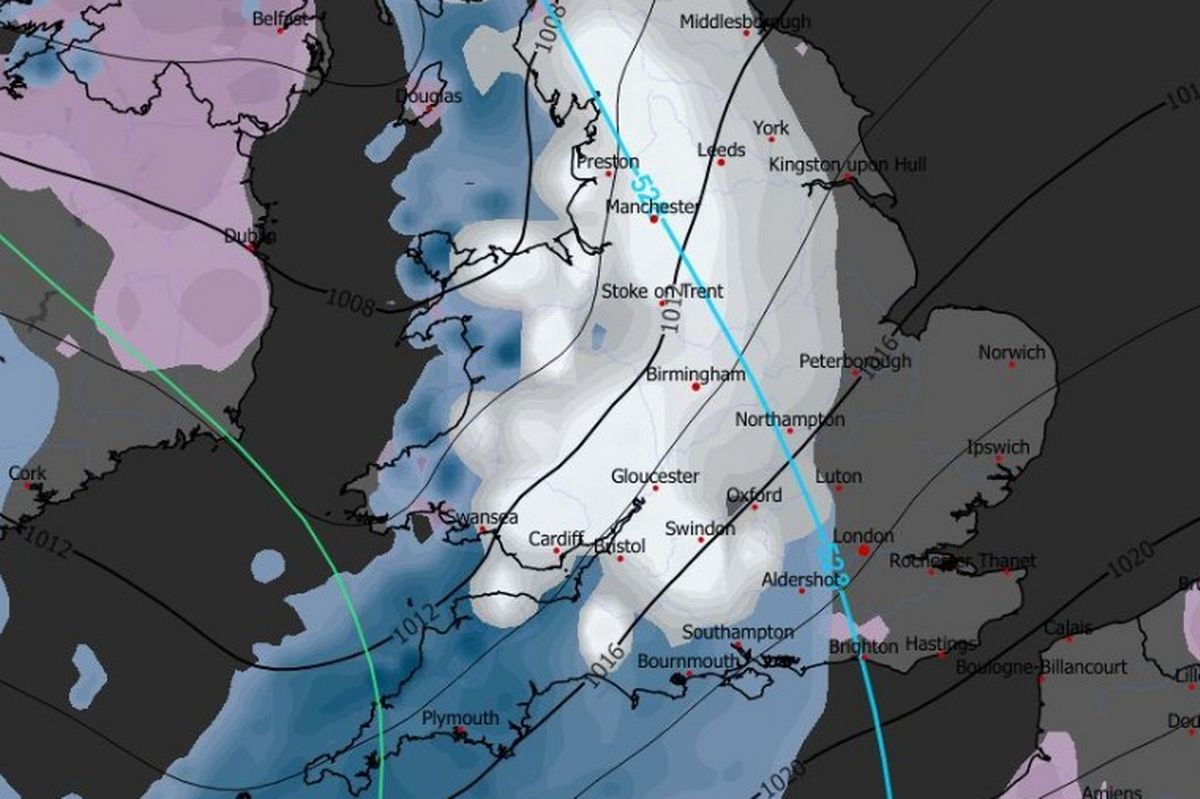 A cold start to the New Year is set to bring snow to Wales(Image: WX Charts )
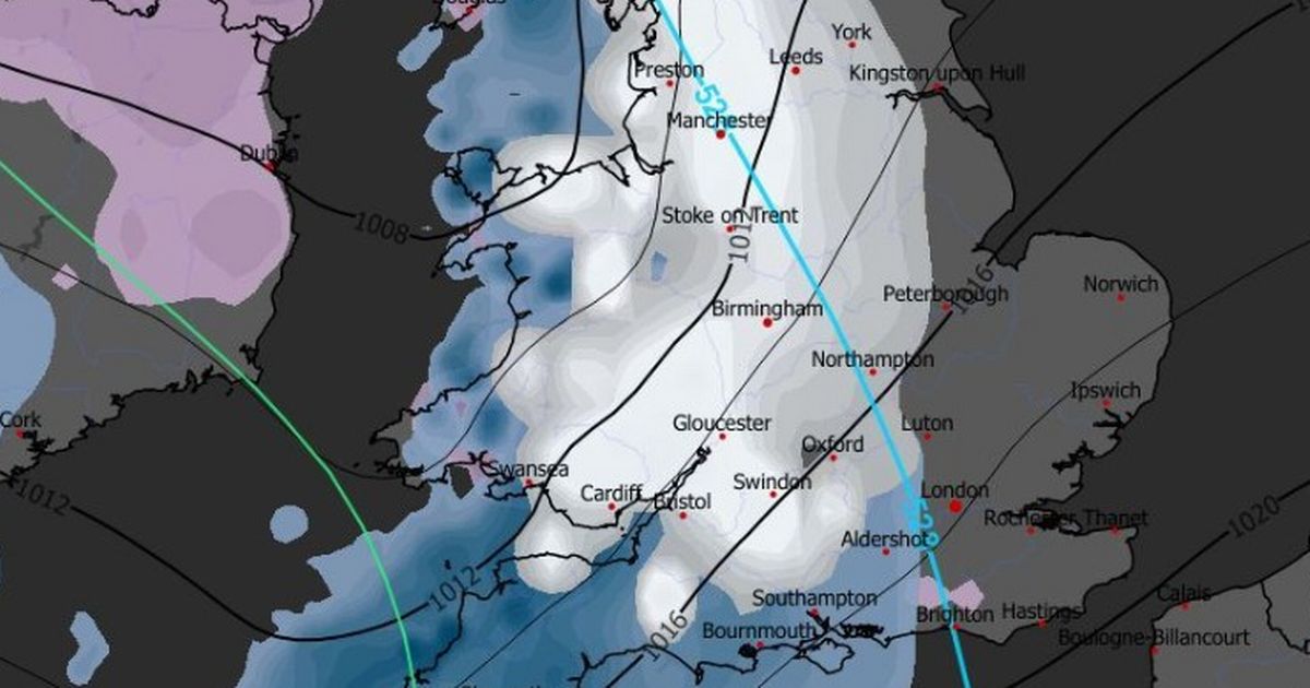
Wales is likely to see snowfall this weekend, with temperatures set to drop even further as we head into the New Year. Forecasters have warned that there is a significant risk that many parts of Wales could see “snow showers” on Saturday, January 3 and Sunday, January 4.
According to the Met Office, arctic air will bring very cold conditions to the UK for the first week of 2026, making wintry and snow showers likely. The weather agency issued a yellow snow and ice warning for Scotland and has warned that it’s likely more areas will see weather warnings as we head into the new year.
Weather maps reveal that snow flurries are forecast across multiple parts of Wales this weekend.
Met Office Deputy Chief Forecaster Mark Sidaway said: “It certainly looks like we are in for a taste of ‘winter’ as we welcome in the New Year, initially in the north, but more widely across the UK for the first week of 2026.
“Arctic air and strong northerly winds will bring cold or very cold conditions to all parts of the UK, and it will feel especially cold in the strong winds. Widespread and locally severe frosts are expected, along with the first snow of the winter for many.
“A yellow warning for snow and ice has been issued for northern Scotland on New Year’s Day and beyond, where frequent and heavy snow showers may lead to some travel disruption.
“These colder conditions and wintry hazards – snow, ice and strong winds – will develop more widely as we enter the New Year, with more warnings for snow and ice likely. It looks like this cold spell will last through at least the first week of January, so it’s important people keep up to date with the latest forecast and warnings.”
Here are the Met Office weather maps which show the parts of Wales set to see snow this weekend:
Friday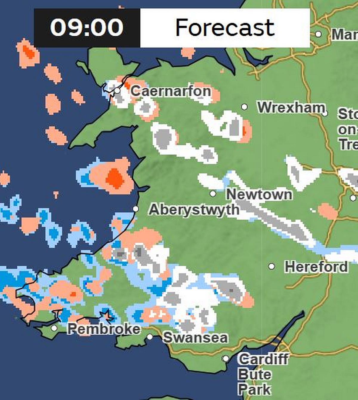 (Image: Met Office)
The first flurries of snow are expected to fall overnight on Friday and into the morning. Snowfall is forecast in south and north Wales, before turning into rain showers for the rest of the day.
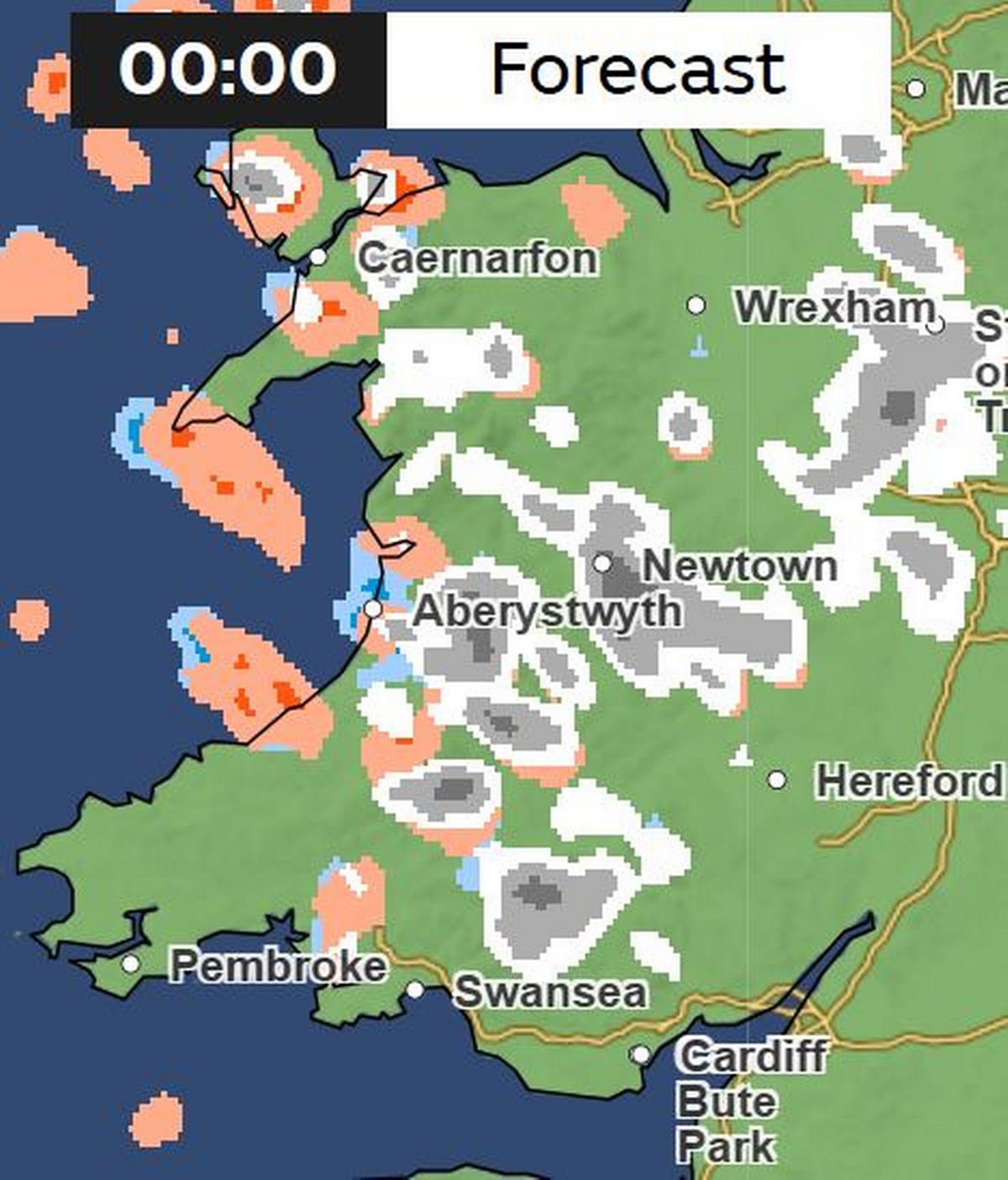
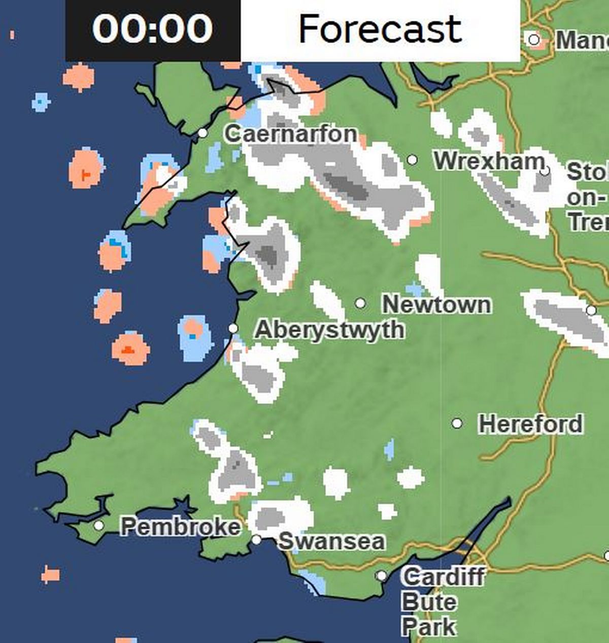
Saturday
Midnight
 (Image: Met Office)
Snow showers are expected to ramp up from midnight on Saturday. According to Met Office weather maps, some areas will see more than 4mm of snow fall in an hour.
3am
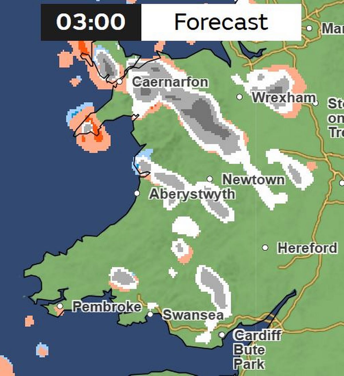 (Image: Met Office)
North Wales will see some heavy showers overnight. For the biggest stories in Wales first, sign up to our daily newsletter here
9am
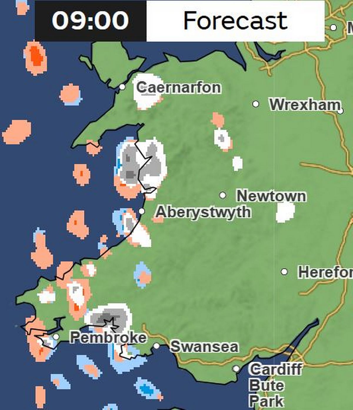 (Image: Met Office )
Widespread snow showers will have eased by the time many wake up on Saturday morning, but there will still be some flurries on the west coast.
3pm
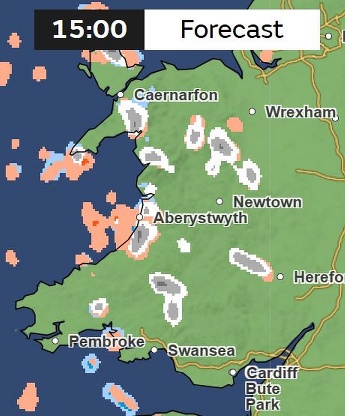 (Image: Met Office )
This is the picture at 3pm on Saturday. The Met Office forecast for Wales this weekend states: “Turning colder, especially in the wind, with the increased risk of wintry showers into the weekend. Frost and ice overnight.”
9pm
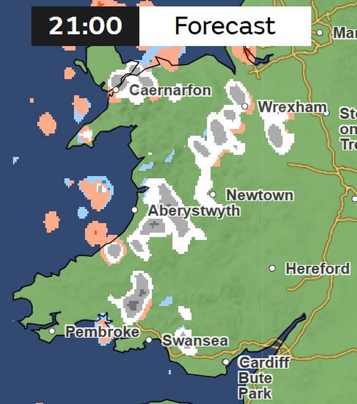 (Image: Met Office )
There will be more snow as temperatures drop on Saturday evening.
Sunday
Midnight
 (Image: Met Office )
There will be more snow showers overnight on Sunday.
3am
(Image: Met Office)
The Met Office has warned that colder conditions and wintry hazards , including snow and ice, will develop more widely as we enter the New Year.
Get daily breaking news updates on your phone by joining our WhatsApp community here. We occasionally treat members to special offers, promotions and ads from us and our partners. See our Privacy Notice