The Met Office has warned that ‘snow flurries’ forecast at the end of the week could cause disruption throughout Wales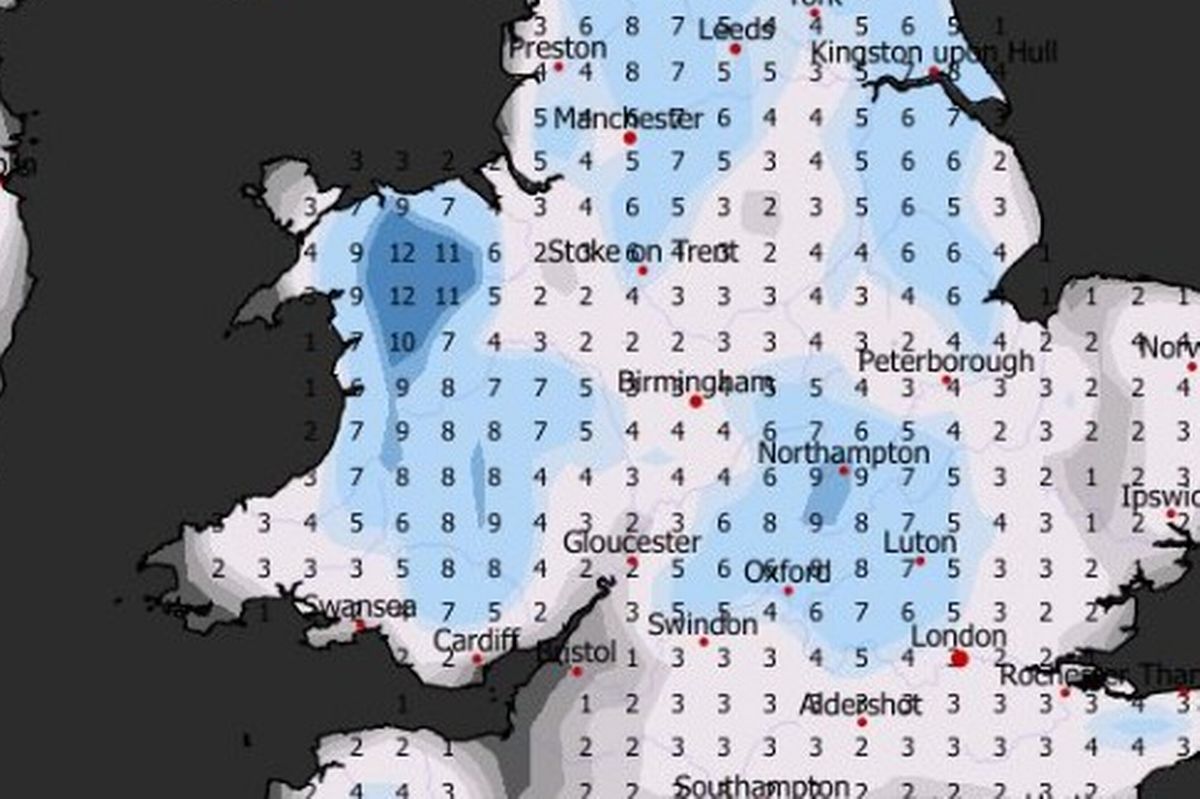 A Met Office yellow snow and ice warning has been issued for Wales(Image: WX Charts)
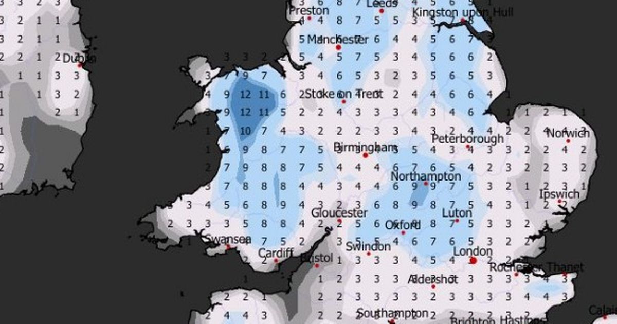
Wales is set to be in for a cold and snowy start to the New Year with snow flurries forecast for many parts of the country as we head into the weekend. The Met Office has issued a 12-hour yellow weather warning for snow and ice affecting 15 parts of Wales on Friday, January 2.
Forecasters expect there to be a marked drop in temperatures in the coming days, along with an increased risk of snow and ice, as Arctic air pushes downwards across the UK. This will result in “a prolonged spell of very cold weather” as we head into the New Year, the Met Office said.
The yellow snow warning for Wales comes into force at midnight on Friday and remains in place until midday. The Met Office warn that “snow flurries” could last for two to three hours in some areas, resulting in up to 5cm settling on the ground.
The areas affected by the warning are: Blaenau Gwent, Caerphilly, Carmarthenshire, Ceredigion, Conwy, Denbighshire, Flintshire, Gwynedd, Merthyr Tydfil, Monmouthshire, Newport, Powys, Rhondda Cynon Taf, Torfaen and Wrexham.
Chief meteorologist at the Met Office Jason Kelly said: “We’re entering a much colder period with Arctic air sinking south to cover the whole country by Friday. Temperatures will fall well below average, with snow showers and snow accumulations likely, particularly in northern and some central areas. There is also a risk of widespread ice.
“Very cold temperatures will continue through Saturday and Sunday, with minus double figures overnight and daytime temperatures not rising above 0°C for many areas.
“Wintry hazards will continue, with more severe weather warnings possible. It looks like this cold spell could last well into next week, so it is important people keep up to date with the latest forecast and warnings and plan ahead.”
Here are the Met Office weather maps which show the parts of Wales which will see snow during the weather warning:
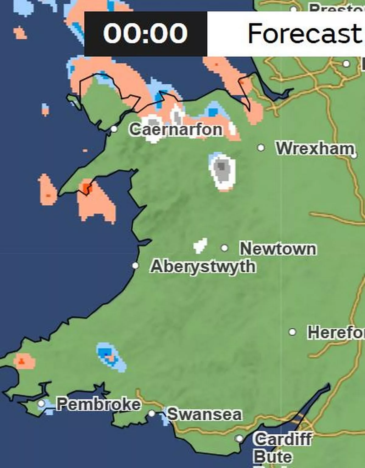
Friday, January 2
Midnight
 (Image: Met Office)
When the yellow snow warning comes into force at midnight, there will be some snow in north Wales.
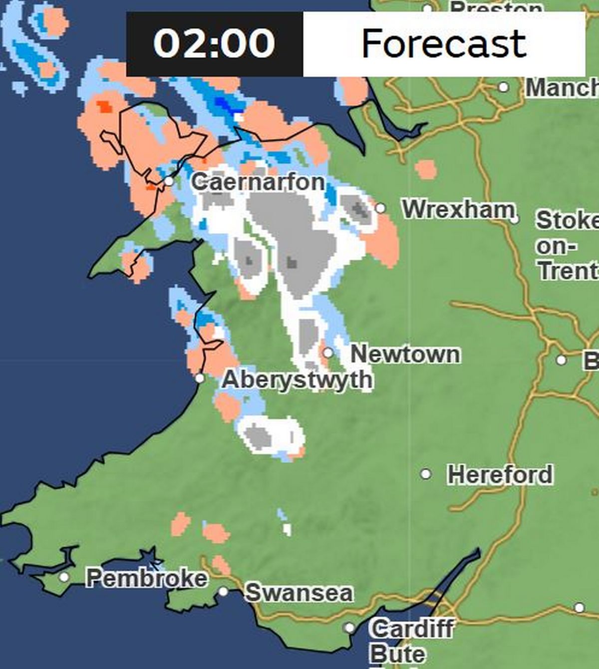
2am
 (Image: Met Office )
More areas of Wales will see snow as the night goes on. For the biggest stories in Wales first, sign up to our daily newsletter here
4am
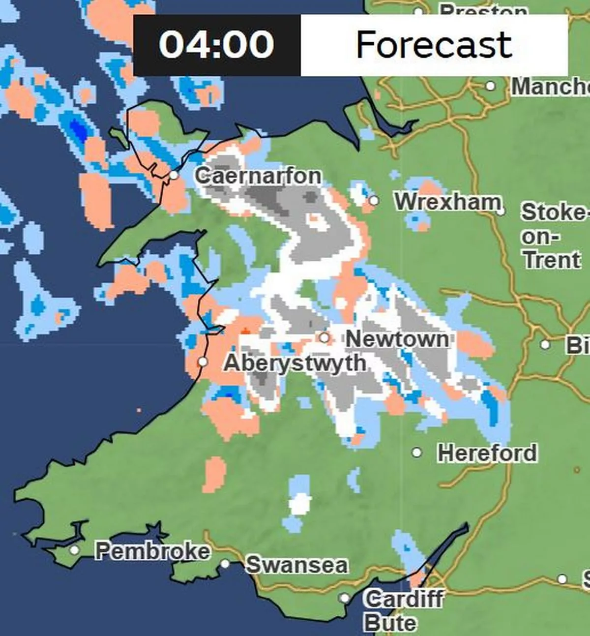 (Image: Met Office)
There will also be hail (shown in orange) and some rain showers (shown in blue).
6am
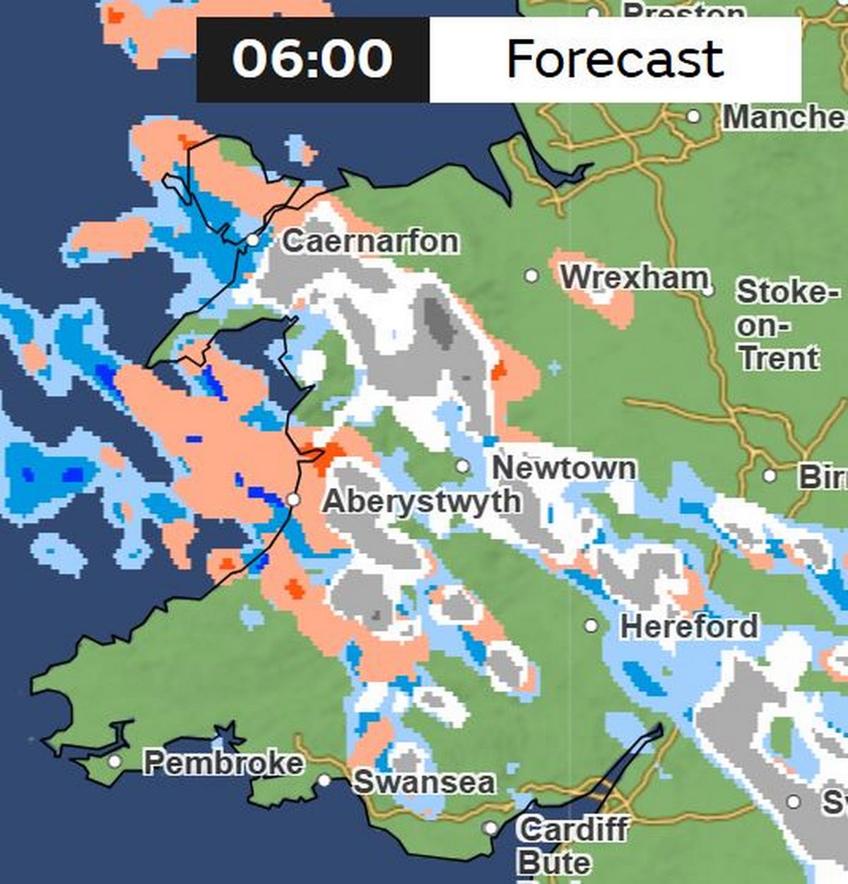 (Image: Met Office)
By 6am, many parts of Wales will see snow flurries and wintry showers.
8am
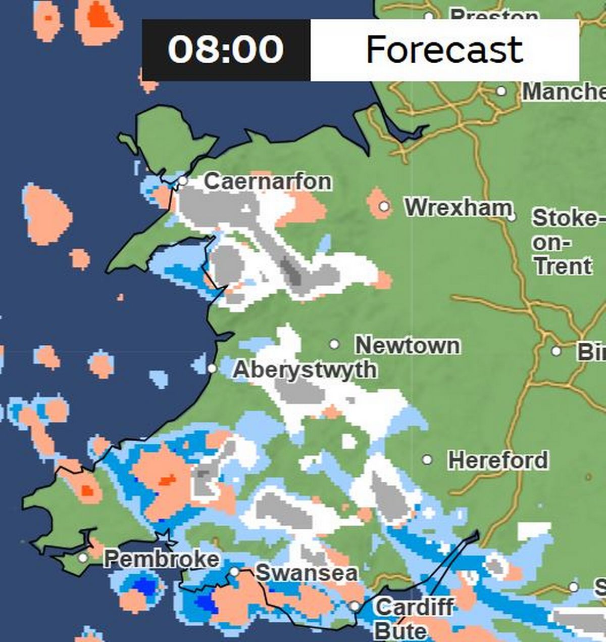 (Image: Met Office)
When many are waking up to bitterly cold temperatures on Friday, there will be snow showers across areas in south, mid and north Wales. There will also be hail and rain in south and west Wales.
Midday
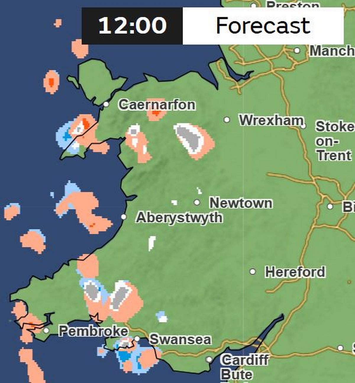 (Image: Met Office)
The snow flurries will have largely cleared by midday, when the weather warning ends. Saturday is forecast to be largely dry, while there is expected to be more snow early on Sunday morning.
Get daily breaking news updates on your phone by joining our WhatsApp community here. We occasionally treat members to special offers, promotions and ads from us and our partners. See our Privacy Notice