Motorists are being given advice if they are taking to the roads tomorrow Make sure you stay safe on the roads(Image: Getty)
The Met Office have issued a yellow warning for a risk of snow and ice covering the city on Friday and into Saturday as temperatures drop below freezing
According to it’s latest statement, the Met Office has forecast sub-zero temperatures throughout Friday daytime and it getting increasingly cold at night, thanks to wind making it feel even colder.
In addition, the agency is warning drivers to expect slippery conditions on the roads and are urging them to take precautionary steps. In addition, pedestrians are also being warned to be careful out on the pavements to avoid slips and falls.
The chillier weather is expected to move across the region from around midnight tonight and by noon on Friday it will be noticeably colder.
The Met Office said: “An area of sleet and snow is expected to move southeastwards across parts of England and Wales, lasting approximately 2 or 3 hours in any one place. Where snow falls, 1 or 2cm is likely for some and perhaps as much as 5cm snow possible in a few spots, especially higher ground of north Wales, northwest England and perhaps the northwest Midlands.
“Some ice may form as a result of precipitation falling on to frozen surfaces and icy patches will also develop quickly as sleet and snow clears.”
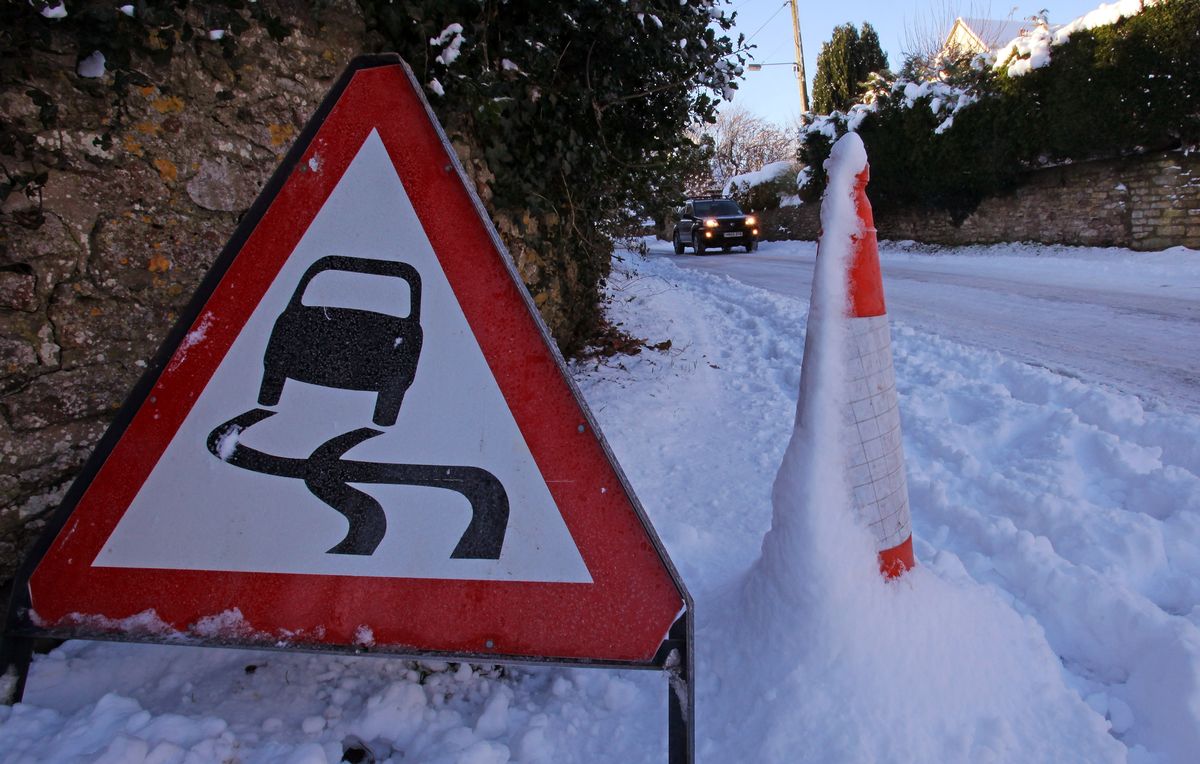 ‘Recent rain means that water could be running off from local fields and causing ice across roads. Black ice is difficult to see, so even when conditions seem normal, it can be very slippery – leading to dangerous driving conditions.'(Image: Getty Images)Hour-by-hour weather forecast for Bristol
6AM
While there will be a gentle northwest breeze, there will be gusts of up to 22mph. This will mean that while the actual temperature will be a balmy 3C, it’s actually feel like -1C for much of the morning. At this stage of the morning the Met Office are forecasting a 70 percent change of rain.
11AM
By 11am the sun will be out and will warm the area to 3C, but with continued gusts of 22mph it will still feel colder at 0C. There will also be a reduced risk of showers.
12PM
The next few hours will be the warmest part of the day, with the temperature with the mercury rising to 4C. However, with the gusts of wind remaining at between 17 and 24mph it will still feel like 0C.
1PM
Met Office forecasters predict this will be the windiest part of the day, with gusts of up to 25mph, keeping pedestrians feeling the chill.
2PM
While the wind will let up a tad, the temperature will remain at around 4C. Thankfully, the risk of rain has dropped to less than 5 percent by this point in the day.
3PM
No change at this stage of the day.
4PM
With the sun setting, it’ll begin to feel colder, with the actual temperature dropping to 3C, but with the wind it will feel like -1C.
5PM
Further drops as the actual temperature drops to 2C.
6PM
For the next couple of hours the actual temperature is expected to go down to 1C, but with the lack of sunshine and west-northwester wind, it will feel like -2C.
7PM
No change at this stage
8PM
The actual temperature will remain steady at 1C, but by this stage of the day it will now feel like -3C and will remain like this for the rest of the night.
What you should do:
The agency is offering advice on how to respond to the warning, stating: “Keep yourself and your family safe when it is icy. Plan to leave the house at least five minutes earlier than normal. Not needing to rush, reduces your risk of accidents, slips, and falls.
“If you need to make a journey on foot, try to use pavements along main roads which are likely to be less slippery. Similarly, if cycling, try and stick to main roads which are more likely to have been treated. “Give yourself the best chance of avoiding delays by checking road conditions if driving, or bus and train timetables, amending your travel plans if necessary. “Snowy, wintry weather can cause delays and make driving conditions dangerous. Keep yourself and others safe by planning your route, giving yourself extra time for your journey. “Check for road closures or delays to public transport and amend plans if necessary. “If driving, make sure you have some essentials in your car in the event of any delays (e.g., warm clothing, food, water, a blanket, a torch, ice scraper/de-icer, a warning triangle, high visibility vest and an in-car phone charger). “Be prepared for weather warnings to change quickly: when a weather warning is issued, the Met Office recommends staying up to date with the weather forecast in your area.”