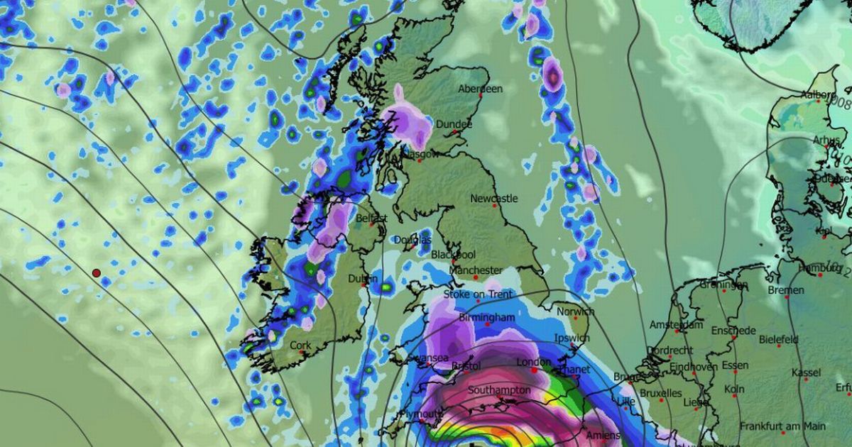
Another snowstorm could bury parts of the UK next week, with London potentially seeing up to two inches – while one region faces a staggering 15 inches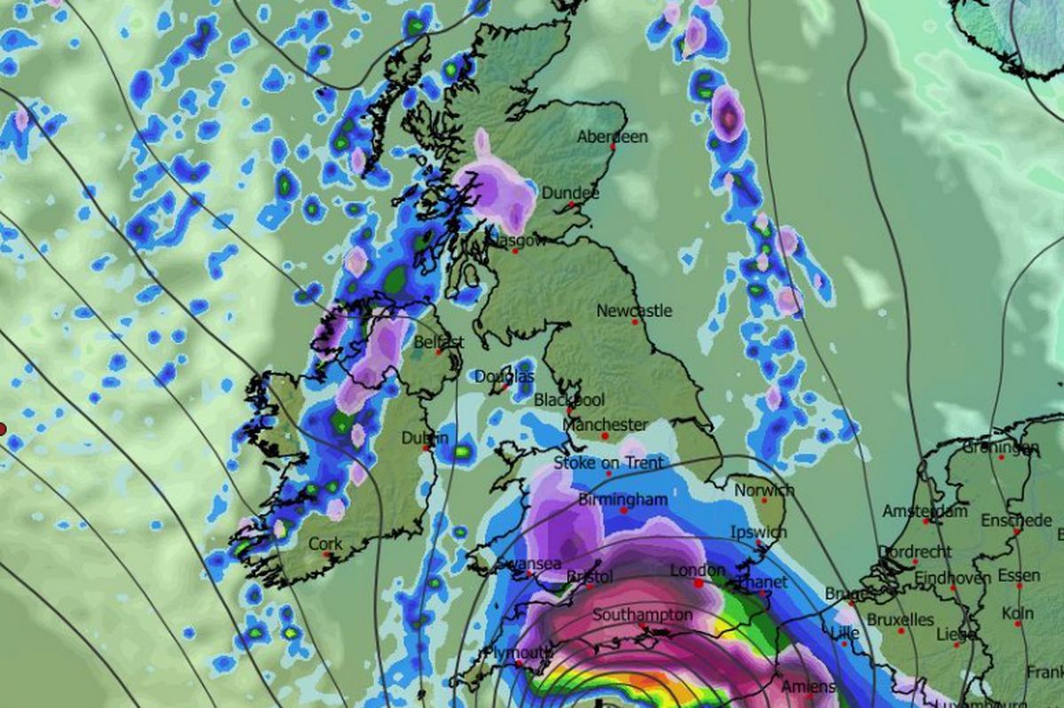 More snow is expected next week (seen here at 6am on January 9)(Image: MetDesk)
A second snow blizzard could be on course to bury major UK cities – including London – next week, according to a fresh set of weather maps.
New modelling suggests a powerful band of snow is set to sweep across the country from the early hours of January 9, with wintry conditions arriving as early as 6am. One region is set to face up to fifteen inches of snow, while London could wake up to just over two inches.
It comes as the Met Office has already issued warnings for snow and ice for this week, in place across England, Scotland, Wales and Northern Ireland, lasting from today until Sunday.
 Several major cities are predicted to welcome snow(Image: MetDesk )READ MORE: UK snow forecast as ‘extremely hazardous’ weather event to follow 15-inch stormREAD MORE: Brits warned of ‘blizzard conditions’ as weather warnings upgraded to amber
The new maps show the first wave of flurries pushing into the south-east and south-west, turning major cities white, including London, Bristol, Southampton, Plymouth and Swansea. At the same time, snowfall is expected to break out across the Midlands, Wales and Scotland, setting the scene for a widespread wintry morning.
Areas including Shropshire, Wolverhampton and parts of Liverpool are also set to welcome flurries as early as 6am, while further north, Glasgow and the Scottish Highlands face accumulating snowfall. The snow band is forecast to be at its most active during the morning commute, before weakening and drifting eastwards by midday, easing into the evening.
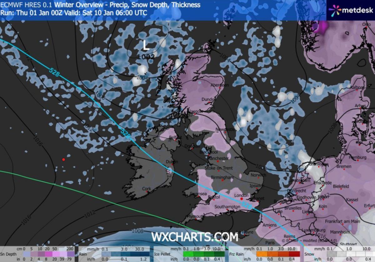
Snow coverage maps show for January 10 show large chunks of the UK – potentially more than half – could see snow next week including all of Scotland, wide areas of the North East and much of southern England and Wales.
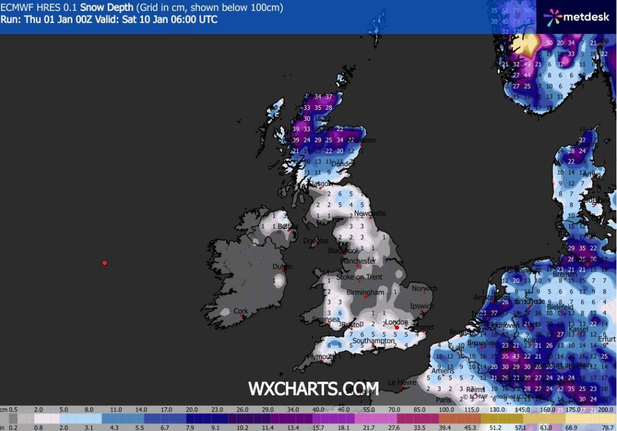 The heaviest snowfall will be seen in Scotland(Image: MetDesk)READ MORE: UK snow maps show 6 English cities hit in first week of 2026 amid horror alert – full list
Cities in the firing line include Newcastle, Leeds, Middlesbrough, Bradford and Manchester, alongside London, Oxford, Luton, Reading, Bath, Portsmouth, Southampton, Britsol and Plymouth. In Wales, Swansea, Cardiff, and Newport are also highlighted on the maps, while Belfast may see lighter snow showers.
Forecasters predict snow depths will vary sharply by region. The maps suggests around 5cm (two inches) could settle in and around London, with 6cm (just over two inches) possible between Bristol and Southampton. Parts of Somerset, including the Taunton area, could see up to 8cm (around three inches).
The most significant accumulations are forecast for Scotland, where higher ground in the Highlands could see up to 39cm (around 15 inches) of snow. Aberdeen faces totals of around 34cm (13 inches), with lighter snowfall expected further south in cities such as Glasgow.
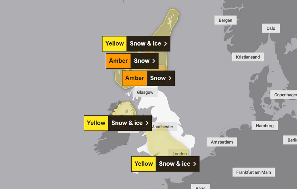 Several Met Office warnings for snow and ice are in place for this weekend(Image: Met Office)READ MORE: Snow forecast maps reveal biblical blizzard to bury Europe as UK faces 20 inches
According to the Met Office, “further snowfall is possible” in central and eastern areas of the UK next week, while lighter snow may be seen in the south and west. Its long-range forecast from January 6 until January 15 reads: “The recent spell of cold, northerly winds should begin to ease by the middle of next week, with snow showers in the north and east becoming lighter and less frequent.
“However, bands of rain seem likely to gradually move in off the Atlantic and, as these encounter the cold air entrenched over the UK, some further snowfall is possible, particularly in central and eastern areas, with rain more likely in the west. From next weekend, the outlook becomes more uncertain.
“Most likely is that conditions will be less cold than recently, but there still remains potential for further spells of snow, especially in northern and central areas. Further south and west, some milder interludes are possible, with the chance of some heavier rain and stronger winds at times.”