The warning is set to come into effect on Sunday 4 December Greater Manchester is set to see more snow and ice over the coming days(Image: Mirrorpix)
A fresh new year has begun with freezing temperatures and snow forecast for large parts of the country – with new warnings set to come into force over the coming days.
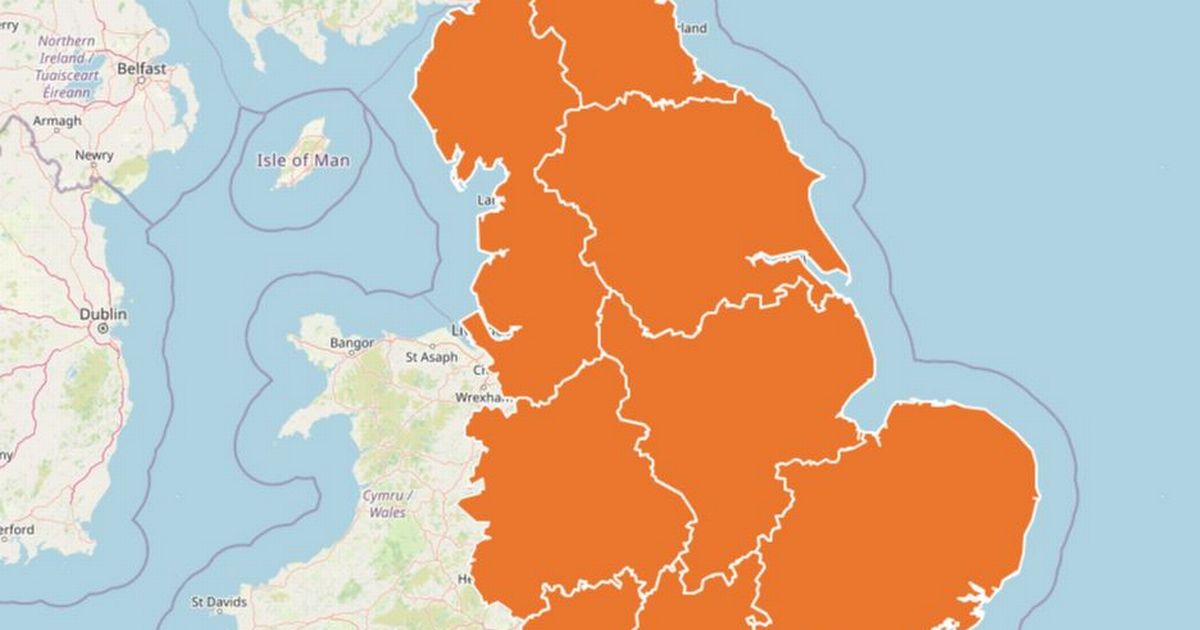
It comes as an amber cold health alert has been issued by the UK Health Security Agency (UKHSA) covering England in its entirety until January 9 at 10am. This has been extended from the original warning which was to be lifted on January 6.
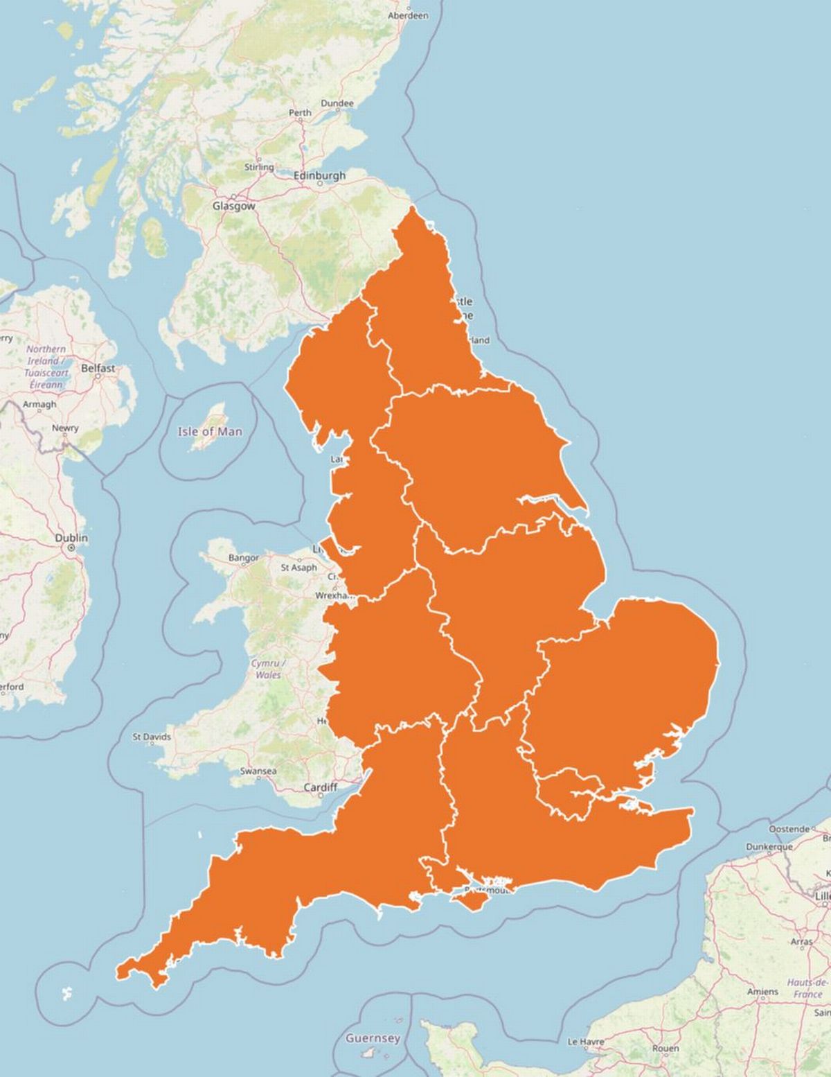 Amber cold health alerts are in force across the whole of England until January 9(Image: UKHSA)
An amber cold health alert is issued when when the forecast weather is likely to cause ‘significant impacts’ on health and social care services, which includes a ‘rise in deaths’, particularly among individuals aged 65 years and over and those with serious underlying health conditions such as respiratory and cardiovascular diseases.
Several snow and ice warnings are currently in place across the UK including a 24-hour amber snow warning affecting Scotland as the Met Office warns of ‘heavy snow showers’ which will cause disruption. Areas affected by the amber warning include Aberdeen, Moray and the Highlands.
And now a new yellow weather warning for snow has been issued for Greater Manchester from 3pm on Sunday, January 4, remaining in place until 12pm the following day, as ‘disruption’ is expected to hit the region. Other parts of the UK included in the warning are parts of Wales, South West England, West Midlands, other parts of North West England and East Midlands.
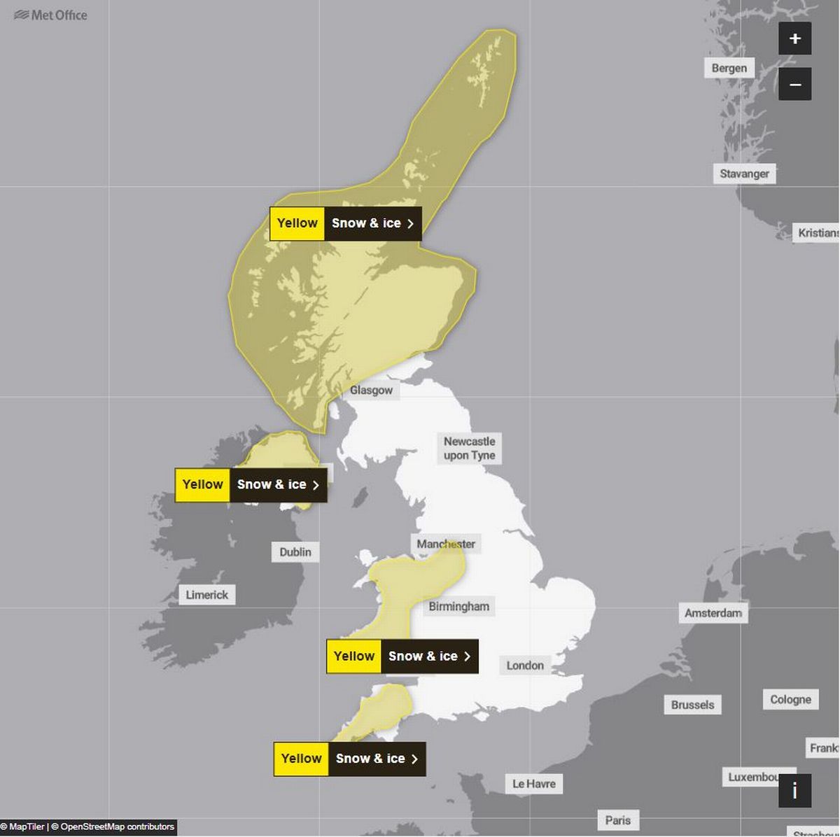 These are the Met Office warnings in force across the UK on Sunday 4 January(Image: Met Office)
Met Office’s warning reads: “Snow and ice has the potential to cause disruption to travel in places from Sunday evening through to Monday morning.” And further description warns of ‘snow showers’, ‘sleet’ and ‘icy patches’.
The Met Office says: “Snow showers are expected to push further inland across Wales, parts of northwest England, the West Midlands and southwest England during Sunday evening. Along windward coasts, rain and sleet is more likely, but inland showers will fall as snow.
“Whilst not all locations in the warning areas will see snow, around 1-3 cm is expected to fall in many places by Monday morning, with the potential for 5-8 cm to build up in a few locations, particularly across inland and higher parts of Wales. Icy patches are likely to form widely.”
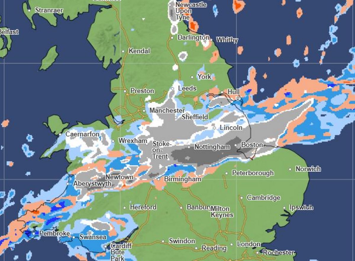
As well as the warning affecting Greater Manchester on Sunday night into Monday, Met Office maps show a wall of snow moving over Greater Manchester and the south of England on Tuesday, January 6.
 Met Office maps show snow above the UK on Tuesday evening (Image: Met Office)
Met Office precipitation maps show the wall of snow over Greater Manchester at 9pm on Tuesday, gradually moving in a southerly direction by 12am reaching the Midlands including Birmingham and Peterborough. Then, it will reach London and other southern parts of the country by 3am the same night.