
Yellow weather warnings have been put in place for much of the country, with ice and snow expected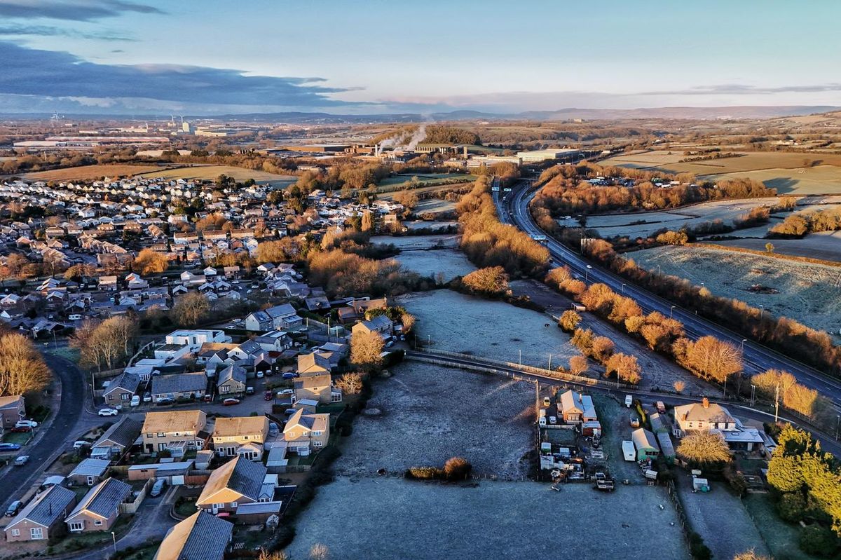 There could be a frosty start in Monmouthshire(Image: John Myers)
Temperatures across some parts of Wales are due to plummet to -10°C as snowy and icy conditions across the country lead to weather warnings. A large portion of the Welsh population has woken up to snow on Sunday morning and the cold weather from Arctic air is set to continue.
Weather warnings issued by the Met Office are in place, and forecasters are predicting that temperatures could drop to as low as -10°C in parts of rural mid Wales overnight on Sunday.
BBC Weather presenter Matt Taylor said that temperatures could drop as low as -10C in parts of mid Wales overnight. Live updates here.
A spokesperson from the Met Office said: “(There is) A mixture of clear periods and scattered wintry showers this evening and overnight, these leaving a covering of snow and icy stretches in places. Skies clearing later and turning frosty.”
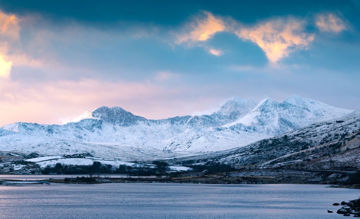 Eryri on Sunday morning after a period of snowfall(Image: Rich Smith)
A yellow weather warning is in place for Wales for snow and ice, until 12pm on Monday. People should prepare for snow showers to push further inland across Wales
In coastal areas there could be some rain and sleet.
As far as snow is concerned, 1cm to 3cm could develop in many places by Monday morning, with a possible 5cm to 8cm in some locations, particularly across inland and higher parts of Wales. Icy stretches are also likely to form widely.
Chief Met Office forecaster, Neil Armstrong, said “With Arctic air now covering most of the UK very cold weather will continue through the weekend, with minus double figures overnight in places and daytime temperatures struggling to rise above 0°C for some.
“It looks like this cold spell could last well into next week and wintry hazards will continue with more weather warnings likely. It is therefore important people keep up to date with the latest forecast and warnings and plan ahead.”
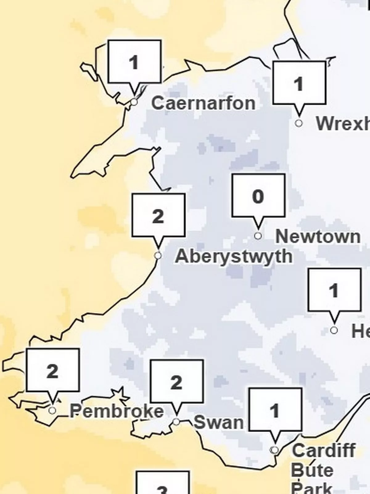
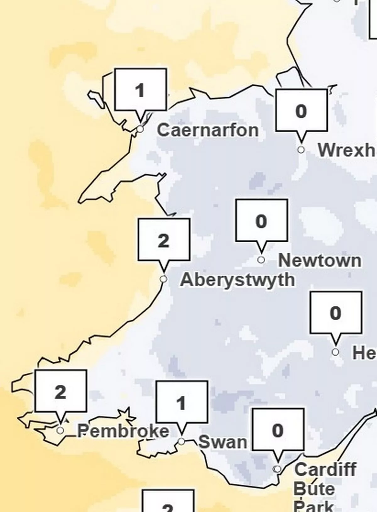
Here are the maps for Wales showing the temperatures you can expect to see Sunday night:
At 5pm, temperatures reach 0°C in mid Wales with areas in west Wales slightly warmer at 2°C.
 (Image: Met Office)
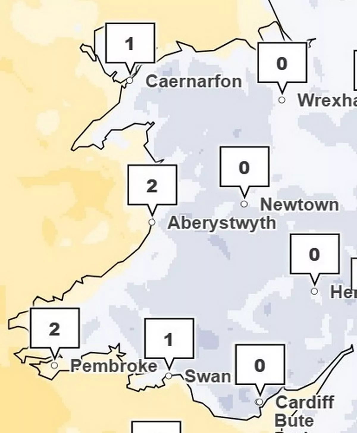
At 7pm, the east side of the country reaches 0°C from Wrexham down to Cardiff while it remains slightly warmer in the west.
 (Image: Met Office)
At 9pm, the temperature remains the same with the west slightly warmer than the east.
 (Image: Met Office)
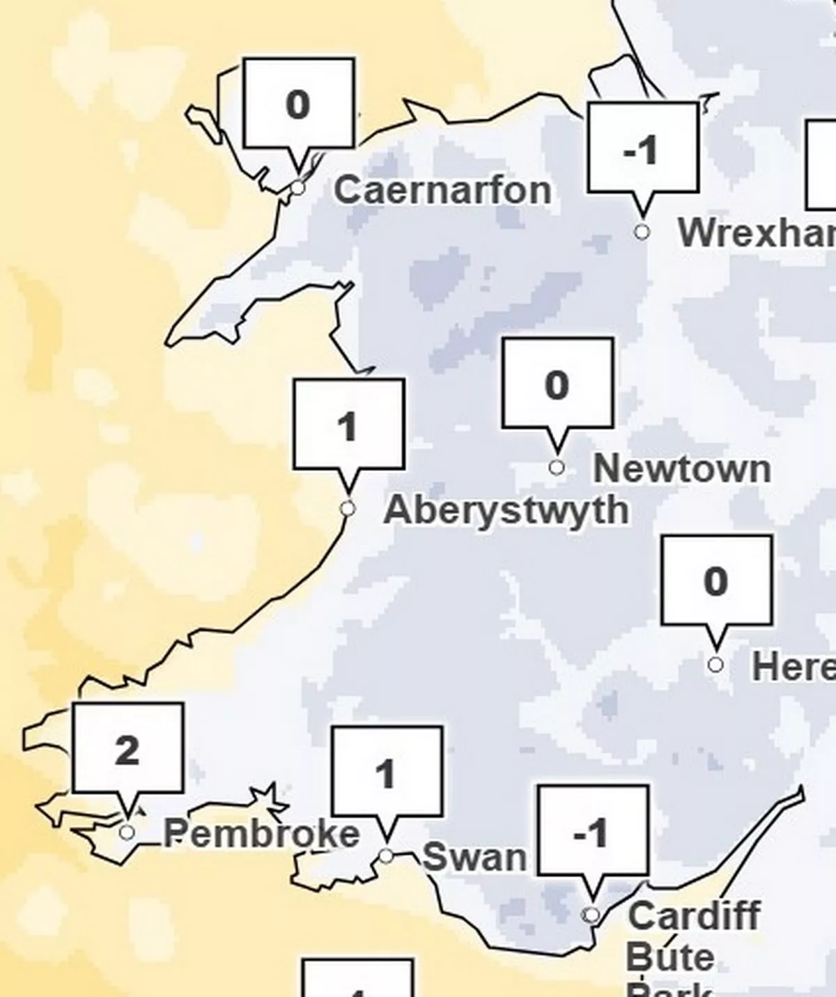
At 11pm, temperatures reach -1°C in Wrexham and Cardiff and plummet to O°C in Caernarfon while it remains slightly warmer in the west.
 (Image: Met Office)
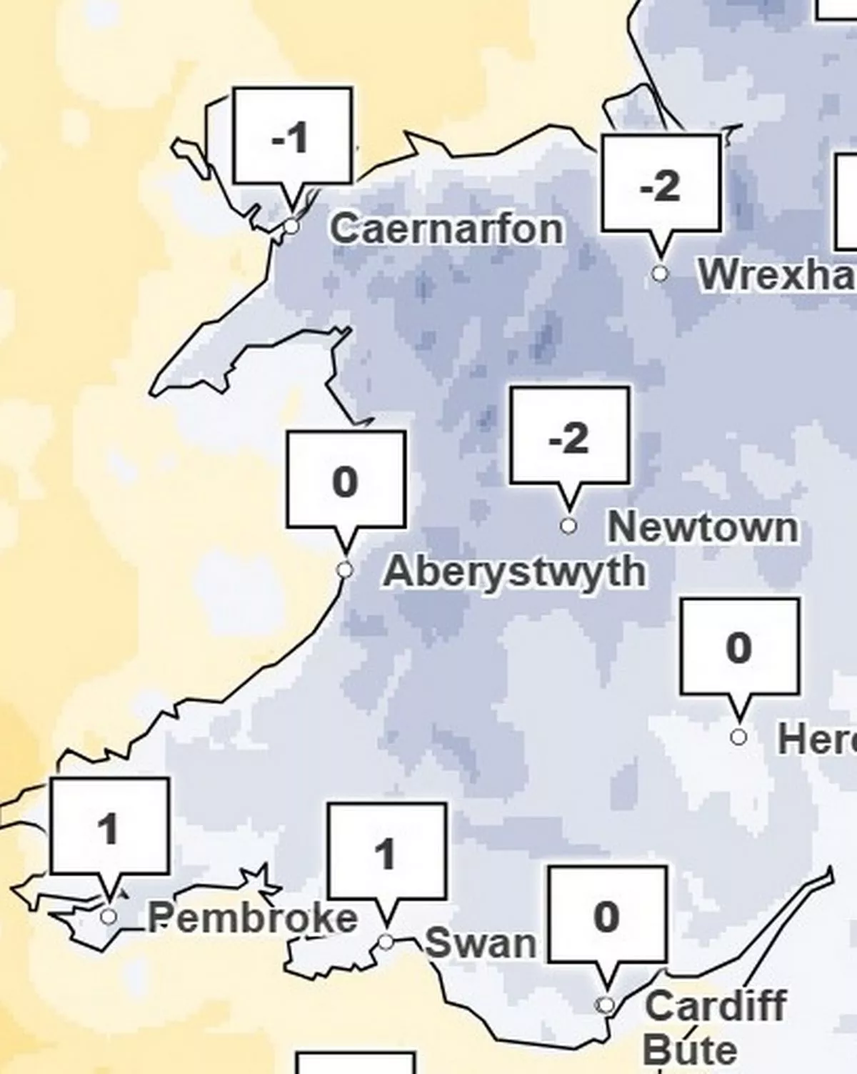
At 1am, Wrexham and Newton reach temperatures of -2°C while Pembroke and Swansea reach 1°C.
 (Image: Met Office)
The Met Office forecast for Wales this week says: “Remaining similar with scattered snow flurries on Monday, these primarily in western areas. Sunny intervals too, these most prolonged in eastern counties. Staying very cold with icy stretches persisting in places. Maximum temperature 4 °C.”
The outlook for Tuesday to Thursday says: “A frosty start on Tuesday, then mainly dry but some rain and hill snow is possible later. Gradually turning somewhat less cold and more unsettled on Wednesday and Thursday.”