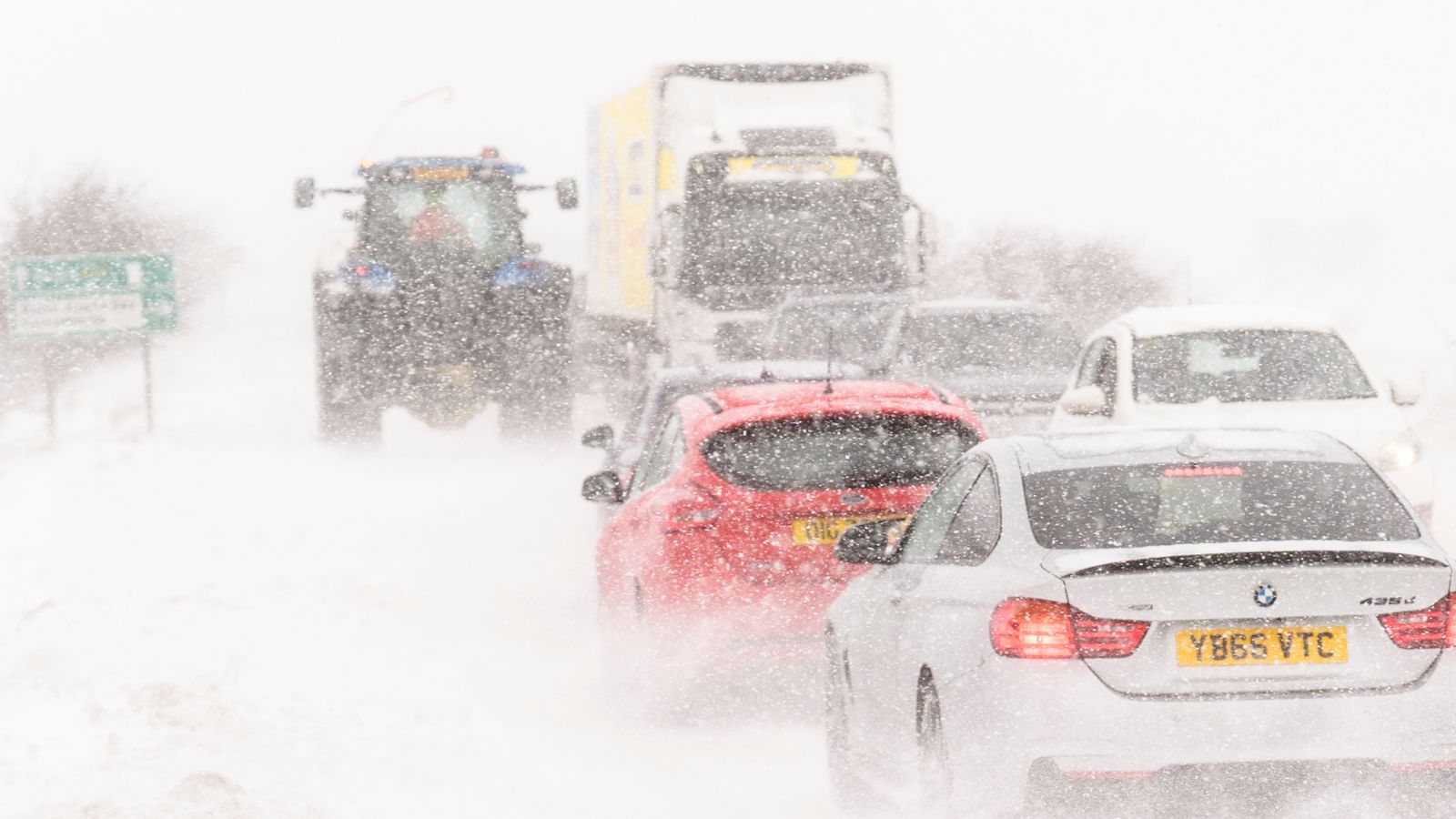
Blizzard conditions are forecast as Britons return to work and school today – with amber warnings in force across parts of the UK.
Temperatures overnight into Monday fell as low as -9.3C (15F) in Benson, south Oxfordshire, bringing the risk of icy conditions on the roads.
The frosty conditions coincide with many workers resuming their daily commutes after the Christmas break, and schools in most areas reopening.
It is also the worst day of the year for vehicle breakdowns, according to the RAC.
Find out the weather in your area
X
This content is provided by X, which may be using cookies and other technologies.
To show you this content, we need your permission to use cookies.
You can use the buttons below to amend your preferences to enable X cookies or to allow those cookies just once.
You can change your settings at any time via the Privacy Options.
Unfortunately we have been unable to verify if you have consented to X cookies.
To view this content you can use the button below to allow X cookies for this session only.
Enable Cookies
Allow Cookies Once
The Met Office has issued three amber warnings for heavy snow with the risk of blizzard conditions, strong winds and travel disruption in parts of northern Scotland – including Aberdeenshire and the Cairngorms, along with Orkney and Shetland.
Forecasters said a few places could see 20cm to 30cm (8in to 12in) of snow, and there is a risk that rural communities could become cut off and power cuts are likely. The amber warnings expire at 10am this morning.
A separate yellow warning for snow and ice covers much of Scotland north of Glasgow, and expires at 11.59pm tomorrow.
Schools will be closed in Shetland today, while they won’t open until 11am in Aberdeen.
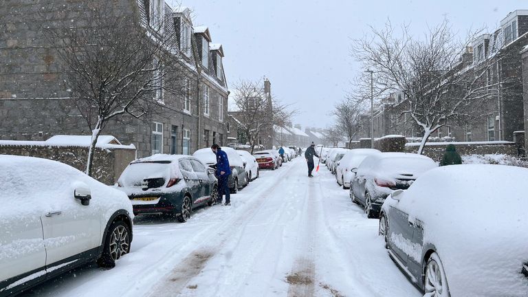
Image:
Wintry conditions in Aberdeen on Sunday, which is covered by an amber warning. Pic: PA
A large part of England, and all of Wales and Northern Ireland, is covered by several yellow warnings for snow and ice for Monday morning, expiring on or before midday.
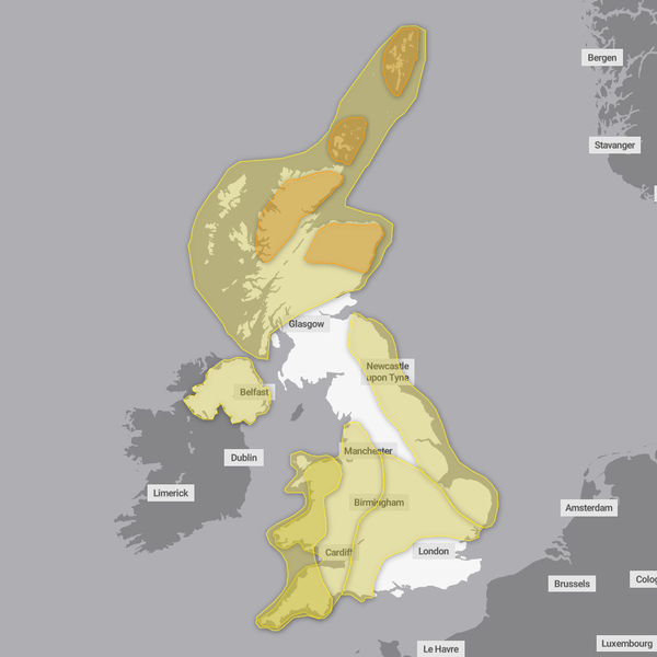
Image:
Weather warnings blanket most of the UK on Monday. Pic: Met Office
Much of the North Sea coastline has a yellow warning for snow and ice until 11am tomorrow, covering an area north of Ipswich and ending in East Lothian.
The Met Office said scattered snow showers will move inland with the risk of ice through Monday night as temperatures fall below freezing. There is also the risk of lightning and gusty winds.
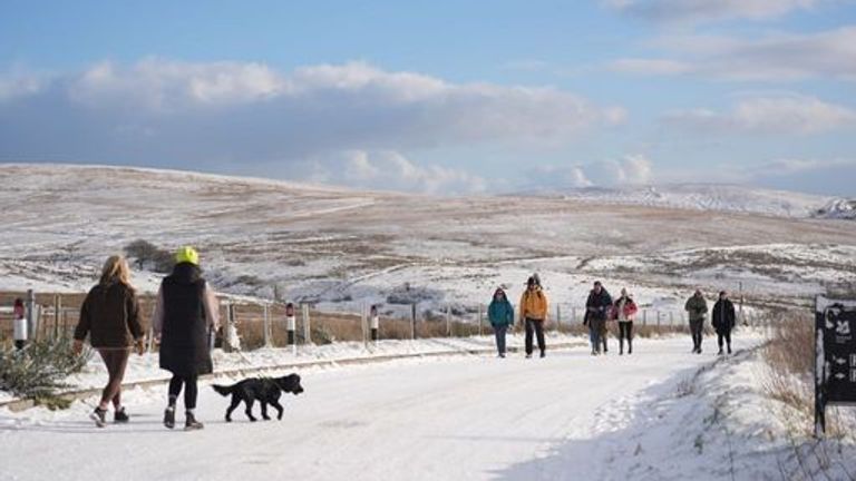
Image:
Snow scenes near Hannahstown, County Antrim, over the weekend. Pic: PA
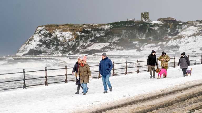
Image:
A snowy sea front in Scarborough. Pic: PA
Western coasts, including a large part of Wales and southwest England, are also set to receive scattered sleet and snow showers.
A yellow warning applies from noon today through to 11am tomorrow.
Forecasters predict up to 5cm to 10cm (2in to 4in) of snow could accumulate, “but ice will be a more widespread hazard overnight” into Tuesday.
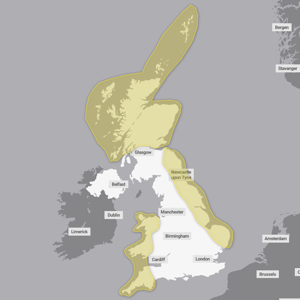
Image:
Yellow warnings for snow and ice continue into Tuesday. Pic: Met Office
Met Office chief meteorologist Matthew Lehnert said: “Elsewhere in the UK, snow showers, ice and frost are expected at times but milder air will make attempts to spread eastward from Tuesday.
“This will mean rain becomes more likely in the south, but there is also the possibility of more organised snow along the boundary of the mild and cold airmasses. Strong winds could also be a feature later in the week.”

Image:
Sledging in Whitby over the weekend. Pic: PA
Flat battery blues
The first working day back after New Year is the worst day of the year for vehicle breakdowns, according to the RAC. It blames flat batteries, as cars have been left idle over the holidays.
The motoring group expects the recent cold weather will make the situation worse and older, weaker batteries are more likely to fail.
Read more from Sky News:
How police are changing tactics
Mum pays tribute to ‘special boy’
Prisoner charged after escape
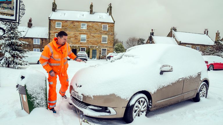
Image:
Snow covers a car in Lythe, North Yorkshire, on Saturday. But today, other drivers could face flat batteries. Pic: PA
Treacherous travel conditions
Forecasters in Ireland have also issued yellow weather warnings across all counties for a combination of ice and snow.
Met Eireann said some areas are expected to see temperatures fall to between -2C and -5C (28F and 23F) overnight into Monday, and has warned of potential “treacherous travel conditions”.
It has predicted a possible sharp or severe frost, icy stretches including black ice, as well as wintry showers with some snow accumulations.
Meanwhile, the UK Health Security Agency (UKHSA) has issued amber warnings for every area of England which will remain in place until 10am on 9 January.
It said the weather is “likely” to cause significant impacts across health and social care services, including a “rise in deaths” among those with health conditions or aged 65 or over.