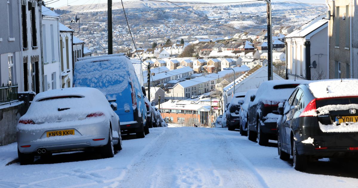
Over 10cm of snow has already fallen in some parts of Wales, but there could be more on the way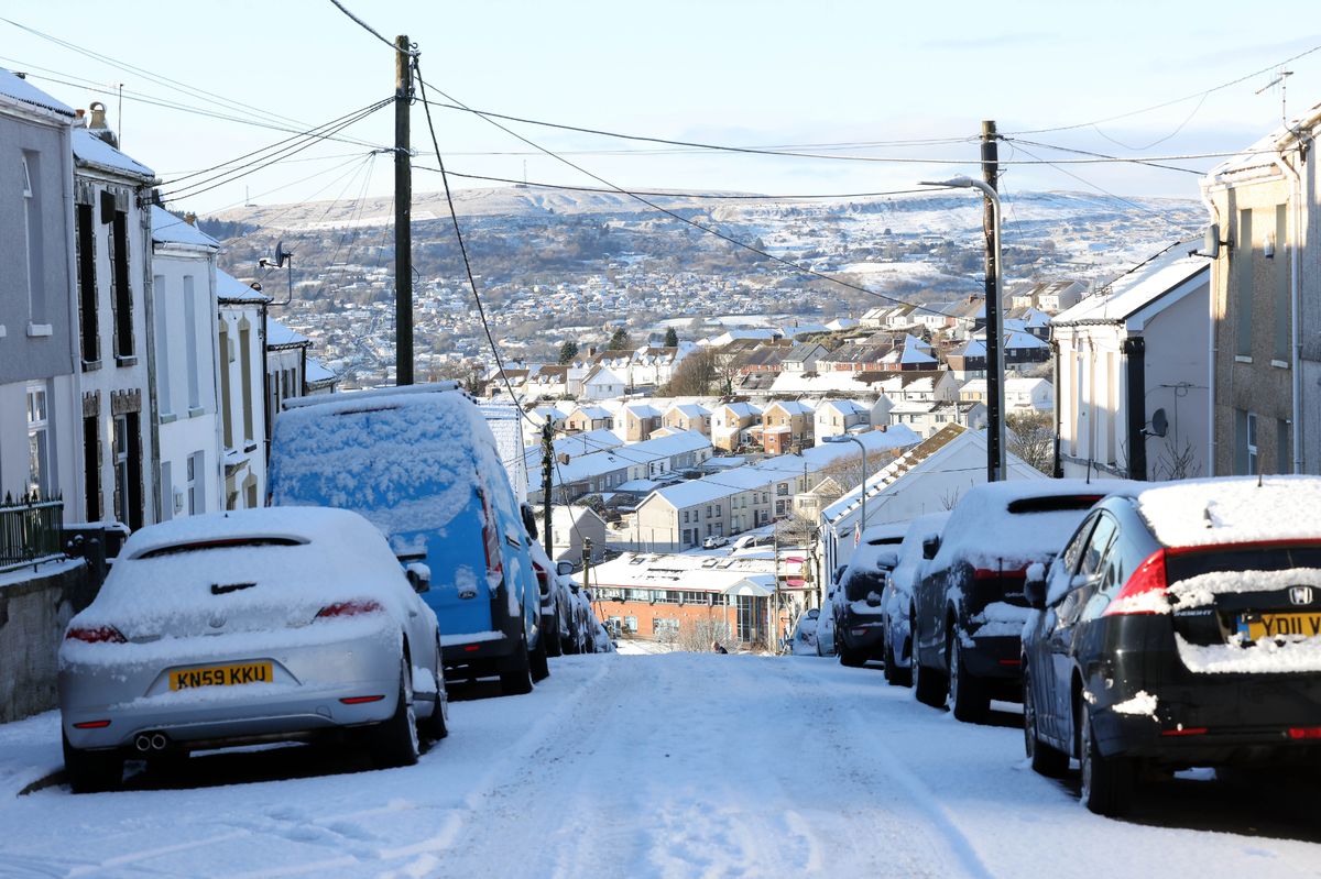 Snow caused disruption across Wales on Monday, January 5(Image: WalesOnline/Rob Browne)
An Arctic airmass covering the UK could bring more snow and disruption to Wales, forecasters have warned. Dozens of schools were forced to close on the first day back after the Christmas break and roads were treacherous on Monday after snow flurries overnight.
A Met Office yellow warning for snow and ice is in place in parts of north and west Wales until 11am on Tuesday, with people told to be cautious when travelling. While the weather warnings might come to an end on Tuesday morning, the cold and wintry weather looks set to continue.
Monday morning saw poor conditions for many after significant snowfall, particularly in west and north Wales. Drivers in some areas were warned about snow and ice on the roads and asked to only travel if absolutely necessary.
There was also disruption for parents and children expecting a return to school after the Christmas holidays, with many forced to close on Monday morning in Gwynedd, Anglesey, Carmarthenshire, Neath Port Talbot, Bridgend county, Caerphilly, Pembrokeshire, and Rhondda Cynon Taf.
Some schools are set remain closed on Tuesday, with worsening weather conditions expected in Pembrokeshire and Carmarthenshire overnight. Follow all the latest weather news here.
Following the end of the weather warning on Tuesday, January 6, the Met Office says Wales could see a “continuation of wintry showers” as well as a mix of rain, sleet and snow later in the day.
The cold is set to continue for much of the week thanks to an Arctic air mass which is sinking southwards across the UK. For the biggest stories in Wales first, sign up to our daily newsletter here
Met Office chief meteorologist, Matthew Lehnert, said: “The UK will continue to experience a range of winter weather hazards through this week, with low temperatures as well as snow showers and the risk of ice for many. A number of severe weather warnings have been issued and these are likely to be updated through the week so do keep up to date with the forecast.”
As for Wednesday, Arctic air will remain dominant, bringing more icy patches and a widespread frost to start the day. There is some chance of sleet and snow showers.
Changing weather fronts make the forecast for later in the week more uncertain, but the Met Office has warned that disruption is likely.
On Thursday, an area of Atlantic low pressure will move in from the southwest, bringing milder and more wet conditions. However, there is uncertainty over the track of this weather front and where it will combine with the Arctic air currently sitting over the UK.
The Met Office currently believe that there is a 50% chance that the Atlantic low could bring “disruptive snow” to central parts of the UK, including large parts of Wales.
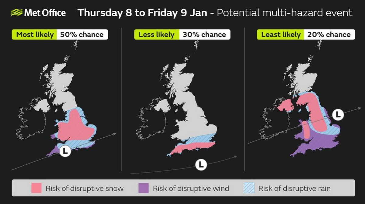 The forecast is uncertain for the end of this week, with multiple outcomes including ‘disruptive snow’ possible
Deputy chief meteorologist Mike Silverstone explained: “While we’re confident an area of low pressure will move in from the west on Thursday and into Friday, the exact position of that low pressure is uncertain at this stage. The position is important as it will determine the type of severe weather different locations may experience.
“The most likely scenario at this stage is for low pressure to track near the south coast. Near and south of the low, heavy rain and strong winds are more likely, whilst snow could accumulate to the north as it encounters cold air. As confidence increases in the track of the low pressure, so will the detail of the weather impacts so it is important to stay up to date with the weather forecast through the week.”
Get daily breaking news updates on your phone by joining our WhatsApp community here. We occasionally treat members to special offers, promotions and ads from us and our partners. See our Privacy Notice