The Met Office has issued a yellow weather warning for some parts of England and Wales, meaning that travel disruption and power cuts are likely.
Scotland is not covered by the warning – but what can north of the border expect from the storm?
Storm Goretti (named by Météo‑France) is expected to bring a spell of wet and windy weather across parts of the country on Thursday and into Friday. With cold air in situ across the UK, rain is likely to turn readily to snow in places
Latest info 👉 https://t.co/QwDLMfRBfs pic.twitter.com/5V8Gskl7i3
— Met Office (@metoffice) January 6, 2026
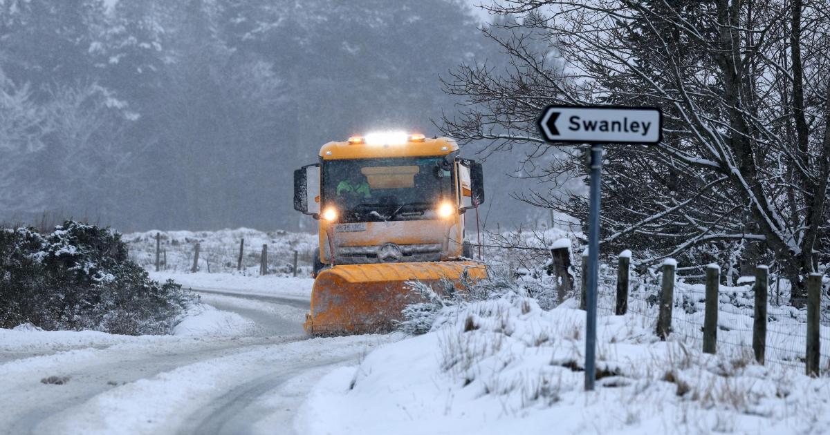
By the time it arrives, an amber warning for snow and ice which has brought huge disruption to Aberdeenshire and the north of the country will have expired.
Icy patches are expected into Wednesday, with yellow weather warnings in place until 10am across the south of Scotland.
A yellow warning for snow and ice in the north of Scotland will be in place for much of the day on Wednesday.
However, by the time the storm arrives on Thursday, conditions are expected to have cleared.
In Glasgow and the Central Belt, which avoided the snow that blighted much of the country at the start of the week, the forecast is said to be centred on “showery outbreaks of rain, sleet or hill snow on Thursday.
Multiple warnings have been issued for the coming days, here is a summary of the situation as it currently stands 👇
Latest info 👉 https://t.co/QwDLMfRBfs
Stay #WeatherAware⚠️ pic.twitter.com/cvRfJALIMr
— Met Office (@metoffice) January 6, 2026
“Friday and Saturday mainly dry, cold. Low risk of rain, snow in south late Thursday into early Friday,” The Met Office said.
In Aberdeen and the North East, the weather is to turn wet, with “outbreaks of rain, sleet or hill snow on Thursday. Friday and Saturday [will be] mainly dry and cold, a few coastal showers, wintry at times.”
Read More:
Met Office Deputy Chief Forecaster Chris Bulmer said: “A deepening area of low pressure – named Storm Goretti by Meteo France – will move across the south of the UK during Thursday and into Friday. It will clash with the very cold air here, meaning Thursday night could be what we call a ‘multi-hazard’ event, with snow on the northern flank of the low, wind and rain on the southern flank.
“We have therefore issued a yellow warning for snow for parts of England and Wales, where heavy snow could lead to disruption and difficult travelling conditions. Strong winds associated with Storm Goretti may also lead to some disruption, and so in addition a yellow wind warning has been issued for southwest England.
“The exact track of the low is still uncertain, and these warnings are likely to be amended – and potentially escalated – over the coming days. It is therefore vital people keep up-to-date with the latest forecasts.”