Storm Goretti’s strong winds could bring up to 20cm of snow to Wales, forecasters have warned Storm Goretti is expected to bring heavy snow to Wales on Thursday, January 8(Image: Met Office)
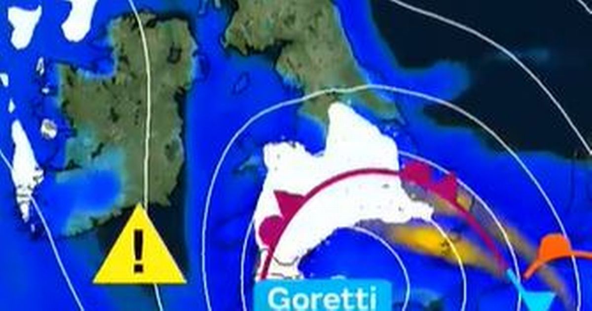
Large parts of Wales are set to be hit with heavy snow brought of Storm Goretti, the Met Office has warned. The weather agency has labelled Storm Goretti as a “multi-hazard event”, with the hefty falls of snow expected to be accompanied by wind and rain which could also cause disruption as the storm rolls in on Thursday evening into Friday morning, January 8-9.
A yellow weather warning for snow, covering 20 parts of place will be in place from 6pm on Thursday until midday Friday. The Met Office has warned that up to 20cm of snow could fall in some locations, especially over higher ground.
The severe wintry weather will be brought by strong winds over northern France, named Storm Goretti by the country’s forecaster, Meteo France. These strong winds mean that some drifting of snow will be possible.
A Met Office spokesperson said: “A deep area of low pressure will move across the south of the UK during Thursday and into Friday bringing a mixture of rain, snow and strong winds.
“A spell of heavy snow is likely to develop over higher ground in south Wales later on Thursday before rain turns to snow more widely over parts of England and Wales during Thursday night.
“In some areas, 5-10 cm of snow may settle with the potential for up to 20 cm in some locations, especially over higher ground. Strong winds may lead to some drifting of snow. Rain and snow will then clear eastwards during Friday.”This system has been named by Meteo France as the strongest winds associated with Storm Goretti are most likely over northern France.”
Storm Goretti comes after widespread disruption across Wales over the past two days, with heavy snow forcing the closure of major routes including parts of the A5, A470, A494 and A548, while a number of mountain passes and rural roads were left impassable. Drivers were urged to avoid travel in some parts of west and north Wales as conditions deteriorated rapidly.
Schools across several local authorities were also affected, with numerous closures and delayed openings reported as snow and ice made travel unsafe for pupils and staff. While the weather has caused some disruption, it also brought beautiful scenes across the country, which you can see here.
Here are the Met Office weather maps which show where and when the heavy snow will fall:
Thursday, January 8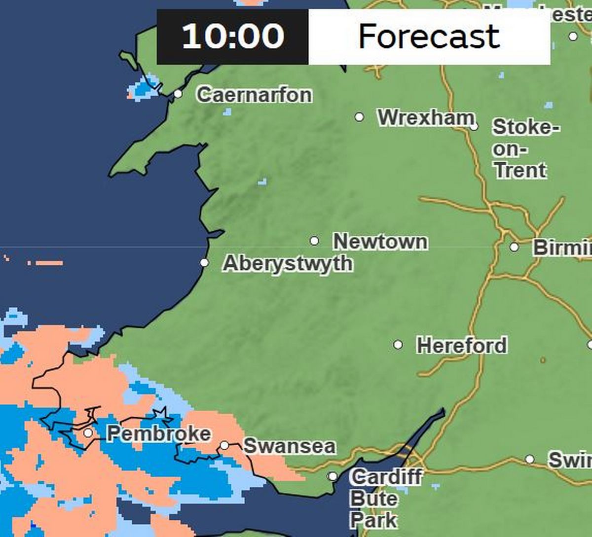 (Image: Met Office)
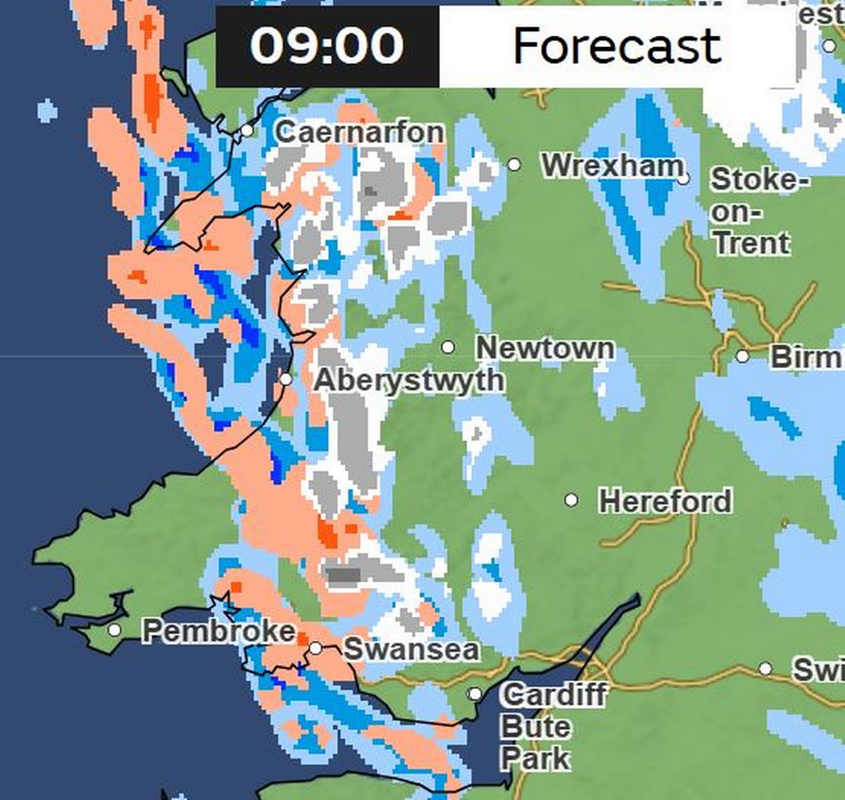
At 10am on Thursday, Storm Goretti will start to move in from the southwest. At first its strong winds will bring rain and hail (shown in orange). For the biggest stories in Wales first, sign up to our daily newsletter here
 (Image: Met Office)
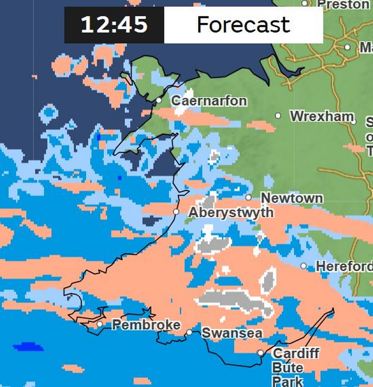
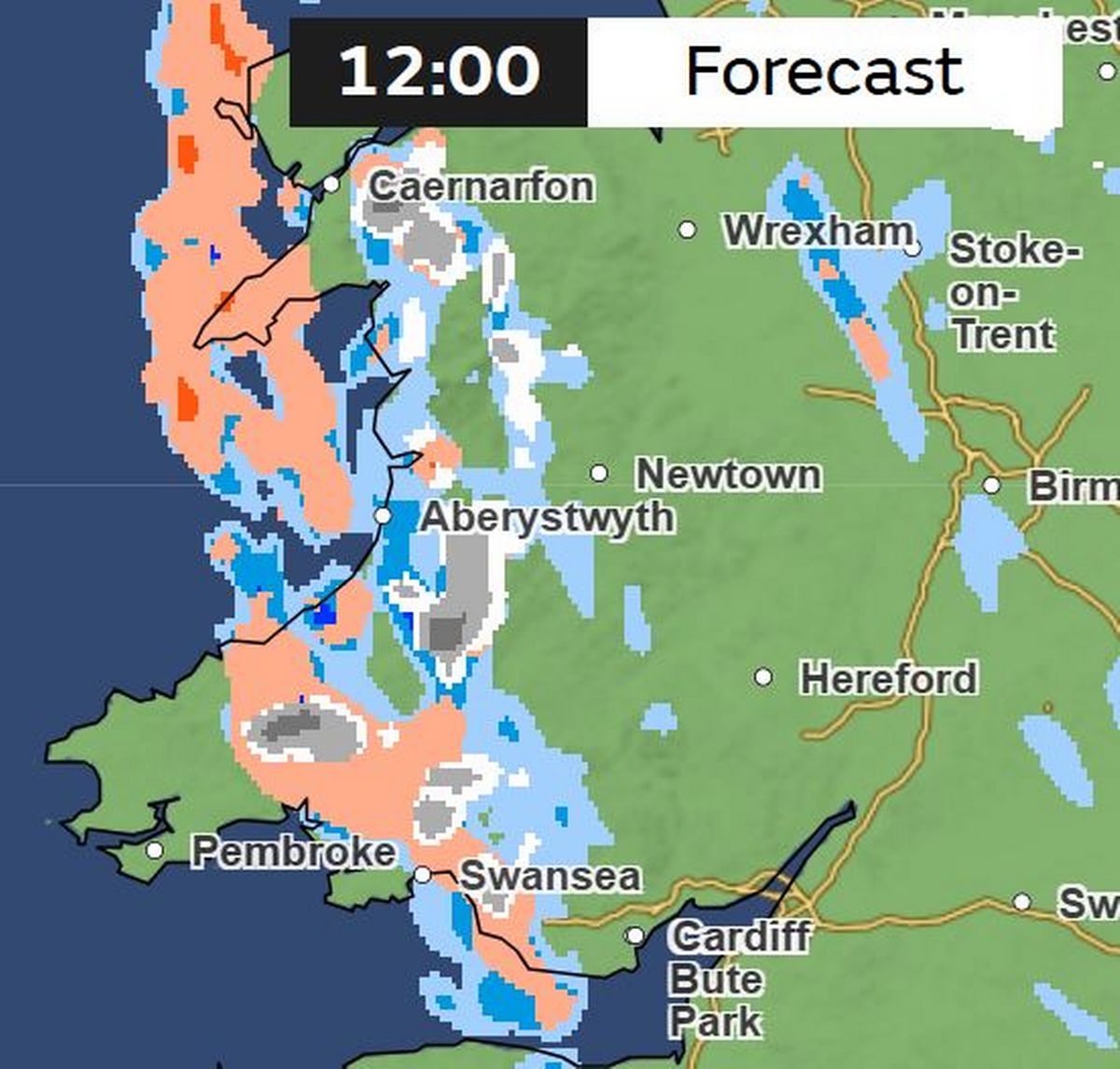
By midday there will be some sleet and snow in mid and south Wales.
 (Image: Met Office)
The snowfall will gradually ramp up as the afternoon goes on.
 (Image: Met Office)
Many parts of Wales will be seeing snow flurries by 4pm, according to the forecast.
 (Image: Met Office)
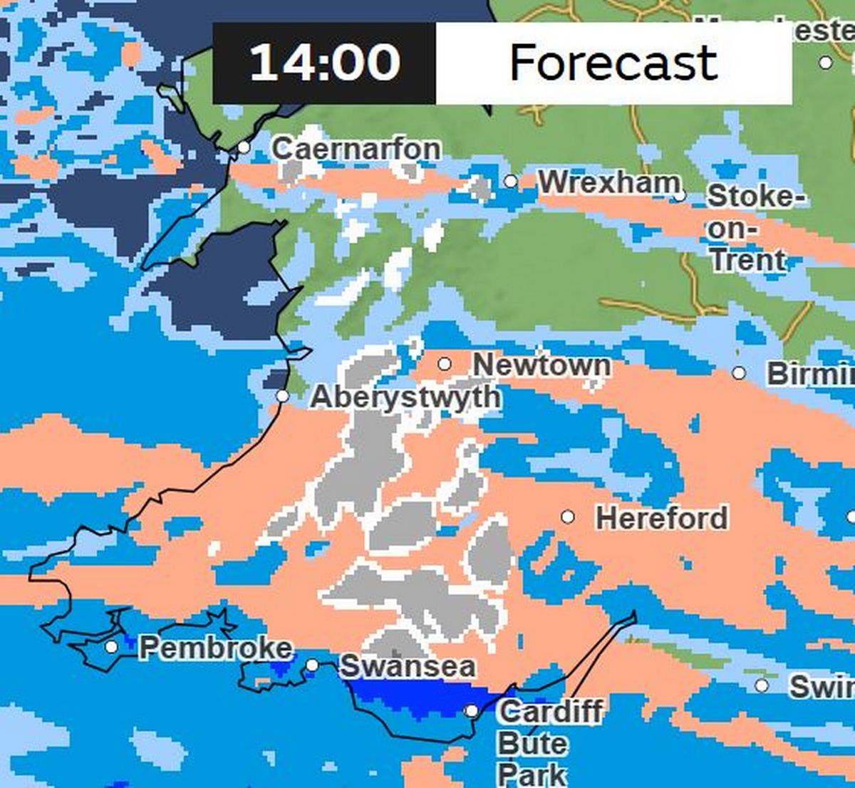
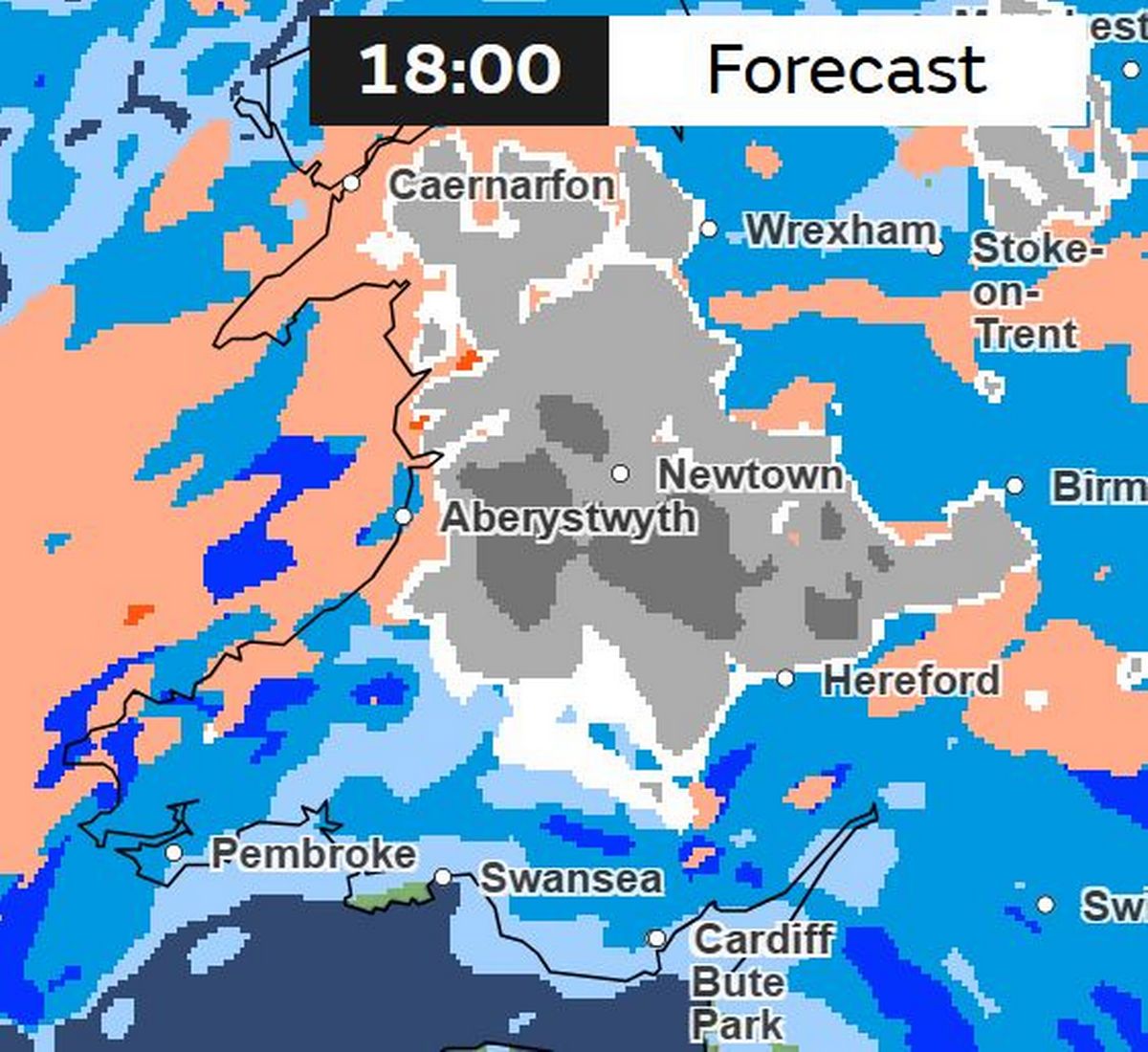
This is the picture at 6pm, when the yellow snow warning comes into force.
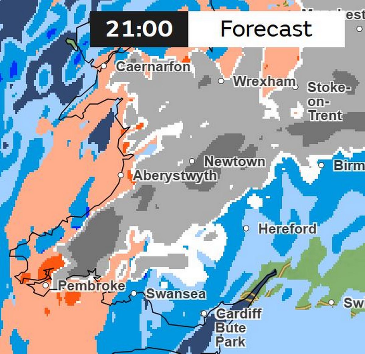
There will be more snow and wintry showers throughout the evening. This is the forecast for 9pm.
Friday, January 9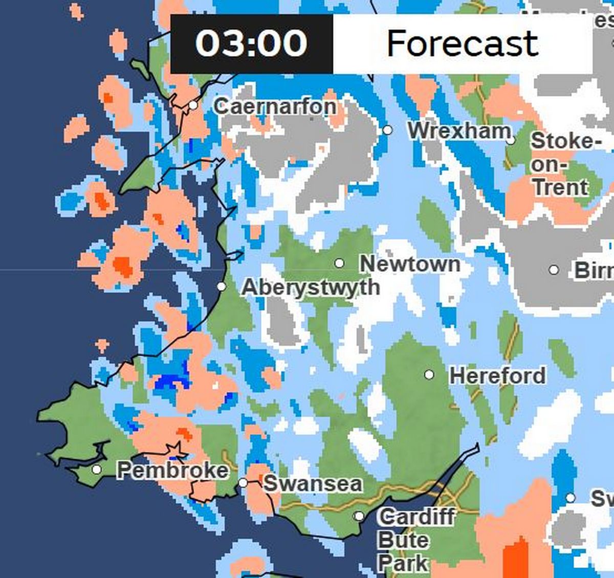 (Image: Met Office )
While the worst of the snow is forecast for Thursday evening, there will be more snow flurries overnight.
 (Image: Met Office)
This is the picture at 9am on Friday. It’s also set to be very cold, with highs of around 2 or 3C.
Snow flurries will continue until Friday evening. When the yellow snow warning ends at midday, there is set to be some scattered snow showers across Wales.
The Met Office outlook for Wales towards the end of the week says: “Some snow, along with strong winds, which may linger into Friday. Sunshine and showers Saturday.”
Get daily breaking news updates on your phone by joining our WhatsApp community here. We occasionally treat members to special offers, promotions and ads from us and our partners. See our Privacy Notice