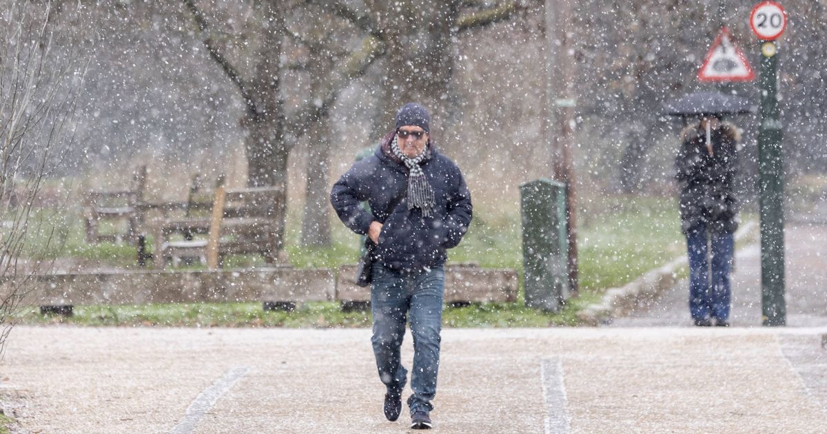
The bleak weather is set to continue into next week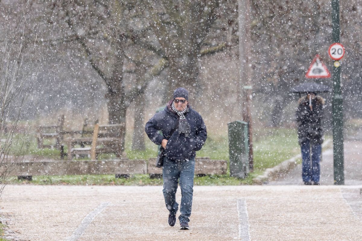 London could look like this on Monday (January 12)(Image: Brook Mitchell, Getty Images)
A weather map predicts another freeze is set to hit London next week. The map shows a wall of snow is headed toward the capital, according to forecasters at WX Charts.
It looks set to hit at about 3am on Monday (January 12). The snowfall is represented by purple shading on the map, so the darker the colouring, the heavier the blanketing of the white stuff.
WX Charts’ map, which has updates every three hours, shows the snow wall arriving from a westerly direction and then heading off in a northeasterly one.
The Met Office seems to disagree, forecasting just a cloudy day on Monday, with a fair chance of rain.
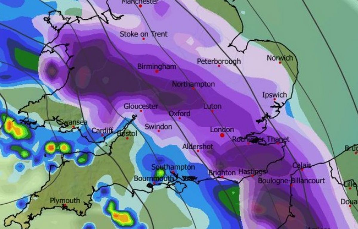 A massive snow wall is coming to London(Image: WX Charts)
It comes as the entirety of Scotland has been hit with Yellow Weather warnings for snow and ice today (Wednesday, January 7). This means some roads and railways may be affected with longer journey times by road, bus and train services
There is also a risk for some injuries from slips and falls on icy surfaces. There will also probably be some icy patches on some untreated roads, pavements and cycle paths. The upcoming London weather according to the BBC can be found below.
London weather
Today (Wednesday, January 7) saw ‘early coastal showers with some icy stretches. For most it looks a dry and rather windy day though. Bright with long sunny spells developing at times, before cloud starts to increase from the west towards the evening. Another cold day. Maximum temperature 5C’.
While tonight will see ‘cloud thickening from the west this evening with some outbreaks of light rain arriving during the early hours. Perhaps a little sleet over the highest ground. Some frost in places. Minimum temperature -2C’.
Tomorrow (Thursday, January 7) has seen ‘cloudy with patchy light rain or sleet through the morning. Light winds. Rain, heavy at times with sleet in places, arriving during the afternoon. Winds strengthening with coastal gales. Maximum temperature 6C’.
While Friday (January 8) through to Sunday (January 10) will be miserable. There will be ‘heavy rain, sleet and snow clearing east on Friday afternoon. Saturday; dry with light winds. Cloudy and windy on Sunday with rain, wintry at first, arriving from the west later’.
Looking for more from MyLondon? Subscribe to our daily newsletters here for the latest and greatest updates from across London.