Your support helps us to tell the story
From reproductive rights to climate change to Big Tech, The Independent is on the ground when the story is developing. Whether it’s investigating the financials of Elon Musk’s pro-Trump PAC or producing our latest documentary, ‘The A Word’, which shines a light on the American women fighting for reproductive rights, we know how important it is to parse out the facts from the messaging.
At such a critical moment in US history, we need reporters on the ground. Your donation allows us to keep sending journalists to speak to both sides of the story.
The Independent is trusted by Americans across the entire political spectrum. And unlike many other quality news outlets, we choose not to lock Americans out of our reporting and analysis with paywalls. We believe quality journalism should be available to everyone, paid for by those who can afford it.
Your support makes all the difference.Read more
Storm Goretti brought a potentially deadly mix of violent winds, ice and heavy snow and rains on Thursday, forcing schools to close and leaving more than 65,000 homes without power.
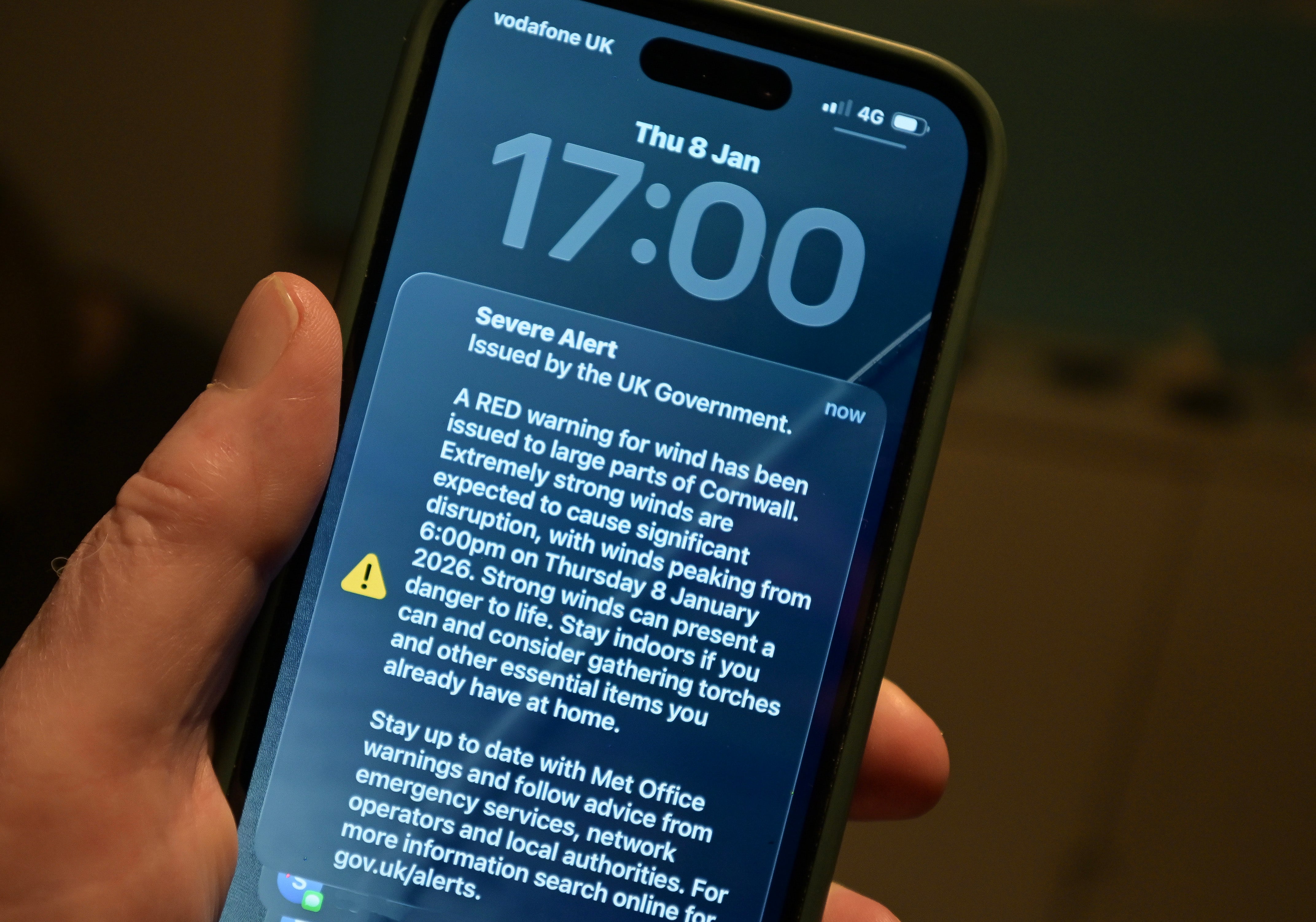
Gusts of up to 99mph were recorded as authorities issued a rare red warning – the highest level – of winds for the Isles of Scilly and Cornwall.
Emergency alerts were sent to mobile phones in the area and they sounded an alarm even if set to silent.
.jpeg)
open image in gallery
Storm warning: Heavy weather in Guernsey (Government of Guernsey)
More than 65,000 properties in south-west England are without power, according to the National Grid. Over 11,000 homes in the West Midlands and 2,600 in Wales are also without power.
A red warning officially means “it is very likely that there will be a risk to life, with substantial disruption to travel, energy supplies and possibly widespread damage to property and infrastructure”.
The Met Office says of red warnings: “You should avoid travelling, where possible, and follow the advice of the emergency services and local authorities.”
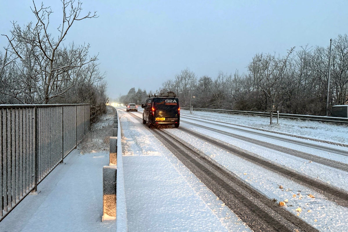
Rain started to turn to snow in the west country, the Midlands, Wales and the Pennines, as part of the “weather bomb” hitting the country.
But officials in the Midlands fear the worst of the snow is yet to come, with 30cm (11in) expected to fall on Friday – causing widespread travel disruption.
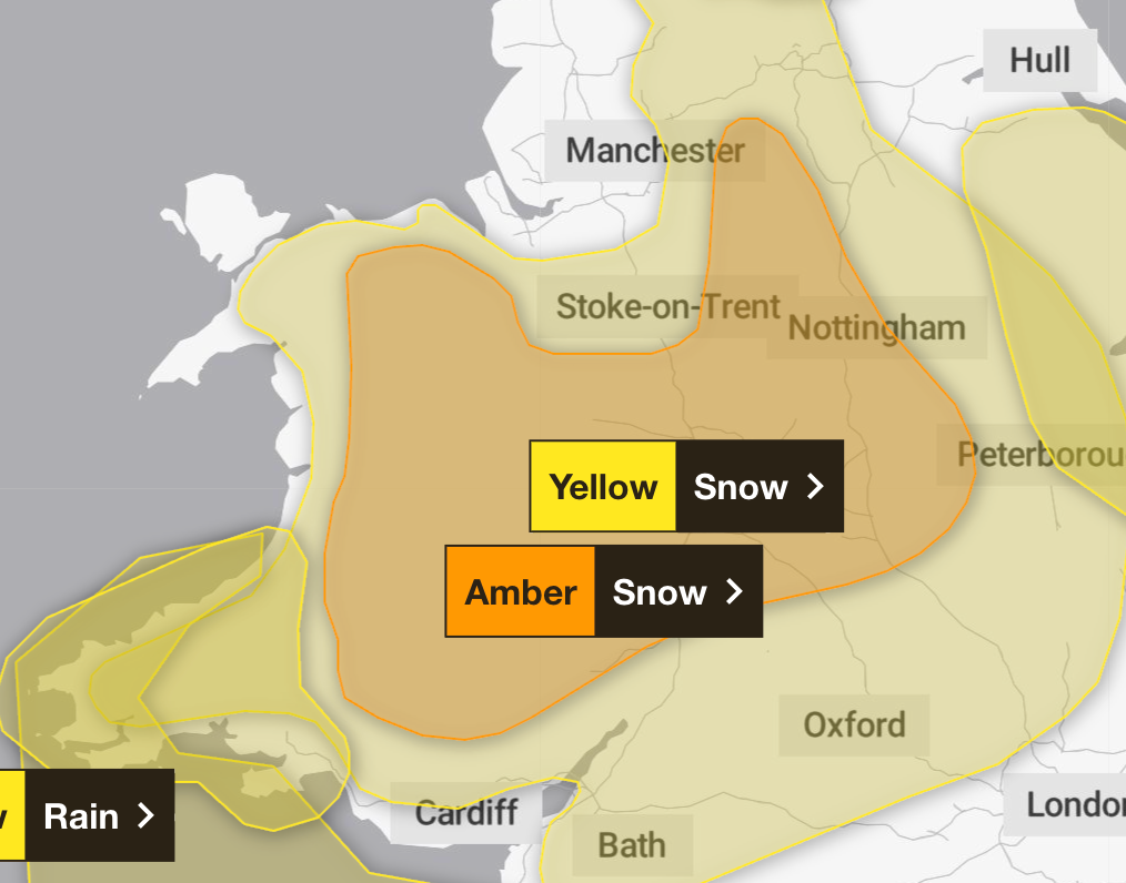
An amber warning for snow on Thursday night and into Friday morning was in place across a swathe of the UK from southeast England to south Wales and southwest England to Yorkshire and Scotland.
open image in gallery
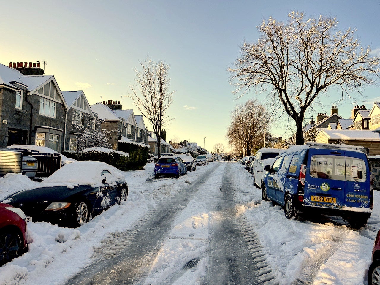
Some cars were trapped in snow in Aberdeen (Beth Edmonston/PA)
Yorkshire and the east of England were also under a yellow warning of rain overnight.
Winds of 99mph were recorded at St Mary’s Airport on the Isles of Scilly – a new record for the site.
Dozens of schools in Cornwall finished lessons early on Thursday as the storm approached, and others in the Midlands and Wales decided to close on Friday.
In Scotland, more than 250 schools are remaining closed for a fifth day on Friday following several days of intense snow, ice and sub-zero temperatures.
open image in gallery
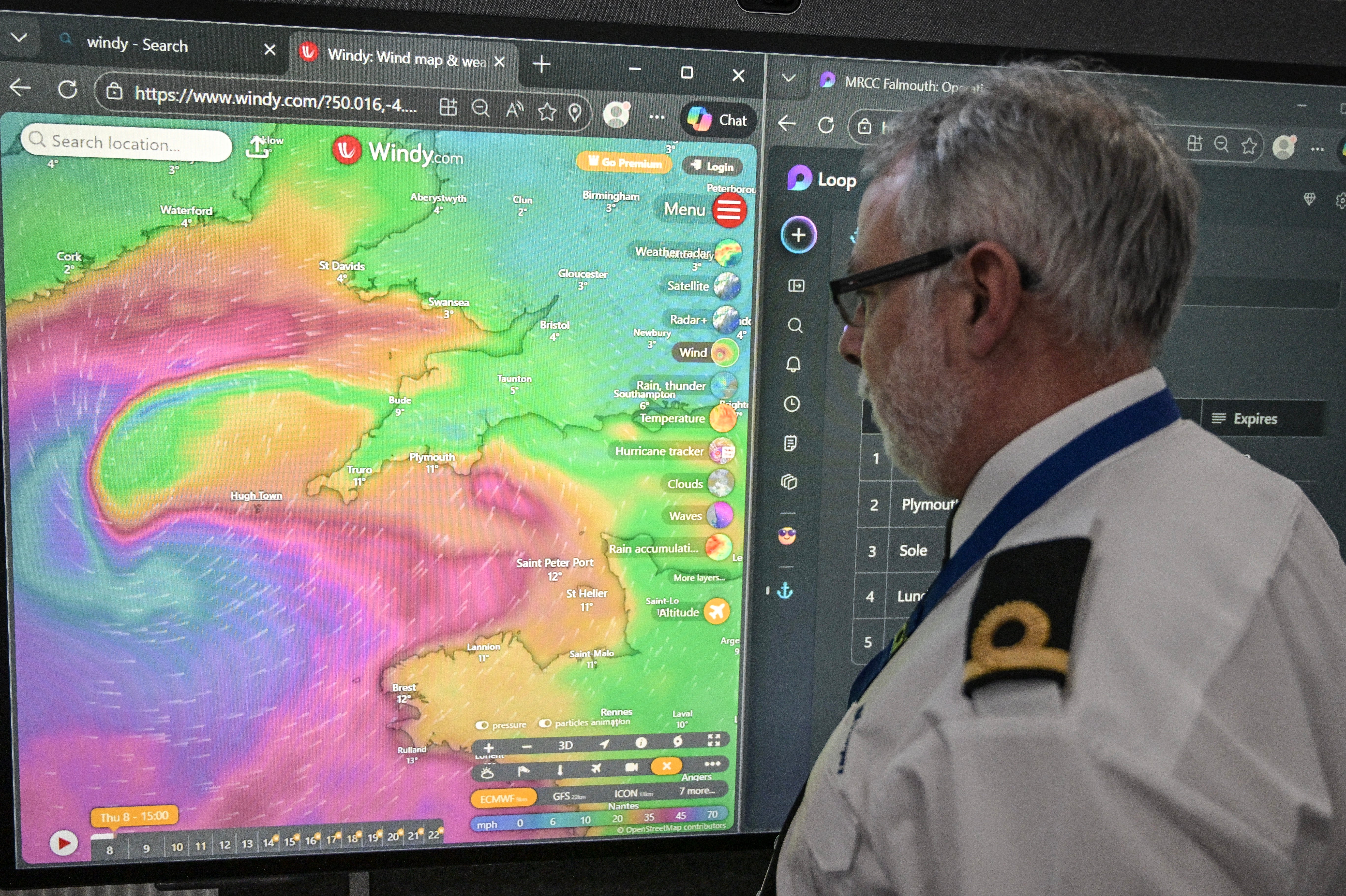
An officer at the Falmouth Maritime Rescue Co-ordination Centre monitors the progress of Storm Goretti (Getty)
Anyone trying to travel faced delays or disruption in the west and southwest of England. All trains in Cornwall were suspended from 6pm on Thursday, and in Devon, services on the Exeter-Okehampton and Exeter-Barnstaple routes were also suspended because of forecast high winds.
In Wales, six railway lines closed at 3pm on Thursday, with a reduced service on the remainder. Avanti West Coast cancelled one in three trains between London and Birmingham and Manchester.
Passengers were advised not to try to travel, with services disrupted again on Friday morning. Train operators offered passengers the option to postpone their journeys as far ahead as Monday.
No replacement buses were laid on because snow and rain were set to make road travel risky.
open image in gallery
A government red alert was sent to mobile phones in the southwest (Getty)
British Airways cancelled 30 flights to and from London Heathrow.
The RAC warned drivers of the risk of falling trees and cars being buffeted about.
Spokeswoman Alice Simpson said: “A red weather warning is every bit as serious as it sounds: avoid the roads – unless absolutely essential – until the storm winds have passed.
“With the worst conditions expected in Cornwall and the Isles of Scilly, we strongly urge motorists in these areas to stay safe by parking well away from trees that could be uprooted by the strongest winds the area has seen in years.
“Exposed routes and coastlines pose the greatest danger as motorists are completely exposed to the elements and risk being ‘buffeted’ across the road by sudden gusts.”
open image in gallery
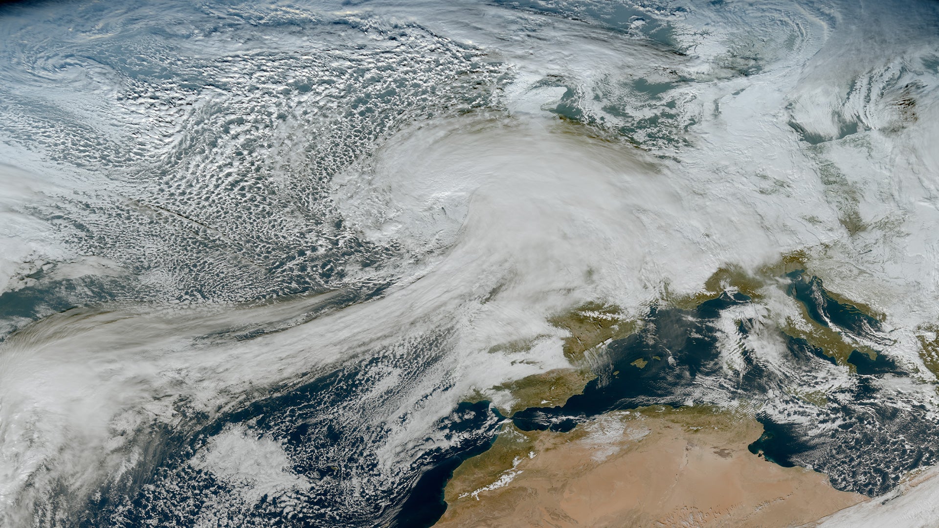
The storm as seen from a weather satellite 36,000km above Earth (EUMETSAT)
A weather bomb, also known as explosive cyclogenesis, is caused when the central pressure in an area of low pressure falls rapidly. The pressure has to fall by 24 millibars in 24 hours to qualify.
Storm Goretti, named by French forecaster Météo France, also prompted a yellow warning for wind for the rest of the south coast of England and for Wales, where gusts of up to 70mph were forecast.
Yellow warnings mean disruption to travel is likely in some areas or when the weather could bring much more severe effects to most people, but they are less likely, according to the Met Office.
open image in gallery
The amber snow warning on 8 January (Met Office)
The agency said the exceptional wind speeds could be even higher than in recent storms, such as Ciaran in 2023 and Eunice in 2022.
Met Office chief forecaster Neil Armstrong said: “Storm Goretti will be a multi-hazard event, with the most significant impacts from snow in parts of Wales and the Midlands and the very strong winds in the far southwest, though heavy rain in some parts of Wales and East Anglia also has the potential to bring disruption to many.”
Forecasters say Saturday is set to be calmer but by Sunday more snow and strong winds will hit the north of the UK and it will rain in the south.
Next week is predicted to be milder.