A mysterious purple sky was seen over Birmingham, with the cause finally confirmed as Storm Goretti batters the UK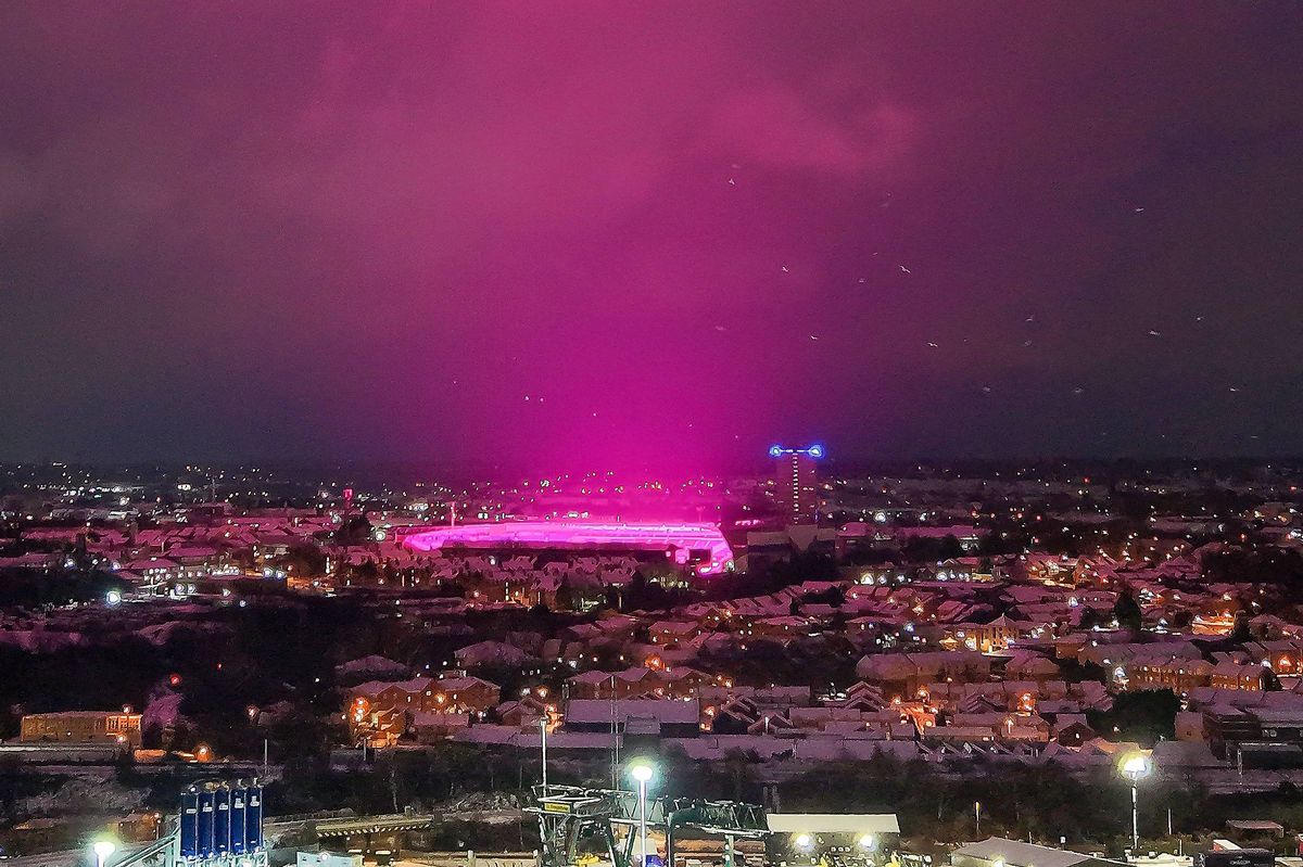
The blue sky over Birmingham during Storm Goretti(Image: Christopher Furlong, Getty Images)
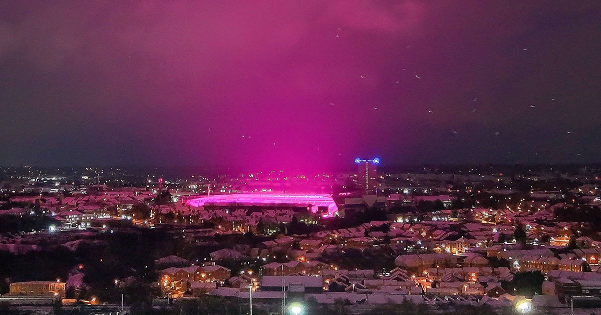
The mystery of the purple sky over Birmingham has been unravelled, with images revealing the source. Aerial shots of the city taken on Friday show a pink glow from the grow lights at Birmingham City Football Club lighting up both the sky and the stadium.
The lights the club used were LED lights, which help the grass on the pitch grow, a common practice used by club groundstaff. The revelation came amid rumours that snow was responsible for the unusual spectacle.
Storm Goretti, the first named storm of 2026 to hit the UK, has been causing havoc across the country. Warnings for snow and ice are in force across much of the UK as tens of thousands of people are still without power after the storm.
Yellow warnings for snow and ice continue until Sunday and rail disruption may be seen through the weekend across England, Wales and Scotland, National Rail said. About 30,000 properties were without power in the South West at 6am on Saturday, according to the National Grid’s website, along with close to 1,700 in the West Midlands and about 150 in the East Midlands, while all power has been restored in Wales.
Downing Street said support was being offered to homes left without power. Forecasters warned that the combination of melting snow and rain will increase the flood risk for some in the coming days.
READ MORE: Met Office issues new snow and ice warning after Storm Goretti chaosREAD MORE: Every game called off this weekend as FA Cup third round clash postponed
Forecasters recorded 15cm of snow at Lake Vyrnwy in Powys and 7cm at Preston Montford in Shropshire and Nottingham. In Scotland, there was 27cm at Altnaharra in Sutherland, 26cm at Loch Glascarnoch and 22cm at Durris in Kincardineshire.
The highest rainfall total was recorded in Cornwall, with 61.8mm at Colliford Dam, followed by 57mm at Ddolwen Bridge, Dyfed, and 54mm at White Barrow in Devon.

The purple sky eminated from Birmingham City’s stadium(Image: )
A yellow warning for snow and ice is in place until 3pm on Saturday, with further snowfall possible across parts of northern England and much of Scotland, while a widespread risk of ice is expected to cause disruption.
A separate yellow warning for ice covers large parts of England and Wales until midday on Saturday as partially thawed snow refreezes, accompanied by wintry showers and freezing fog. In Northern Ireland, a yellow warning for snow and ice will run until 11am on Saturday, with the Met Office warning of icy patches and some hill snow.

A fallen tree in Cornwall as Storm Goretti has caused havoc across the UK(Image: PA)
A yellow warning for snow and ice will be in force for much of Scotland, the East and West Midlands, north-east and north-west England and Yorkshire from 2am until 3pm on Sunday. A further 2-5cm of snow is likely in the warning area, with 10-20cm possible above 200 metres.
Dan Stroud, Met Office meteorologist, said the weather over the weekend will remain “unsettled and cold.” He said: “Wintry showers will continue to affect some coastal areas on Saturday, although these will increasingly become confined to northern and eastern parts as the day progresses.
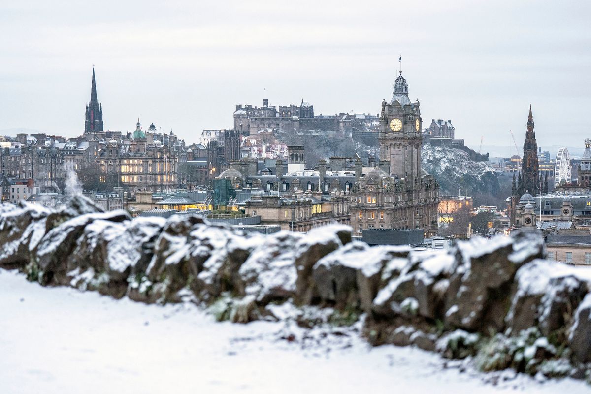
Edinburgh city centre as snow and ice warnings remain in place(Image: PA)
“Elsewhere, after a cold and frosty start, it should be a mostly dry day with variable amounts of cloud. It will be a widely cold day, with frost lingering across parts of the country. Sunday will start dry in the east, but cloud and rain already present in the west will move steadily eastwards.
“The rain will fall as snow inland across the north Midlands and areas further north. However, temperatures will rise through the day, meaning the snow will become increasingly confined to higher ground by the afternoon.”