A ‘Beast from the East’ storm could be just days away from sweeping across the UK, with weather forecast maps showing snow will hit major cities including London
19:17, 10 Jan 2026Updated 19:41, 10 Jan 2026
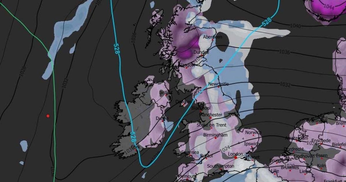
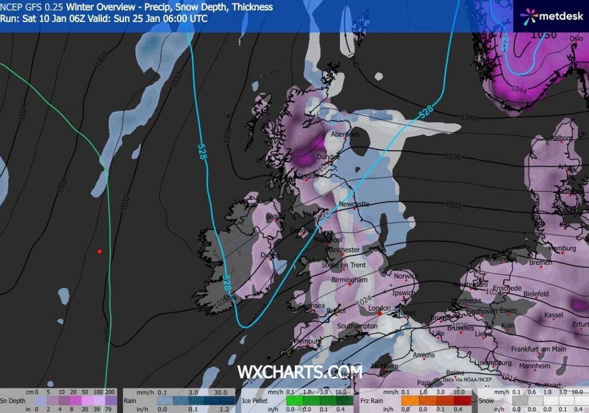
The snowstorm is expected to make landfall on January 23(Image: WXCharts)
More snow could fall across the UK later this month as a ‘Beast from the East’ storm appears to be on the cards.
Advanced forecast maps show a major weather front moving over the UK from the East on January 23, bringing snow across the entire length of the country. London, Birmingham, Manchester, Newcastle and Glasgow could all face flurries at around midday.
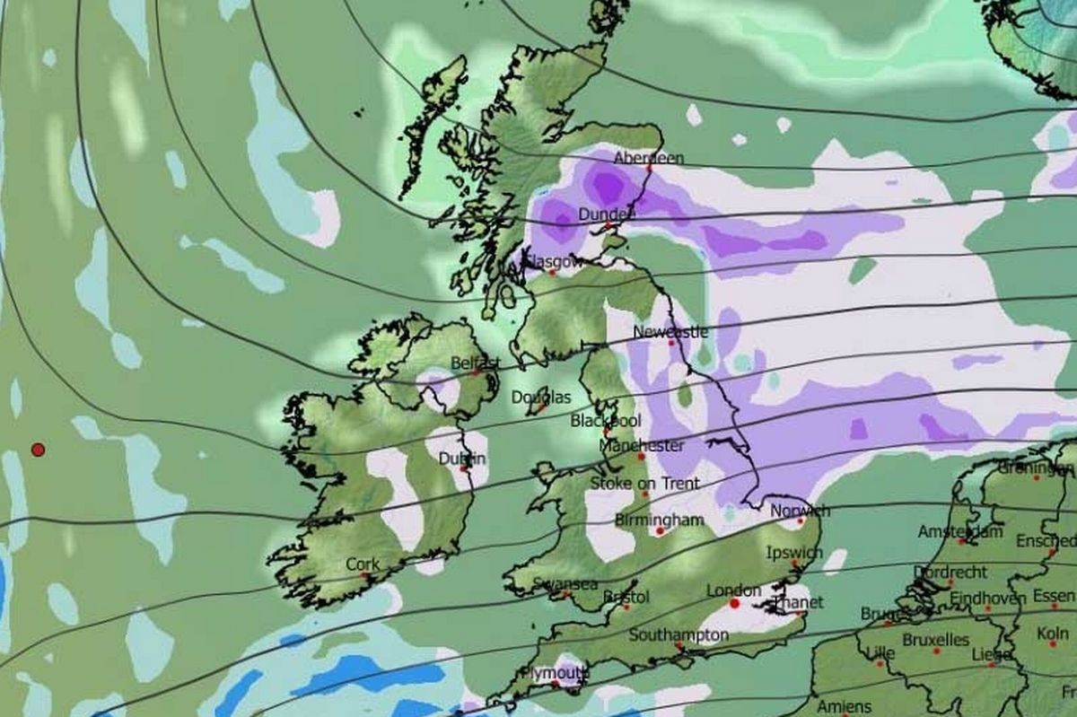
The GFS weather model suggests snow will continue falling throughout January 23 and 24, also hitting Wales and Northern Ireland. Snow coverage maps for January 24 and 25 reveal the true extent of this wintry blast.
More snow is expected on January 24(Image: WXCharts)
READ MORE: Snow forecast maps reveal 3-day blizzard bringing 16 inches after Storm GorettiREAD MORE: Met Office tells six areas ‘gather essentials’ as 12 more inches of snow coming
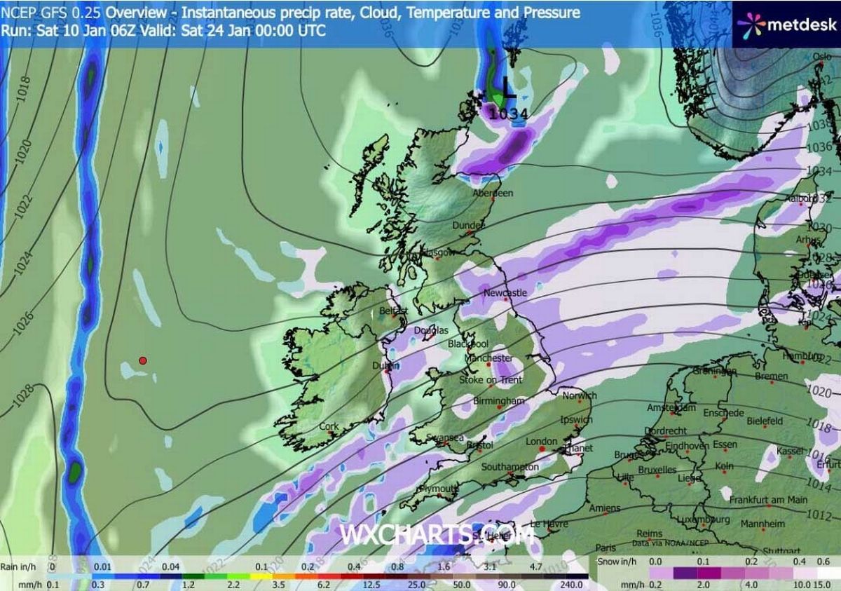
They show snow settled on the ground from the southern coast of England to the far north of Scotland – spanning roughly 600 miles. London, Bristol, Cardiff, Birmingham, Nottingham, Norwich, Manchester, Newcastle, Edinburgh, Glasgow, Dundee and Aberdeen are all seen with snow on the ground.
The blizzard could bring back memories of the infamous Beast From The East in 2018, when temperatures in some parts of the country dropped as low as -14C and snow accumulations topped 20 inches.
Snow coverage (in purple) on January 24(Image: WXCharts)
READ MORE: Met Office tells Brits ‘get emergency kit ready’ in new warnings for 37 hours
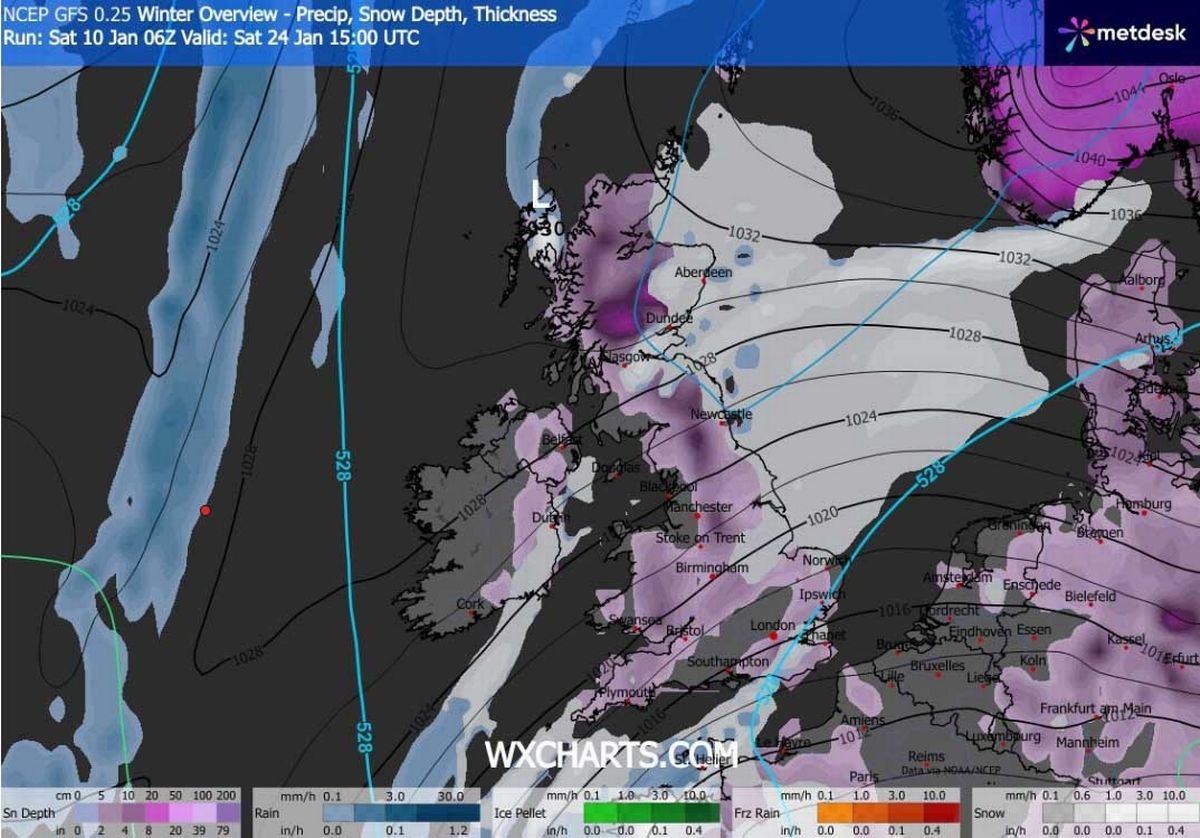
Although the weather front later this month is expected to come from the East, thankfully snow accumulations won’t be so extreme. The data suggests eight inches could settle in Scotland, two inches in northern England, with one inch settling elsewhere.
BBC Weather’s long-range forecasts also hint at more snow to come later this month and at the start of February. The January 19 to 25 forecast states: “The chance of any meaningful snowfall is low, but some wintry showers are possible in northern regions, chiefly in Scotland, in fleeting chillier and brighter spells between weather systems. For most areas, precipitation amounts will be near or above normal, with a further thaw of any remaining snow.”
Snow coverage (in purple) on January 25(Image: WXCharts)
READ MORE: Ryanair and Jet2 warn of flight delays at UK airports as even more snow forecast
The January 26 to February 8 forecast states: “The broad circulation pattern should linger through to the end of January and start of February, with mild west to south-westerly winds often present, and Atlantic low pressure systems bringing further bouts of wet and windy weather.
“Chiller interludes between systems, mainly in the northern UK, should be short-lived, and there is little sign of any return to a lasting cold regime. Any wintry showers should be confined to Scotland’s uplands, and temperatures are most likely to average out above normal.
“Uncertainty inevitably increases this far ahead, however, and there are suggestions of high pressure building at higher latitudes, possibly over Scandinavia. If that were to develop more strongly, then there would be a chance of some colder flows, so that’s something to keep an eye on. However, it’s not the favoured outcome at the moment.”