
A monster storm is expected to hit this weekend as new weather maps show the band of rain and snow sweeping across the UK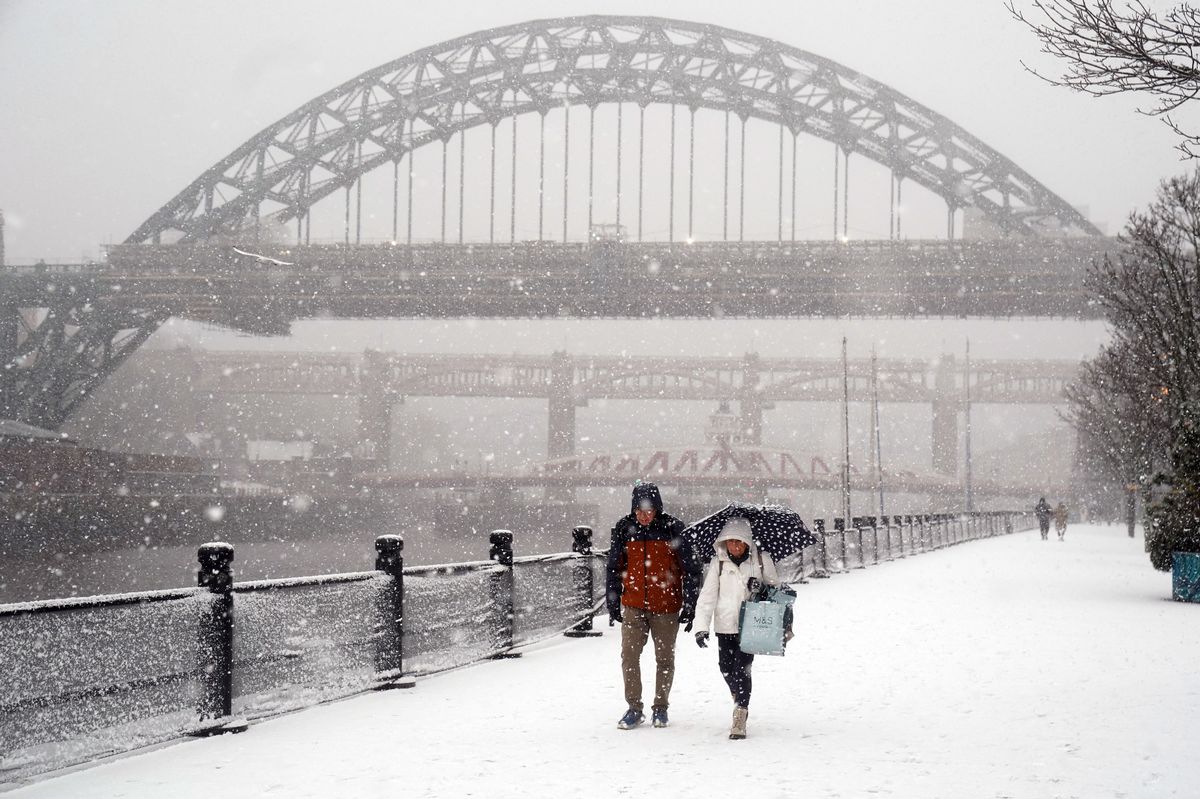
People braving the wintry conditions in Newcastle(Image: PA)
The wintry weather is set to continue with a snow and rain storm set to hit the country. Weather maps from WXCharts show a band of rain moving across the country on Saturday, January 17.
In higher ground areas, this is expected to fall as snow, with parts of England forecast to get buried in drifts up to 10 inches (25cm) deep. The charts show the band of rain and snow sweeping across the UK next Saturday evening.
In more northern parts of the country, and over high ground this is forecast to fall as snow, blanketing parts of England around the Peak District and the Yorkshire Dales, The Mirror reports. Overnight on Saturday and into Sunday morning the weather front is due to pass over the British isles, from west to east, leaving snow behind for many areas.
By early Sunday morning the band of rain and snow will have largely passed over the UK, with heavy snowfall lingering in parts of the Scottish Highlands and areas around Newcastle in the North East of England. Over this time snow is also expected to hit southern Wales, with around the Brecon Beacons seeing especially heavy snowfall, according to the forecasts from Metdesk.
The snow is set to make a return later in the day, with snowfall in the midlands this time and patches of the white stuff as far south as London by 3pm, the charts show. By Sunday afternoon much of the UK is forecast to be covered with snow, ranging from an inch or two up to 10 inches in some areas.
The deepest snow will be over the Cairngorms in the east of the Scottish Highlands, with as much as 10 inches forecast to have settled on the highest peaks by the end of next weekend. Meanwhile the Met Office long range forecast for the same period, covering Friday 16 Jan – Sunday 25 Jan says that weather is likely to remain changeable and unsettled over the period.
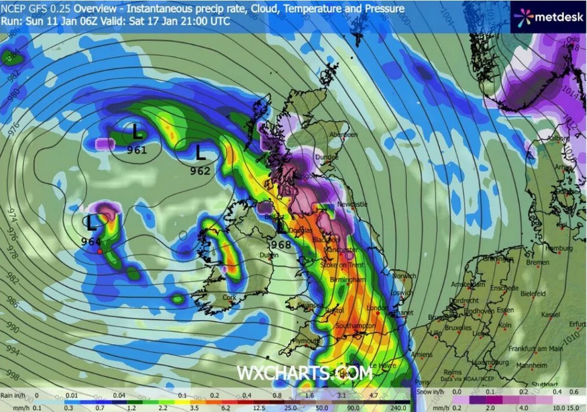
A weather map for Saturday January 17(Image: WX Charts)
“Further areas of low pressure moving in from the Atlantic will tend to dominate, meaning showers or longer spells of rain for many parts,” the forecaster said. “Wet weather will more likely be most prevalent across western areas, though given the potential for low pressure systems to become slow-moving in the vicinity of the UK, heavy rain is possible anywhere at times.
“Periods of windy weather are also possible from time to time. Temperatures probably near normal overall, though the possibility for some colder spells in the north, with the potential for associated winter hazards, and occasional milder interludes further south.”