ROAD DAMAGE: Recent icy temperatures will make the problem worse (Image: delectus/Getty)
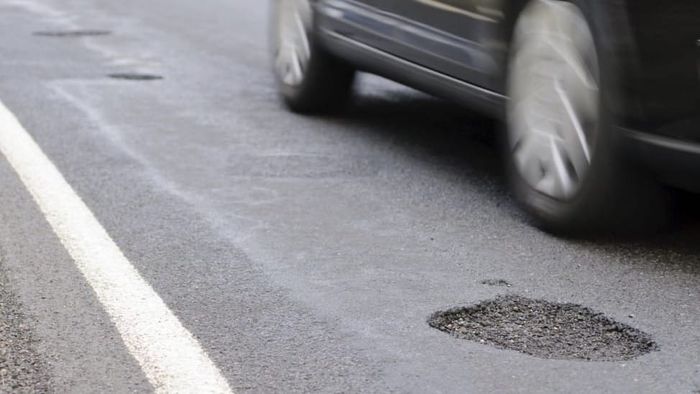
Potholes make driving a challenge and can result in costly damage to tyres, suspension and wheels. This winter’s harsh weather will only exacerbate the problem, as water finds its way into cracks in the road surface, freezes and then expands.
Drivers in England can now see how their council is performing when it comes to dealing with potholes. A new mapping tool from the Department of Transport has given road conditions in every council area either a red, amber or green rating – red areas have the worst roads, green the best.
“For too long, drivers have paid the price because our roads were left to deteriorate,” said Transport Secretary, Heidi Alexander. She said the colour-coded map allows the public to see how well councils are doing in delivering improvements in their local area.
WINTER MOTORING
A total of 11 councils received the worst red rating for the current condition of their road, while 26 councils received a green rating. Only three of the red-rated councils were outside London – in Derbyshire, Bath and North East Somerset, and West Northamptonshire.
Separate ratings also exist which take into account how well councils respond to potholes. However, our map (available on web only – you can see the full list below) is based solely on the ratings for the condition of the roads.
“We’ve put our money where our mouth is, increasing the funding for local highway authorities with £7.3 billion to fix roads and given them the long-term certainty they have been asking for,” said the Transport Secretary. “Now it’s over to them to spend the money wisely.”
Councils with pothole road condition rated RED
- Bath and North East Somerset
- Bromley
- Derbyshire
- Kensington and Chelsea
- Kingston upon Thames
- Merton
- Richmond upon Thames
- Sutton
- Waltham Forest
- Wandsworth
- West Northamptonshire
Councils rated GREEN
- Bexley
- Bournemouth, Christchurch and Poole
- Cornwall
- Coventry
- Essex
- Gloucestershire
- Hampshire
- Hillingdon
- Hounslow
- Isle of Wight
- Isles of Scilly
- Kingston upon Hull, City of
- Lewisham
- North Somerset
- Oldham
- Portsmouth
- Rotherham
- Sheffield
- Somerset
- Torbay
- Transport for London
- Warrington
- West Berkshire
- Wigan
- Wiltshire
- Wokingham
Edmund King, AA president and founding member of the Pothole Partnership, welcomed the move to hold local highways authorities to account. He said: “The top transport demand for 96% of AA members is fixing potholes with increased investment in repairing and upgrading roads.”
Caroline Julian, from British Cycling and founding member of the Pothole Partnership, added: “A smooth, well-maintained surface isn’t a luxury for cyclists, it’s essential for their safety. This new mapping tool is a step forward. It gives riders clear insight into how well their council is maintaining the routes they rely on every day, whilst holding decision-makers to account.”
READ NEXT