Britain is on alert for a major February freeze with a ‘dislocated Polar vortex’ putting the nation back on snow alert.
Temperatures are forecast to plummet this month as a Sudden Stratospheric Warming (SSW) stirs in high the Arctic atmosphere.
A severe SSW was behind the notorious 2018 Beast from the East which struck at around the same period of winter.
While experts have not warned of anything on the same scale, they say a similar monster could be sharpening its claws.
Jim Dale, meteorologist for British Weather Services, said: “We are looking at something around the middle of February, when it looks at the moment, we could get something significantly colder.
“This could be a big event, with a dislocation of the Polar vortex over Europe bringing the cold air over Russia, Scandinavia and the UK.
“This is more of a northerly rather than an easterly, but if it happens, we could be looking at a significant February cold spell with the risk of snow.”
The panic button has been pressed after meteorologists spotted an SSW event likely to come off during the next fortnight.
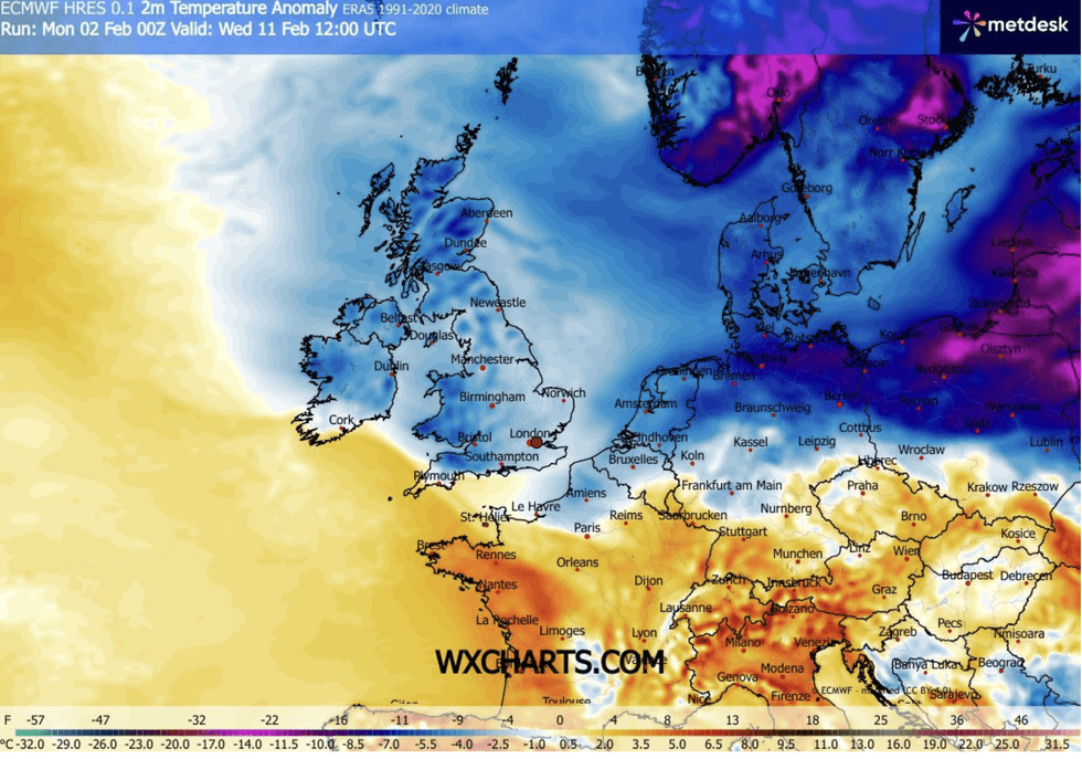
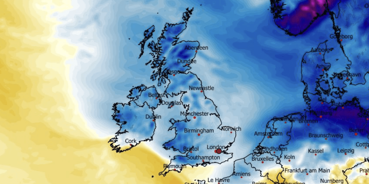
Weather maps show colder weather on the way
|
WX CHARTS
During an SSW, winds high in the Arctic stratosphere slow, or sometimes reverse, causing air to fall.
This compresses and warms, forcing the cold winds beneath to gush out of the Polar region lower into the northern hemisphere.
An SSW event not always leads to cold weather, but this one appears to be putting in motion the right gears for a freeze.
Dale said: “The dislocation of the Polar vortex is becoming more of a threat as the risk of this sudden stratospheric warming becomes apparent.
“For the moment it is a watching brief, and it is early, but it may be something we need to prepare for as we head towards the middle of the month.”
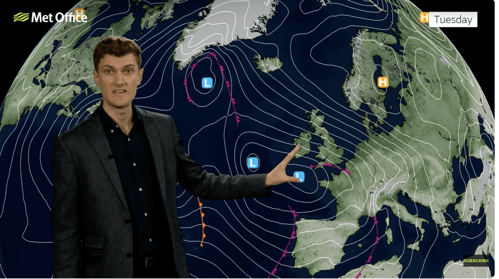
Met Office’s Jonathan Vautrey warns of low pressure heading in from the southwest
|
MET OFFICE
Government forecasters have noted the SSW risk but say any effect would be later in the month.
Next week, however, could bring a first taste of the cold following further outbreaks of wind and rain, the Met Office warned.
Meteorologist Alex Burkill said: “We could see something coming in from the east, and so we could see a drop in our temperatures, and there could be some wintriness as we go through the second week of February.
“Any low-pressure systems that do track further north and hit against that colder air could bring some sleet and snow.
“And any influence of an SSW would be towards the end of the month.”
Meanwhile, southern, southwestern England, Wales and Scotland, already drenched after last week, face a relentless deluge.
Warnings are in force across the West Country for flooding as water table and river levels hit tipping point.
Met Office meteorology Jonathan Vautrey said: “This extra rainfall does bring the potential of exacerbating some of the flooding impacts that we have seen of late.
“On Tuesday, we still have low pressure out towards the southwest, and there are some brisk southeasterly winds and that is starting to filter in some slightly colder conditions from Europe and pushing into the northern area of the UK.
“That is why we could see some snow falling to lower levels over the mountains of Scotland.”