It’s been another glorious weekend so far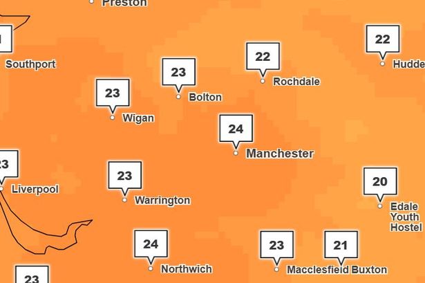 There is plenty more warm weather on the way(Image: Met Office)
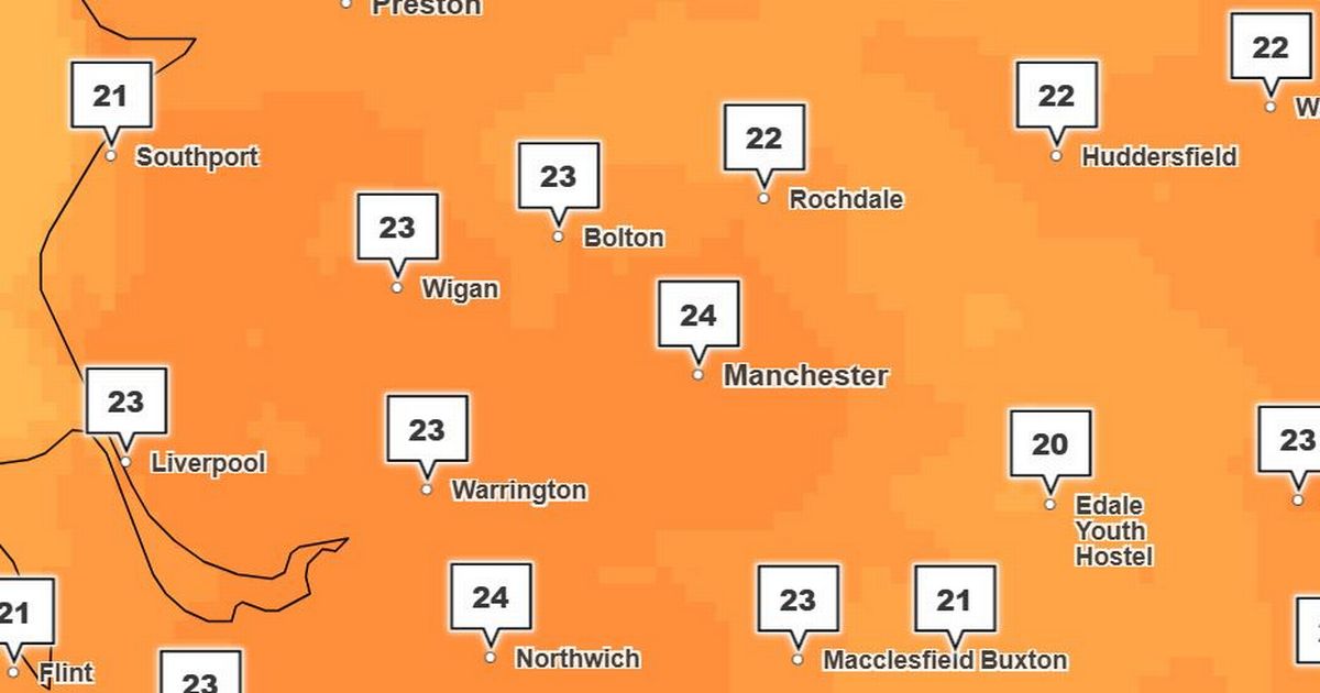
Blue skies and beaming sunshine have been covering Greater Manchester again so far this weekend.
Much of the UK has seen plenty of above-average temperatures in recent weeks, and the theme looks set to continue in our area.
Sunny intervals are forecast across Greater Manchester with highs of 23C today (May 10) and 24C on Sunday.
The Met Office is warning some Brits to expect thunderstorms in the coming days, however.
Heavy and potentially thundery showers could arrive in parts of the country on Sunday and continue on Monday.
The North West looks set to avoid the worst of the weather, as thunderstorms are forecast for the West Country, South Wales and parts of the West Midlands
 Content cannot be displayed without consent
However, the Met Office isn’t ruling some rainfall over Greater Manchester on Monday, with a 30 per cent chance of precipitation currently forecast for the afternoon alongside highs of 25C.
Warm, sunny conditions are currently expected to continue next week, with highs of between 19C and 21C forecast in the next seven days across Greater Manchester.
‘Quite hit and miss’
In areas of the country where rain could fall, the Met Office is warning of ‘heavy, short sharp’ bursts of wet weather, hail and lightning – as showers drift in from the south.
Met Office meteorologist Jonathan Vautrey said: “As is the case with thunderstorms, they’re often quite hit and miss.
Join the Manchester Evening News WhatsApp group HERE
“Obviously it has been a pretty dry spring so for many areas rain is needed, but because of the heavy nature of these showers, splashing onto hard surfaces, there is the potential for minor localised issues and flooding.”
Between 20mm and 30mm of rain could fall within a couple of hours, or as much as 40mm in three hours, the Met Office says.