Next week will see temperatures rising above 20°C again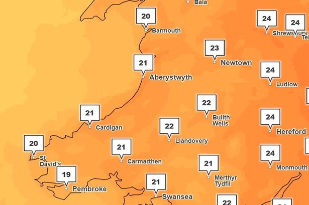 A new weather front could emerge over the UK(Image: Met Office)
After a shaky start to the official summer months, Wales may be in for a more seasonable spell of weather, according to the latest outlook from the Met Office. Following a week of inconsistent temperatures, intermittent rain and breezy conditions, forecasters are now predicting a warmer week ahead.
In its latest forecast, the Met Office notes that the beginning of the upcoming week will be a mix of sunshine and showers, mainly affecting the north of the UK while the south is expected to see plenty of dry weather.
On the wider outlook for Wales, the Met Office states: “Mainly dry early next week with a mixture of cloud and periods of strong sunshine. Lighter winds than of late and turning warmer.”
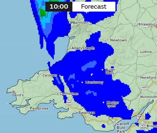
Weather maps suggest that around 7pm on Monday, June 9, some rain will be affecting parts of Wales including Llandeilo and Llangollen.
At 10pm the rain is expected to spread, from Fishguard towards Carmarthen, with other isolated parts of Wales also seeing rain during the evening. Read the biggest stories in Wales first by signing up to our daily newsletter here
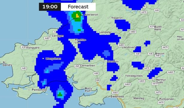 Rain is expected to hit parts of Wales on Monday evening (Image: Met Office)
Looking ahead to Tuesday, the Met Office states that there is a possibility of “a new low-pressure system” currently located far out in the Atlantic. This system may push a new weather front over the UK, though exact details remain uncertain at this time.
This low-pressure system may also help to develop a more southerly flow, bringing warmer air from Wednesday onwards.
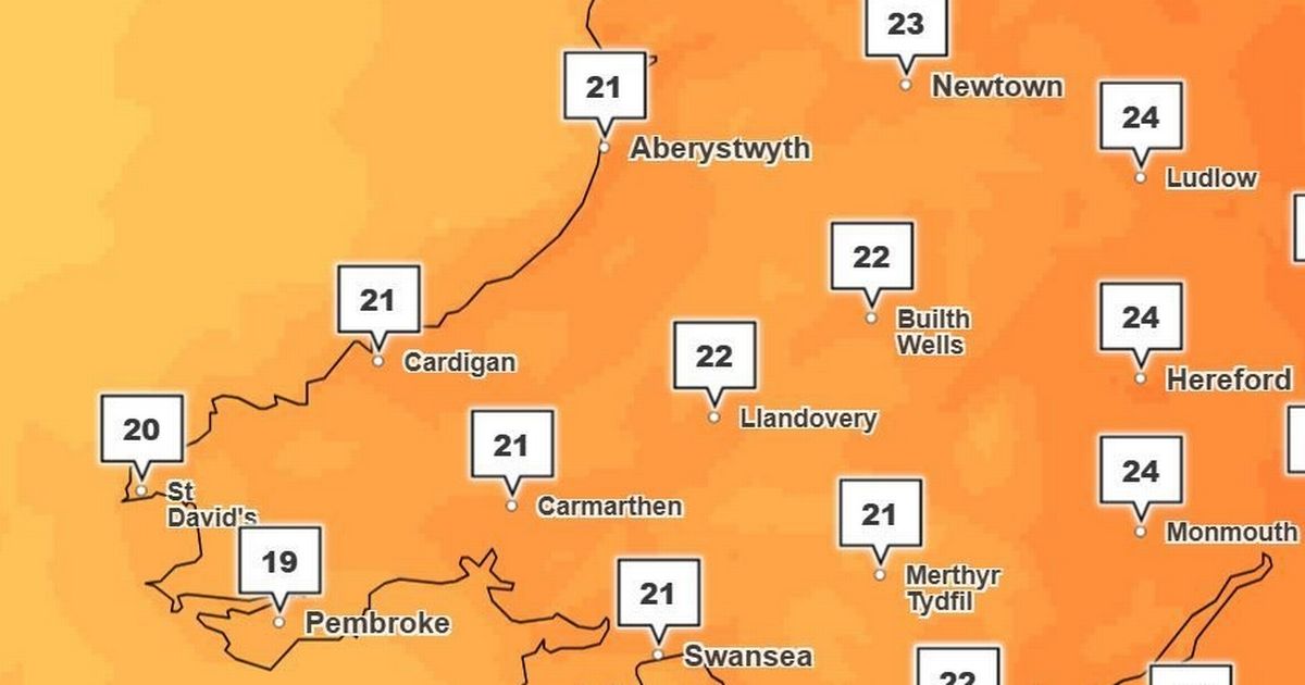
As a result, temperatures are expected to rise above 20°C. Monmouth, up towards Hereford and Ludlow are expected to see the hottest of temperatures, with 24°C.
Meanwhile, areas including Swansea, Cardiff, Builth Wells and Aberystwyth are looking to be averaging at 21°C to 22°C.
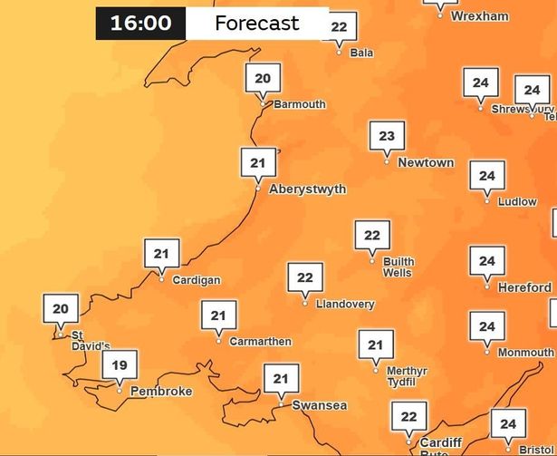 Wednesday is set to be a warm day (Image: Met Office)
This warmer air also brings risk of thunderstorms, potentially leading to an unsettled end to the week across the UK.
The start of this period (Thursday June, 12 to Saturday, June 21) is expected to be widely warm or very warm, possibly locally hot in parts of the south and east.
Showers and thunderstorms are predicted across most areas, with rain forecasted on Thursday, June 12 from the southeast of Wales in Newport – moving towards Merthyr, Brecon and Aberaeron.
 Rain will be back on the morning of Thursday, June 12 (Image: Met Office)
According to the long range forecast, the Met Office states: “Over the weekend (June 14-15) and into the start of the following week, most parts will become drier. However, there may be another brief spell of rain with a risk of some thunderstorms, before high pressure more firmly builds in from the west.
“The rest of the following week looks like being mainly dry with variable cloud and some sunshine and often warm or very warm. The far north may be largely cloudy with a threat of some more rain at times though.”
Get daily breaking news updates on your phone by joining our WhatsApp community here. We occasionally treat members to special offers, promotions and ads from us and our partners. See our Privacy Notice