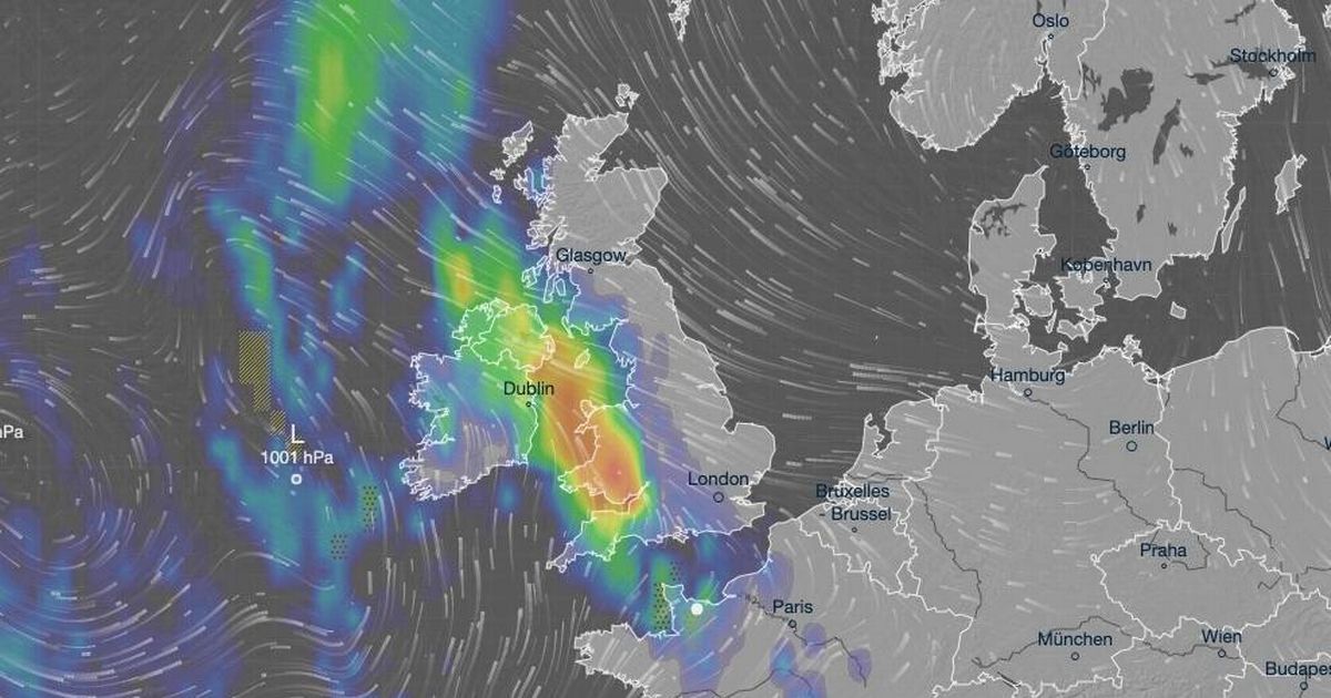
The Met Office warns of ‘intense, thundery’ conditions across the UK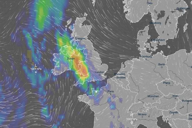 The weather forecast suggests a period of heavy rain from Wednesday evening going into Thursday.(Image: Ventusky)
Half of the average monthly rainfall is forecasted to hit parts of the UK, including Bristol, Gloucestershire and Somerset, this week, with the possibility of thunderstorms, according to weather forecasters.
The heaviest rainfall, which could reach up to 40mm over just a few hours, is expected to affect south Wales and southwest England on the evening of Wednesday, June 11, and may persist into Thursday.
Met Office deputy chief meteorologist Mike Silverstone said: “After largely benign weather early in the week, some intense, thundery showers will move in on Wednesday evening.
“These thunderstorms are being triggered by some warm, humid air that is moving into the UK from the south.
“The intense rainfall could see 20-40mm accumulating over just a few hours, which could cause some disruption.
“While there are no severe weather warnings issued at the moment, it is possible thunderstorm warnings may be issued this week.”
The average June rainfall in Bristol is 65mm, in Cardiff it’s 74mm, and in Plymouth it’s 64mm.
Forecasters at Metdesk have issued weather maps indicating that cities are set to bear the brunt of this week’s downpours, with some areas expecting up to 40mm of rain in just a few days, reports the Mirror.
What will the nights be like?
The likes of Bristol, Somerset, Exeter, Gloucestershire and even Hereford, which usually see 48mm of rain in June, are also in for a soaking.
Yet, as temperatures climb, we’re in for muggy air and sweltering nights.
Mr Silverstone said: “As temperatures rise this week, it is possible heatwave thresholds could be reached in some parts of the UK, particularly the northwest Midlands, north-west England and northeast Wales, however it is very dependent on cloud cover later this week, so it is not a certainty.”
“This warm spell will feel different to the fine weather we experienced in May as the humidity will be much higher, making it feel more uncomfortable.”
“Additionally, while in May the nights were still fairly cool, overnight temperatures this week are forecast to remain fairly warm, which can disrupt people’s sleep.”
What has the Met Office forecasted?
The Met Office’s forecast for Wednesday is: “Dry for much of Wednesday and feeling warm with spells of strong sunshine by day.
“Heavy showers arriving later in the evening, possibly thundery, with a strengthening wind. Maximum temperature 24 °C.
The rest of the week’s forecast is: “Changeable for the rest of the week with further heavy showers and thunderstorms possible, though some brighter interludes in between.
“Warm and humid on Thursday and Friday, fresher on Saturday.”
Where will be the hottest regions in the UK?
London and the Southeast of England are expected to be among the warmest regions this week.
The capital is set to experience highs of 27C on Friday, following midweek thunderstorms.
This marks an increase from Monday’s highest temperature of 21.9C, as recorded by the Met Office at Heathrow Airport in west London.