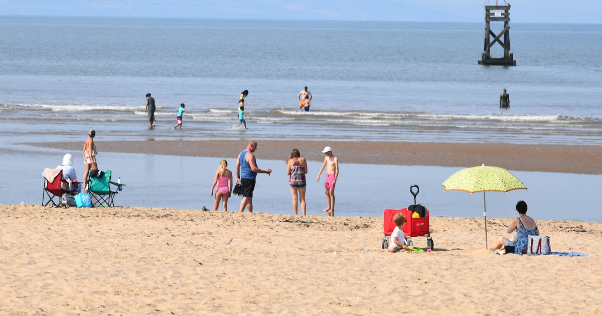
The heat has been gradually building throughout the week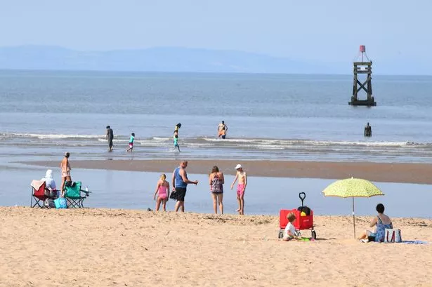 Families on Crosby Beach(Image: Liverpool ECHO)
Temperatures are spiking in Liverpool tomorrow with the Met Office currently forecasting the city to reach a high of 29C and even higher temperatures of 31C on Friday, June 20. The weather agency has predicted “heatwave conditions” for many parts of the UK over the coming days and into the weekend.
The heat has been gradually building throughout the week and much of the UK is now basking in glorious sunshine. It is forecast to be sunny and dry for the duration of the day tomorrow, with 29C being the temperature at 5pm, 6pm and 7pm. After 10am, the whole day will experience temperatures of 20C and above. As late as 11pm is forecast to be a blazing 23C.
According to the Met Office, the rising temperatures this week are a combination of several factors. Over the next few days, settled weather and warm sunshine will allow temperatures to rise day on day.
Tony Wisson, Deputy Chief Meteorologist for the Met Office said: “Temperatures will then rise further towards the end of the week as winds turn more southerly and even warmer air over continental Europe will be drawn across the UK. We could very well see several places exceeding 30C, which will be the highest temperatures of the year so far.”
The highest temperature of the year so far in Liverpool is set to be Friday, June 20. A high of 31C has been forecast for around 4pm. The Met Office says there will be “sunny intervals” throughout the day. In the coming days, pollen levels are said to be “very high”, with a “high” UV level.
A Met Office map taken from 5pm today and 5pm tomorrow shows the huge spike in temperatures over the next 24 hours. At 5pm today, temperatures will be 20C and at the same time tomorrow (June 19) the temperature will be just shy of 30C, at 29C. This is above average for this time of year.
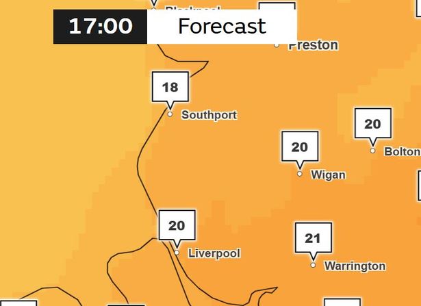 Met Office map for 5pm, June 18 2025(Image: Met Office)
Heatwave conditions in the UK are met when a location records a period of at least three consecutive days with temperature values meeting or exceeding the heatwave temperature threshold for that location. Across much of the north and west of the UK this threshold is 25C, but across Greater London and the Home Counties the threshold is higher, at 28C.
High pressure is expected to move away from the UK into early next week resulting in temperatures falling. However the Met Office says there is uncertainty in how quickly this happens, and the peak temperatures experienced across the UK.
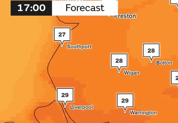 Met Office weather map for Thursday, June 19, 2025(Image: Met Office)
Parts of the UK have been placed under a yellow health alert by the UK Health Security Agency (UKHSA). The alerts come as the temperatures are set to soar across the UK. While the North West is not currently under a heat health alert, the temperatures are still forecast to be very hot.
The UKHSA has issued heat-health alerts from noon today, June 18, until June 22 at 6pm. According to the agency’s Weather-Health alerting system ranks, a yellow alert is issued when temperatures are unlikely to impact most people, but could impact those who are particularly vulnerable. It falls below an amber or red alert. You can see the full list of areas under the alerts here.