The weather agency has issued yellow thunderstorm warnings across the UK as temperatures soar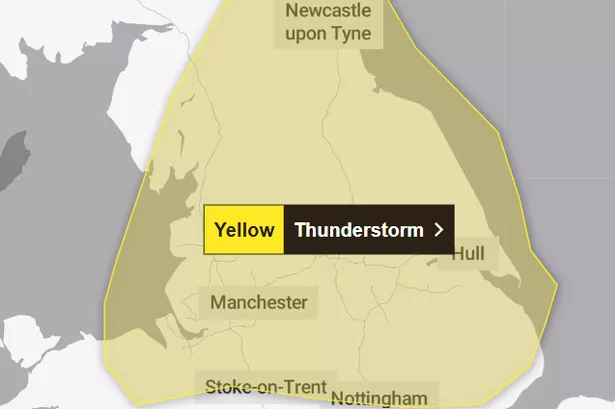 The Met Office has issued yellow weather warnings across northern England(Image: The Met Office)
A thunderstorm warning has been issued by the Met Office affecting parts of the UK this weekend, amid an amber heat-health alert across England.
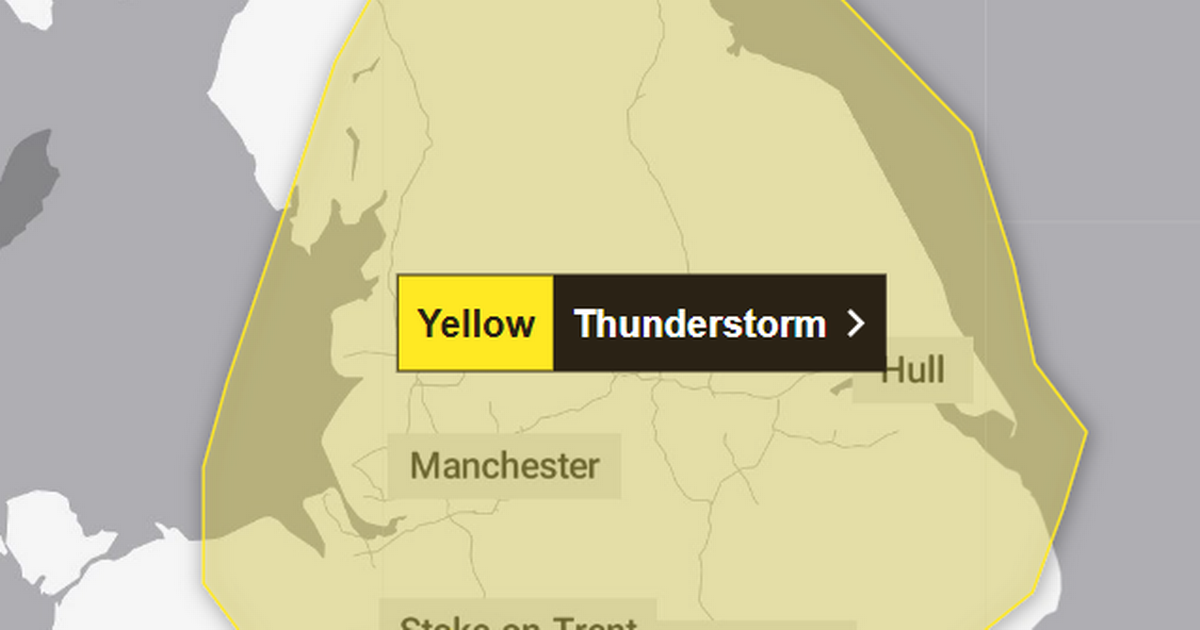
The weather agency says scattered thunderstorms may cause disruption Saturday afternoon (June 21) and into the evening and night, with a yellow warning in place from 3pm tomorrow until 4am on Sunday (June 22).
The Met Office issues weather alerts for a wide range of phenomena including rain, hail, snow, ice and fog. The yellow thunderstorm warning affects Greater Manchester and large parts of North West England, as well as North East England, East Midlands, West Midlands, Yorkshire & Humber and Wales.
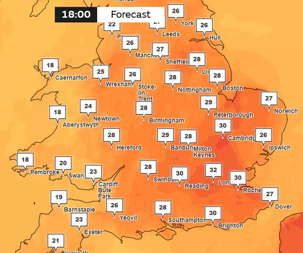
The alert comes as forecasts suggest temperatures could peak at 34C in eastern England on Saturday, with heatwave conditions predicted for much of the UK.
Ahead of the extreme heat, the UK Health Security Agency (UKHSA) issued rare amber heat-health alerts across the whole of England, which will remain in place until 9am on Monday (June 23). The UKHSA warns that the whole health service is “likely” to be impacted by high temperatures, with a “rise in deaths” expected.
Highs of 27C are expected across Greater Manchester on Saturday, with Sunday feeling slightly cooler with highs of 21C.
 Highs of 32C are forecast for Saturday, June 21, at the peak of the UK heatwave(Image: The Met Office)
The Met Office previously warned that the hot weather could bring “intense thunderstorms” to the UK. It said that northern and western parts of the UK may see some showers and thunderstorms, with parts of Wales, England and southern Scotland potentially hit with worse storms.
Deputy Chief Meteorologist, Dan Holley, said on Thursday (June 19): “While Saturday will be a dry and fine day for many, a few showers or thunderstorms will be possible across northern and western parts of the UK, with an increasing risk of some intense thunderstorms developing across portions of north Wales, northern England and southern Scotland later in the afternoon and into the evening hours, which could bring heavy downpours, frequent lightning, gusty winds and possibly large hail.”
The Met Office has told Brits to expect the following disruption ahead of the yellow thunderstorm warning:
- Spray and sudden flooding could lead to difficult driving conditions and some road closures
- There is a small chance that some communities become cut off by flooded roads
- There is a slight chance that power cuts could occur and other services to some homes and businesses could be lost
- There is a small chance that homes and businesses could be flooded quickly, with damage to some buildings from floodwater, lightning strikes, hail or strong winds
- Where lightning strikes occur, there is a chance of delays and some cancellations to train and bus services
If you find yourself outside and hear thunder, the Met Office has said to protect yourself by finding a safe enclosed shelter, such as a car.
“Do not shelter under or near trees, or other structures which may be struck by lightning. If you are on an elevated area move to lower ground,” it warned.