This week will look a lot different to the last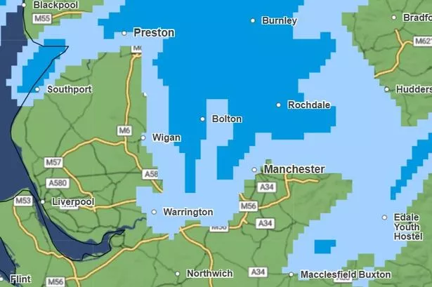 Heavy rain is likely to hit the region this afternoon(Image: Met Office)
Sizzling temperatures have cooled in Greater Manchester with the recent heatwave coming to a halt.
Glorious sunshine basked over the region for much of the past week, with temperatures climbing to around 30C.
But the region saw a change in conditions on Saturday (June 21) with spells of rain, amid a UK warning for thunderstorms which saw parts of the country further north badly hit.
The Met Office is forecasting much cooler temperatures over the coming days compared to last week.
Highs of 21C are forecast in Manchester, Salford, Stockport and Trafford today (Sunday), 19C in Oldham, and 20C in the rest of the region.
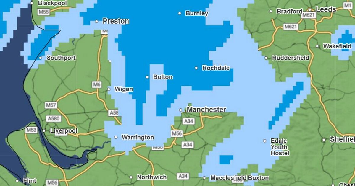
Frequent showers are forecast across the day, with periods of heavy rain also forecast this afternoon.
Content cannot be displayed without consent
Rain is expected to be at its heaviest at around 3pm and 4pm across the region, with heavier rain in Bolton expected from 2pm.
Anyone who has been struggling to sleep in the recent heat will welcome the news of cooler overnight temperatures, with lows of 11C to 12C expected in Greater Manchester overnight.
The Met Office expects Monday to be mostly dry and cloudy, with sunny intervals in the afternoon before an overcast night.
Some parts of Greater Manchester have a higher chance of seeing showers, including Oldham and Rochdale.
Join the Manchester Evening News WhatsApp group HERE
Temperatures are expected to fall again on Monday, with highs ranging from 17C to 19C across the region, and lows of around 13C or 14C heading into Tuesday.
Forecasters currently expect a similar pattern throughout the coming days, with top temperatures lurking in the low-20s, plenty of cloud and a few showers in the forecast – before brighter sunny intervals return by next weekend.