Weather maps show that some parts of the country could see the mercury reach 39C
Chiara Fiorillo and Maxine Denton Reporter
21:38, 05 Jul 2025
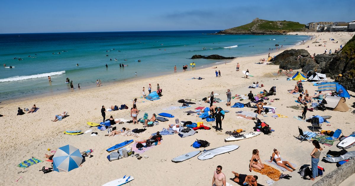
 File photo: Porthmeor Beach in St Ives on hottest day(Image: Greg Martin / Cornwall Live)
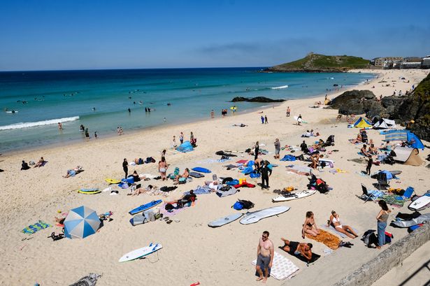
The South West is set to be one of the hottest places in Britain later this month as temperatures start to rise again. The latest weather maps from WXCharts suggest that parts of the country could see the mercury rise to almost 40C on July 14.
According to the forecast, which uses Met Desk data, temperatures in the West Midlands and down into the South West could be the highest, rising up to 39C. On July 14, the South West and South East of England are also expected to see temperatures in the mid to high 30s, with areas around London expected to experience 35C, according to the weather maps.
Meanwhile, Wales will experience temperatures of up to 38C in areas bordering England. But Northern Ireland and Scotland will be cooler, as the mercury won’t reach 30C but will hit highs of 27C. While July 14 is expected to be the next hottest day, these warm conditions are predicted to last for around a week from July 11 to July 18, The Mirror reports.
The Met Office’s long-range forecast from Wednesday, July 9 to Friday, July 18 says: “A broad northwest/southeast split in the weather looks most likely through much of this period. Towards the northwest, Atlantic frontal systems will bring occasional rain and cloudier skies at times, along with breezier conditions, though there should be some drier, brighter interludes too.
“Further south and east, high pressure will likely dominate with a fair amount of dry and sunny weather to be had. With this, there is a signal for increasing heat and humidity and the potential for another period of hot weather around the second weekend of July, and possibly lasting into the following week. Whilst a lot of dry weather is likely in the south, thunderstorms are possible at times, though widespread rainfall looks unlikely.”
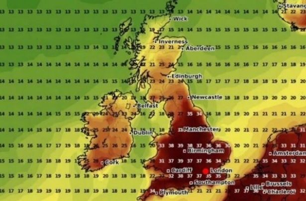 The South West is set to be hit with a heat burst this month(Image: WXCHARTS)
The end of July will also see warm conditions hitting the country, with temperatures likely to be above average overall. The Met Office said we are likely to experience “a continued, and perhaps higher than normal, chance of occasional hot spells, especially further to the southeast.”
But at the beginning of August, there is a possibility of more widely unsettled weather, forecasters said. It comes as provisional Met Office statistics revealed that England had its warmest June on record this year, while the UK experienced its second warmest since the series began in 1884. This follows a record-breaking spring, which was officially the warmest and sunniest spring on record for the UK.
Met Office Climate Scientist, Dr Amy Doherty, said: “While we’ve not conducted formal climate attribution studies into June 2025’s two heatwaves, past studies have shown it is virtually certain that human influence has increased the occurrence and intensity of extreme heat events such as this. Numerous climate attribution studies have shown that human influence increased the chance that specific extreme heat events would occur, such as the summer of 2018 and July 2022.
“Our Met Office climate projections indicate that hot spells will become more frequent in our future climate, particularly over the southeast of the UK. Temperatures are projected to rise in all seasons, but the heat would be most intense in summer.”
South West five-day weather forecast
This Evening and Tonight:
The evening will start rather cloudy with patchy drizzle and some fog over the Moors. The cloudy, murky and occasionally damp theme will continue in the west overnight, though some clearer intervals are likely to develop further east. Rather humid. Minimum temperature 16 °C.
Sunday:
Sunday morning still looks rather cloudy, with patchy rain in the west and perhaps a few heavy showers developing further east. A drier and brighter afternoon is expected though. Maximum temperature 20 °C.
Outlook for Monday to Wednesday:
Monday looks mostly dry, bright and breezy. High pressure will then become more dominant. Remaining dry on Tuesday and Wednesday with lighter winds and increasingly warm spells of sunshine developing.