
. On Friday, August 1, according to maps from WXCharts, temperatures of around 31C are expected in the southern areas of England.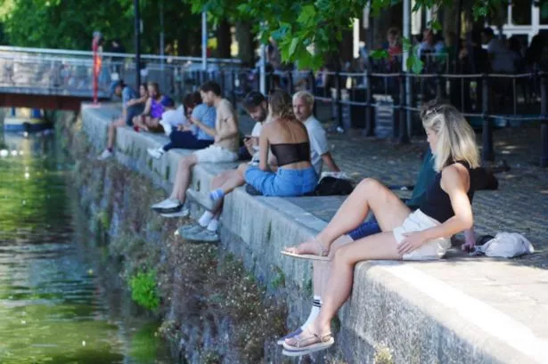 . On Friday, August 1, according to maps from WXCharts, temperatures of around 31C are expected in the southern areas of England.
All the parts of England that will be sizzled in soaring temperatures from early August have been revealed. On Friday, August 1, according to maps from WXCharts, temperatures of around 31C are expected in the southern areas of England.
Areas set to benefit include Hampshire, the Isle of Wight, Greater London, Surrey, West Midlands, Warwickshire, Gloucestershire, Berkshire and Sussex. And highs of 30C are expected to continue to spread across southern England on Sunday, August 3.
The advanced modelling comes from WX Charts, which uses Met Desk data. But in the short term, the Met Office warns to expect “bands of rain and thunderstorms affecting many.”
READ MORE UK households with cars on their driveway could be handed free £300 payment
The forecasting agency says: “A cloudy, damp start, particularly for the southeast and across Northern Ireland where heavy rain is expected during the morning. Brighter elsewhere, though showers soon return; heavy, thundery, and with a risk of hail by the afternoon.
“Further outbreaks of rain across central and northern areas, heaviest and most persistent in the northwest. Drier in the south and east with a few isolated showers.
“Rain across western Scotland eases through the day. Elsewhere a mixture of sunny spells and scattered, possibly thundery showers, mainly in the east. Feeling warm in any sunny spells.”
The outlook for Wednesday to Friday adds: “Sunny spells and scattered showers remain the theme this week as low pressure continues to bring unsettled conditions. Less showers, more sunshine by Thursday, with temperatures around the seasonal average.”
The BBC Weather team says Monday 28 July to Sunday 3 August will be “near seasonal temperatures”, adding: “The end of July and early August may see a continuation of the cooler and changeable conditions, along with a brisk west to north-west or even northerly flow at times. This is likely to be associated with a stronger low pressure in the eastern North Atlantic, which will later move towards Scandinavia as the high pressure area shifts west or north-west of the UK.
“In this case temperatures would be close to the seasonal average for this time of year although they could dip below average at times, especially across Scotland and perhaps Northern Ireland.
“On the other hand the high pressure ridge could also move closer to the UK creating more settled conditions and gradually rising temperatures. Confidence in the forecast remains low though.”