Saturday will see early morning rain clear to make way for a dry sunny morning.
Patchy cloud will bubble up from late morning, perhaps giving a few isolated afternoon showers, with a maximum temperature of 20C.
From Sunday it will be mostly with light winds and gradually turning warmer.
Parts of England will experience high temperatures into the 30s at the start of next week and while NI will also heat up – it won’t be to the same extent.

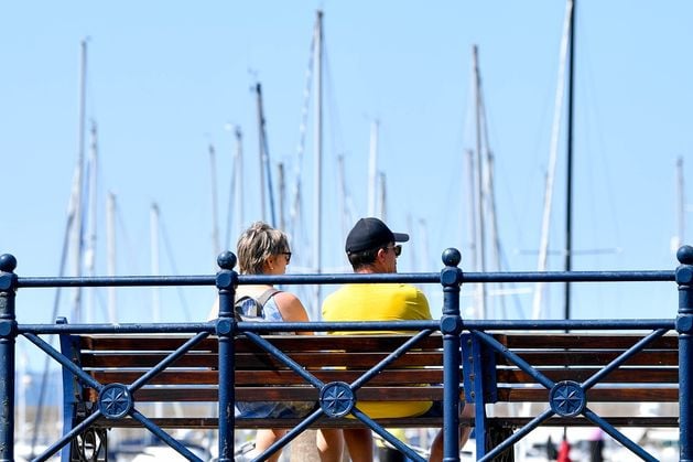
People in Bangor enjoying the weather. Photo – Andrew McCarroll/ Pacemaker Press
Watch: Planes struggle to land at Belfast City Airport as Storm Floris hits NI
Kathryn Chalk, Operational Meteorologist, at the Met Office said: “The heat will start building on Sunday mainly in the south before extending into northern regions by Monday and Tuesday.
“Temperatures reaching into the low 30’s, 32-33C possible in London for example.
“This is mainly from an area of high pressure leading to a southerly flow and thus a build of temperatures day on day from Sunday until at least early next week. However, the longevity of the heat is uncertain at this stage on when cooler fresher air approaches.
“Northern Ireland will see some outbreaks of rain from the remnants of ex-tropical storm Dexter later Sunday and into Monday, before temperatures start to rise Monday and Tuesday, climbing into the mid-20’s. So not as high as the low to mid 30s mainly across England.
“A few showers possible on Monday but largely cloudy with bright or sunny spells later. Highs 24C. Similar on Tuesday again with the risk of the odd heavy shower, with 23-24C as a high. Warm overnight. Average temps for NI are around 18C so will still be above average for August.
“Detail is uncertain on the longevity of the heat from Tuesday onwards. But it’s likely for NI, we could see some heavy showers or spells of rain arrive from the west with temperatures dropping back to average through the period.”
Meanwhile, in the Republic the ex-tropical storm will usher in some patchy rain and drizzle, particularly to the west and northwest of the country, on Sunday afternoon when it sweeps across the Atlantic.
However it will bring “some mild and humid air with a more southerly airflow”.
This is likely to result in some “warmer and more humid conditions” for a time early next week, with highest temperatures expected to reach the low to mid-20s. While there will be good spells of sunshine, some heavy showers may occur in parts too.
Met Éireann said that from midweek, though details remain uncertain, we are likely to return to a fresher westerly airflow, with temperatures returning to average in the high teens.