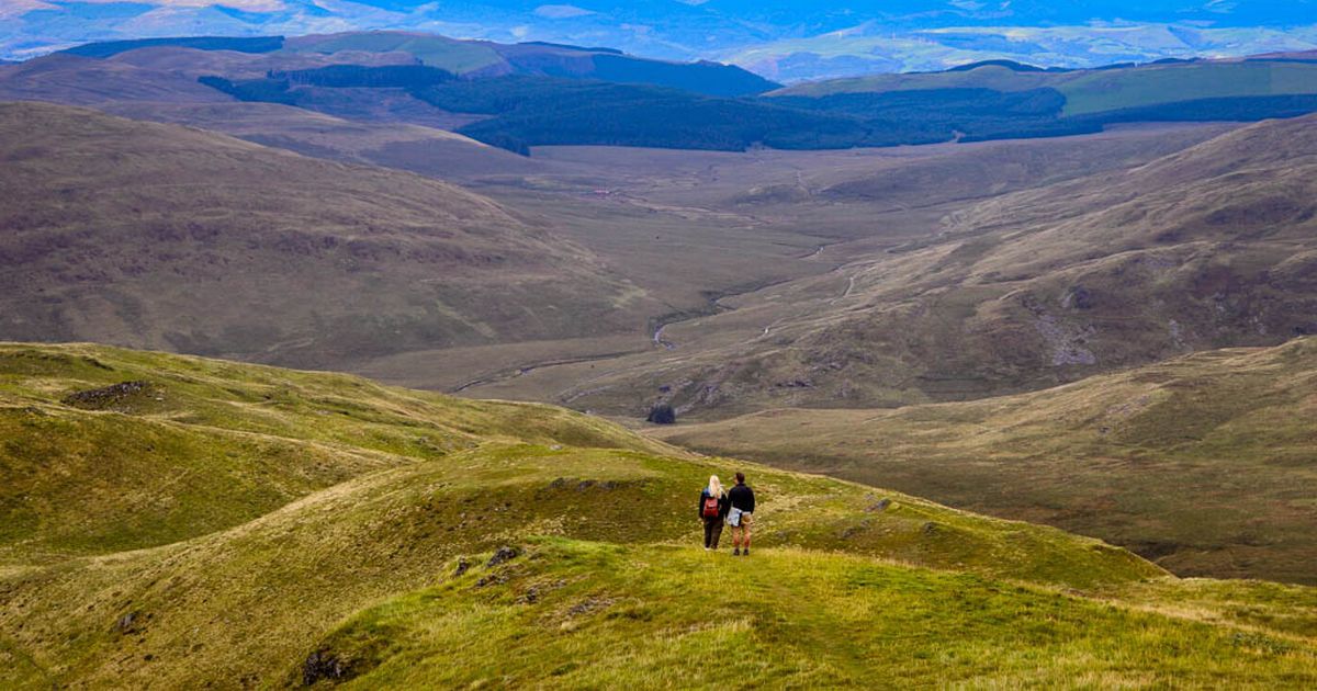
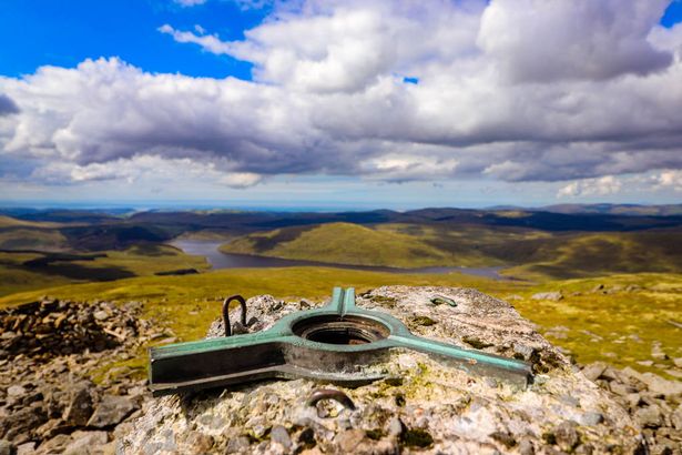
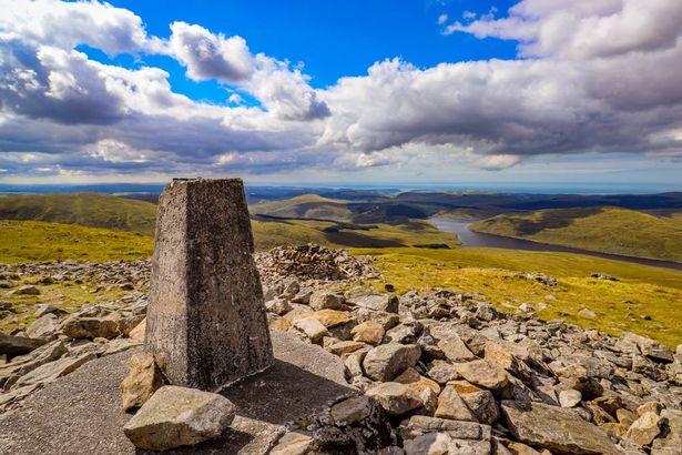
This ethereal-looking peak promises epic views but does not have car parks, road signs, or clearly marked trails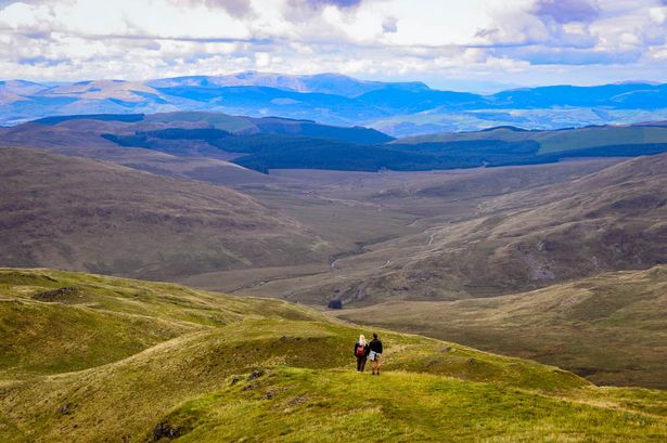 Located in Ceredigion near Ponterwyd, at 2,468ft, Pumlumon Fawr is the highest point in Central Wales(Image: Portia Jones )
When your country is blessed with epic landscapes, it’s bound to attract the attention of hikers and hoards of TikTokkers in flip-flops desperate for a #SummitSelfie. In the post-COVID era in particular, Wales has endured its most scenic beauty spots crammed with tourists flocking to the area, often leaving piles of rubbish and hanging bags of dog waste in their wake.
While Bannau Brycheiniog National Park (Brecon Beacons) has continually begged ill-equipped and unprepared tourists to stay away from the mountains, there’s one quiet peak in Wales that rivals the jaw-dropping views of Yr Wyddfa (Mount Snowdon), which has no queues, crowds, or litter and is usually only visited by pro-hikers who have a deep love and respect for our mountains.
In the wilds of the Cambrian Mountains in Mid Wales, Pumlumon Fawr (known as Plynlimon in English) has somehow managed to escape the attention of snap-happy day-trippers.
Located in Ceredigion near Ponterwyd, at 2,468ft, Pumlumon Fawr is the highest point in central Wales. However, this ethereal-looking peak does not have car parks, road signs, or clearly marked trails, and it’s not an easy trek in these isolated uplands.
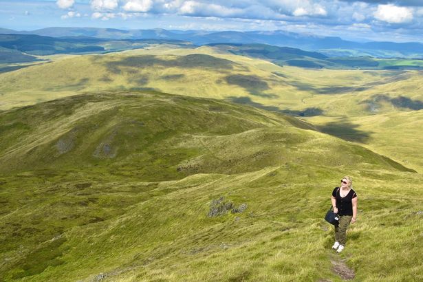
 Its a wild and remote trek to the summit that rivals Yr Wyddfa and Pen y Fan in terms of scenery(Image: Portia Jones)
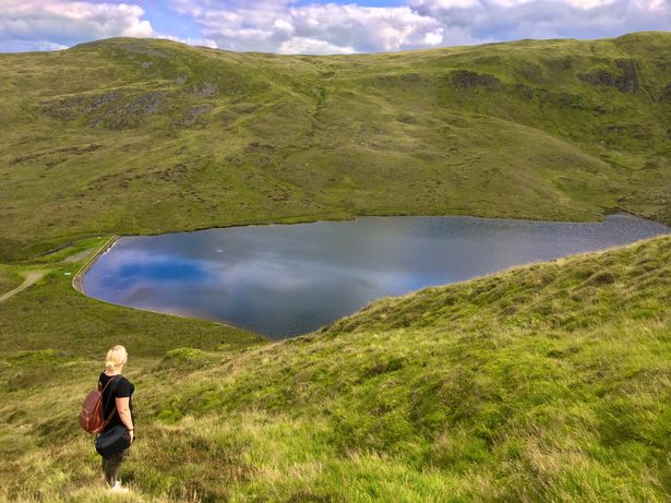
In this massif and the surrounding hills, you can discover the dreamy lakes and streams that are the source of mighty rivers and enjoy uninterrupted views of the mountain ranges of Wales and Ceredigion’s remote inland landscapes.
TV naturalist Iolo Williams describes this wild and empty plateau as “Wales’ last true wilderness, a place where you can lose yourself in nature,” but it is neither a National Park nor an AONB.
The National Parks Commission, a predecessor to the Countryside Commission, actually suggested the Cambrian Mountains as a National Park in 1965, but it was met with fierce local opposition in the 1970s.
Groups of landowners, farmers, and local authorities voiced concerns about potential restrictions on their land use and livelihoods, ultimately leading to the rejection of the designation.
 There’s nothing like exploring remote landscapes(Image: Portia Jones )
While it escaped national park status and the positives and negatives it brings, the area still faces challenges like the loss of traditional farming as land is bought up by companies for afforestation. There’s also the ongoing threat of wind farm development, which many locals oppose. For our free daily briefing on the biggest issues facing the nation, sign up to the Wales Matters newsletter here
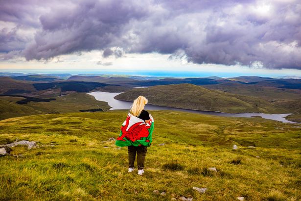
Its remote landscapes, clusters of communities, and crowd-free peaks are precisely why I love these uplands and keep returning to wander the hills and swim in ice-cold rivers and pools.
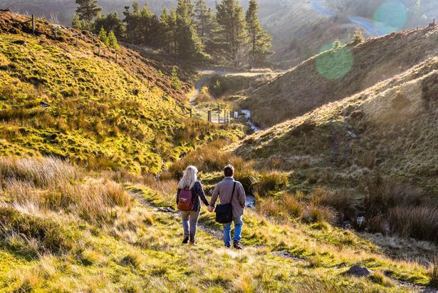
One of my favourite spots is the aforementioned Pumlumon Fawr. Summiting this peak from the northern side involves trekking through deep valleys, boggy patches and boulder-strewn slopes to the Copa (Welsh for summit).
It takes around four hours to complete, but the outstanding views are absolutely worth the trek. To the north, you can see as far as Cadair Idris, Yr Wyddfa, and Aran Fawddwy and right down to Pembrokeshire in the south.
I grew up in Wales but had never heard of Pumlumon until a local guide and talented astrophotographer, Dafydd, took my ever obliging husband and me on a trek up the mountain one gloriously sunny afternoon.
 This is not a have-a-go mountain. There are no marked trails, cafes, toilets or gift shops here(Image: Portia Jones)
‘Pumlumon Fawr has great sunrises and sunsets,’ enthuses Dafydd, who has been climbing the mountain since 1979. ‘A 360-degree view of Wales is possible from the Bronze Age cairn on the summit, as it is near the geographical centre of the country.’
It’s certainly a wild and remote trek to the peaceful summit that rivals Yr Wyddfa and Pen y Fan in terms of scenery, but there is one significant difference: you’re very likely to have this route entirely to yourself.
This might be because it’s not a ‘have-a-go’ mountain. There are no marked trails, cafés, toilets or gift shops here. It’s truly one of the last wildernesses in Wales.
This solitude is both awe-inspiring and slightly eerie. If you’re a hiker who finds comfort in crowds, this is not the trek for you. But if you enjoy unspoilt scenery and almost-perfect tranquillity, Pumlumon Fawr ticks both those boxes.
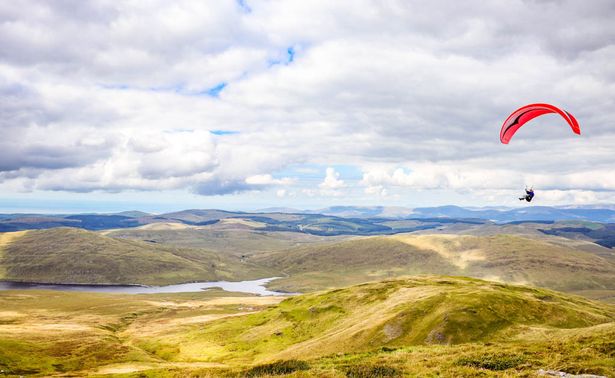 Paragliders taking flight(Image: Portia Jones )
The mountain’s name is rooted in the Welsh word “Pum,” meaning “five.” This reference is fitting, as five distinct routes wind their way to its summit, each offering a unique journey through this craggy landscape.
The George Borrow Trail honours the adventurous spirit of the 19th-century writer and traveller George Borrow, who once roamed these very hills.
In his classic work Wild Wales, Borrow reflected on the joy he felt when he drank from the sources of the three rivers that spring from Pumlumon’s slopes, an experience that filled him with unparalleled happiness.
The Pig Trail, named after the Nant y Moch stream (which translates to “stream of the pigs”), follows the course of this waterway from the expansive reservoir of the same name.
 We took the Caradog Jones route(Image: Portia Jones)
The Caradog Jones Trail is a tribute to Wales’ own mountaineering hero, Caradog Jones, the first Welshman to conquer Mount Everest. This trail begins near Pontrhydfendigaid, the village where Jones grew up, only a few miles from Pumlumon’s slopes.
On the eastern side of Pumlumon, the Sabrina Trail takes its name from the ancient name for the River Severn, one of the three rivers born from the mountain’s embrace.
The Sir Chris Bonington Trail begins at Eisteddfa Gurig, near the Pumlumon watershed and the boundary between Ceredigion and Powys.
On our first hike here, we took the Caradog Jones route. The initial ascent from Nant y Moch reservoir involves scrambling up some boggy and slippery terrain as you follow a stream up the mountain to reach the summit.
There is no signage or clear trail markers here, which is probably why you won’t see many walkers or annoying buzzing drones at the top. You really have to know your onions to traverse these grassy slopes and serene lakes.
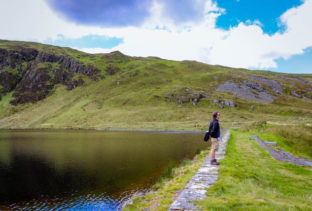
 It’s really important to respect Wales’ wild landscapes (Image: Portia Jones)
You can’t rely on Google Maps or signal-dependent hiking apps out here; your best friends are an OS map and a compass. Thank Arawn (yes, I know my Welsh mythology) for having a hiking pro with us who had climbed this lonely peak many times. I’m very much a ‘follow the All Trails app route’ walker, so this was out of my comfort zone.
Our small hiking squad ventured onwards along boggy paths and past tiny, meandering streams, looking for signs of the summit, which we had been promised would hold epic views.
You can normally guess when you are nearing the summit of a popular mountain, as crowds will usually congregate for a summit selfie.
In recent years, there have been many reports of hundreds of tourists queuing at Yr Wyddfa (Mount Snowdon) to film their final ascent for social media. Pics or you may as well stay home right?
However, at the summit of peaceful Pumlumon, the only queues were two paragliders waiting for the right moment to take their leap of faith.
As I sat at the top of the Copa with a steaming mug of coffee and a well-earned Bara Brith, I had to concede that, yes, the views here give the Eyry’s jagged 3000 peaks a decent run for their money.
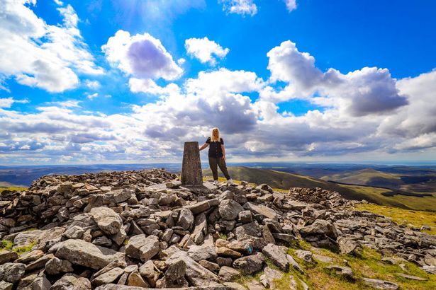
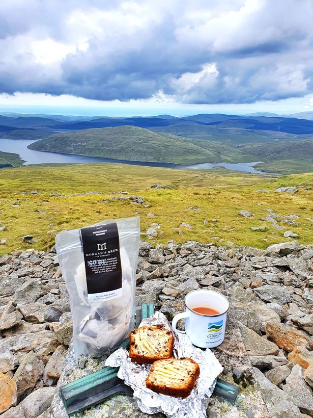 Have a tea break at the Pumlumon Fawr summit(Image: Portia Jones )
The panorama is nothing short of utterly extraordinary. On a clear day, you can see as far as Cadair Idris and Aran Fawddwy to the north. The whole sweep of Cardigan Bay can also be seen from Pen Llŷn in the north, right down to Pembrokeshire in the south.
The challenging trek is well worth the dreamy views, but I wouldn’t recommend people new to hiking attempt it due to its remoteness, lack of signage, and boggy terrain. You are very much alone at Pumlumon Fawr; there’s no exit via the gift shop.
We were fortunate enough to have a highly experienced guide with us, as there are no clear route markings as you make your way up Pumlumon Fawr.
With Welsh Mountain Rescue teams reporting huge volumes of callouts, it’s more important than ever to respect Wales’ wild landscapes.
 Pumlumon Fawr is the highest point in Central Wales(Image: Portia Jones)
You need to be appropriately prepared for hiking here. This is not a Crocs and socks trek around the park; you need skills for Pumlumon, posing does not count.
Bring a map and compass, and be adequately kitted out in good-quality gear. You don’t want to be the hapless tourist who needed rescuing because you wore a vest top in the mountains and it suddenly started hailing. Carry food and loads of water, and be prepared to turn back if visibility becomes poor or conditions become treacherous.
Bringing all your rubbish home is also essential so these fragile landscapes remain litter-free and can be enjoyed by adventurous trekkers. If I catch you placing a dog poop bag behind a rock here, we’re going to have very cross words.
 The views are epic(Image: Portia Jones )
While more hikers are venturing out into the Cambrian Mountains, our trusty guide, Dafydd, believes it might be a while before Pumlumon becomes a popular day trip in Wales.
“A lot of work and investment would be needed to make it more accessible. More and more people are discovering it, but 75% of the time, I’m up and down, having not seen a soul.”
If you’re well-versed in map reading and don’t mind a lack of amenities, I would recommend this lonesome mountain for a spot of solitude among some of the most remarkable landscapes Wales has to offer.
How to get to Pumlumon Fawr
 Pumlumon Fawr is located in Ceredigion near Ponterwyd.(Image: Portia Jones)
Pumlumon Fawr is located in Ceredigion near Ponterwyd. It’s around an hour from Aberystwyth and 30 minutes from Devil’s Bridge. The Grid Reference for the mountain is SN 78971 86945.
If you summit from the north side, drive towards Nant y Moch Reservoir and park in a small layby. There’s no parking or obvious signage, so you’ll need to rely on maps or go with a local guide like Cambrian Safaris, who can organise bespoke tours of the area.
Pumlumon Fawr is also part of the Cambrian Way, an incredibly scenic and challenging long-distance trail from Cardiff to Conwy. It’s over 298 miles through some of the wilder parts of Wales.
How to prepare
When hiking in Wales’s beautiful landscapes, remember to also ‘leave no trace’ and follow the countryside code and the Adventure Smart guidance, as mountain rescue teams have been busier than ever this year.
If you’re attempting a particularly remote hike, plan an alternative option or two so that if the weather changes or it’s too busy, you can still have a great day out.
What you wear will make a huge difference when hiking in Wales. Sturdy hiking boots, warm clothes, socks, and a decent outdoor jacket are necessary for mountain hiking here. Welsh weather can be notoriously unforgiving, and conditions can change instantly.
Also, pack a head torch, compass, map, water bottle, thermos flask, whistle, first aid kit, mobile phone, and a lightweight and compact survival blanket.