A horror 600-mile storm wall is on the way to the UK set to pummel most of the county with just eight counties escaping its wrath – is your county set for a drenching?
07:55, 17 Aug 2025Updated 07:58, 17 Aug 2025
 The current hot weather is set to turn wet (file)(Image: Getty Images)
The UK’s summer of unpredictable weather looks set to continue, with fluctuating forecasts now predicting temperatures will drop as a mega storm sweeps in.
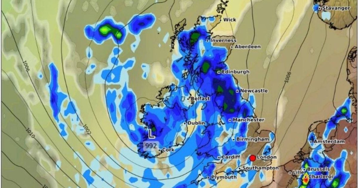
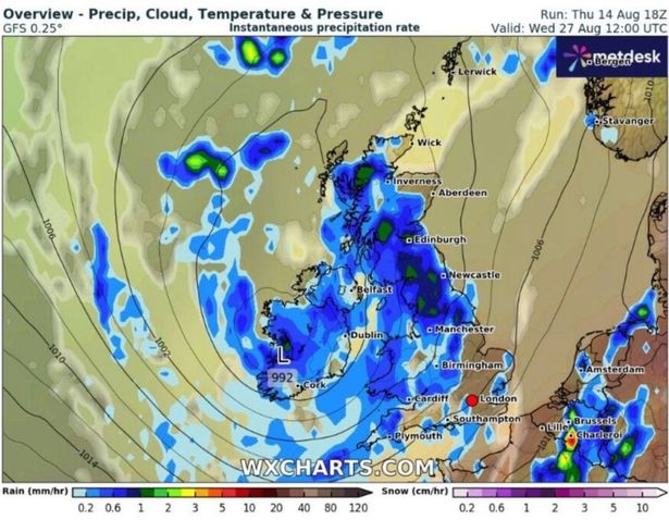
Weather maps reveal a 600-mile wall of rain is due to hit the UK in less than a fortnight, with all but eight counties bracing for the impending wet and chilly conditions. The disruptive weather is expected to kick off on August 27, with predictions indicating that the East Midlands and southern Scotland will bear the brunt of the heaviest rainfall.
According to WXCharts’ weather maps, Aberdeenshire, Somerset, Middlesex, Kent, Essex, Suffolk, Norfolk and Cambridgeshire are the only areas likely to escape the downpour.
 The forecast is grim(Image: WXCHARTS)
Currently, the UK is enjoying its fourth heatwave of the summer, with temperatures reaching a sizzling 30C in some regions. However, the incoming weather front could see temperatures plunge to a chilly 5C in central Scotland and around 10C in parts of England.
The rainfall is forecasted to persist for about 24 hours, intensifying to around 3mm per hour in northern England on August 28, while largely retreating from the south of the country, according to the Express.
The Mirror reports that while the impending rainstorm signifies a shift from the hot and sunny weather enjoyed by most of the country earlier this month, it’s just the latest in a series of changeable weather patterns this summer, which has been characterised by scorching highs and disruptive downpours.
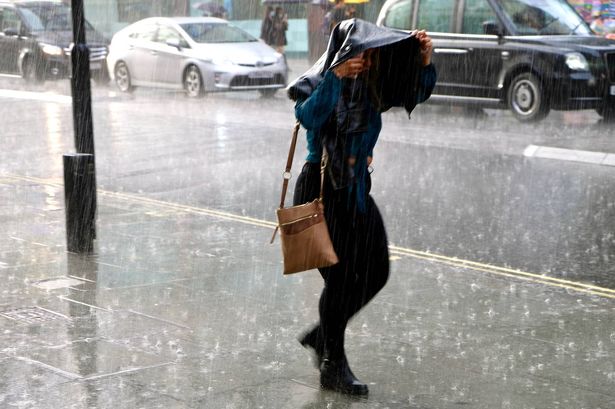
 A wall of rain is predicted to batter the UK in the coming weeks (file)(Image: Getty Images)
The Met Office has slapped yellow thunderstorm warnings across a vast swathe of north-eastern Scotland and eastern Northern Ireland for Thursday.
With sweltering heatwave conditions persisting, motorists have been cautioned about treacherous driving conditions, whilst power supplies and public transport face potential chaos, alongside flooding threats.
The weather service’s outlook for the rest of the month paints a similarly turbulent picture, with Atlantic low pressure systems set to sweep in and wreak havoc.
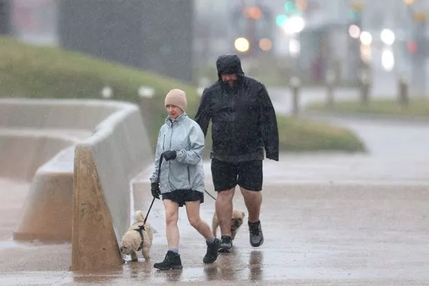
 Only 8 counties will escape the deluge (file)(Image: Getty Images)
The Met Office’s forecast for August 19 to August 28 warns: “This brings an increasing possibility of stronger winds and rain, some of which could be heavy and thundery, especially for southern and western areas, but this perhaps becoming more widespread with time.”
The Met Office’s projections for August 29 through September 12 also warns of “unsettled conditions with showers or longer spells of rain”, with “heavy and thundery rain and strong winds” on the cards.
The forecast goes on to predict that temperatures will largely stay above the seasonal norm, though there’s potential for sporadic bursts of hot weather across southern regions.
 The East Midlands and southern Scotland are likely to cop it the most (file)(Image: PA)
Earlier this week, Britain witnessed yellow heat alerts rolled out across seven English regions, as the nation has battled relentless heatwaves throughout the summer months.
These yellow alerts highlight the risk of increased deaths “particularly among those ages 65 and over or with health conditions”, according to the UK Health Security Agency (UKHSA). When the alert is issued, it warns of potential increased pressure on health services, indoor temperatures in hospitals and care homes surpassing the “recommended threshold for clinical risk assessment”, alongside potential disruption to staff’s capacity to provide care.
For the latest breaking news and stories from across the globe from the Daily Star, sign up for our newsletter by clicking here.