
With the sunshine set to hold a little longer, and a long weekend stretching out in front of us, it’s the perfect time to get on your bike for a peaceful cycle into the countryside. From a family-friendly canalside trail in Somerset to a former railway line that hugs Scotland’s west coast, we have teamed up with Sustrans to round up some of the most beautiful — and easygoing — routes across the country, with cafés and pubs that make perfect pit-stops along the way.
The route You can start this circular route at any point along the loop. One recommended start point is Bath Spa station, a short ride from the Bath Two Tunnels circuit on National Route 4. This iconic loop takes you from the centre of historic Bath through two tunnels, over the spectacular Tucking Mill Viaduct. It passes the Dundas Aqueduct on the Kennet & Avon Canal, returning alongside the River Avon to head back into Bath. On the way you’ll pass through the Combe Down Tunnel, which stands at an impressive 1,672m, and at just over one mile long is the UK’s longest cycling and walking tunnel. Bikes can be hired from Green Park Bike Station, Bath (greenparkbikestation.info)
Lunch The Raven, Bath (theravenofbath.co.uk)
Map sustrans.org.uk/bath-two-tunnels
2. The Phoenix Trail, Buckinghamshire/Oxfordshire
Distance 15 miles
Start and end Princes Risborough railway station, HP27 9DN
The route This quiet, traffic-free ride takes you between the market towns of Princes Risborough in Buckinghamshire and Thame in Oxfordshire. From Princes Risborough station, follow National Cycle Network Route 57 signs along local roads and a byway, crossing the heritage railway to Chinnor for a couple of miles to reach the start of the trail. Keep an eye out for wildlife along the way — including red kites — as well as a series of 30 artworks that were inspired by the old railway route and the landscape looking out to the Chilterns. Pause for lunch or a rest in the lovely market town of Thame, before retracing the route. Bikes can be hired from Chilterns Cycle Hire (otec.bike).
Lunch The Bird in Hand, Princes Risborough (birdinhandprincesrisborough.co.uk)
Map sustrans.org.uk/phoenix-trail
3. Swiss Valley Cycle Route, Llanelli, Carmarthenshire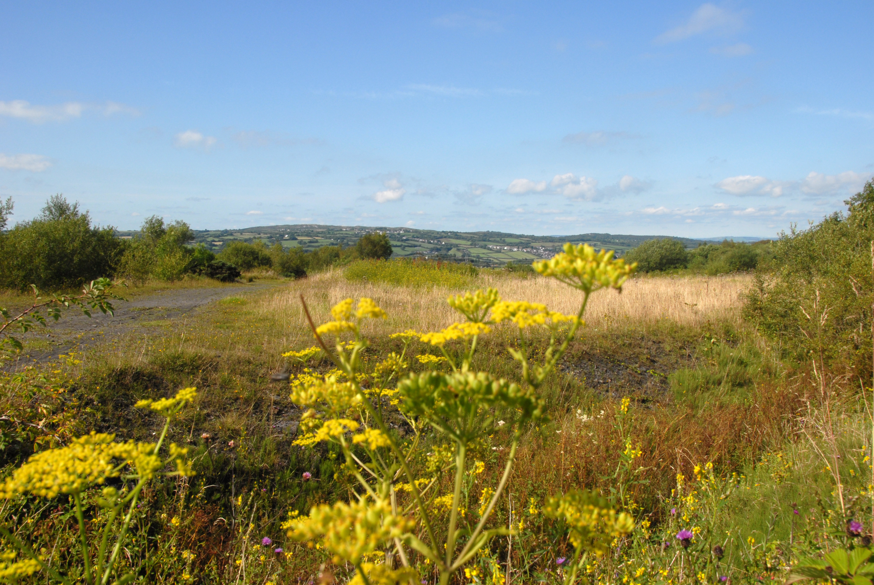
The Millennium Coastal Park
PETER KNOWLES/SUSTRANS
Distance 21.6 miles
Start and end Start and end at Sandy Water Park, Llanelli SA15 4SR, a short distance from Llanelli train station, SA15 2RN
The route Starting at Sandy Water Park in Llanelli, the Swiss Valley Cycle Route on National Route 47 is a pretty walking and cycling trail that follows a disused railway line. It climbs gently from the Millennium Coastal Park into the rolling hills of Carmarthenshire, past the peaceful Lliedi Reservoirs and on to the village of Y Tymbl. If you need a rest there is a lovely clearing in the woods at the halfway point with picnic benches. At the end of your ride there’s the option to continue north to the National Botanic Garden of Wales — an additional four-mile ride along National Route 47 on roads and traffic-free paths, but well worth the journey. Otherwise, take the same route you came back to Llanelli.
Lunch Humble Coffi, Llanelli (humble-coffi.tablein.com)
4. Brampton Valley Way, Northamptonshire
Distance 33.6 miles
Start and end Near Market Harborough train station, LE16 7DT
The route This lovely traffic-free cycle path travels through beautiful countryside between Market Harborough and Northampton following a dismantled railway path, with scenic views of the surrounding landscapes. Starting in Market Harborough near the train station, head down Rockingham Road on National Route 64, following the River Welland before turning left and crossing Springfield Street. This brings you onto the southern end of Britannia Walk where the path runs alongside Oaklands Park on National Route 6. After crossing Scotland Road, you soon reach rolling, open countryside. From here, you will head towards the marvellously spooky Oxendon Tunnel before crossing the flat valley of the little River Ise. From this point there are two detours where you can opt to visit local attractions such as Kelmarsh Hall, Brixworth Country Park and Lamport Steam Railway — otherwise follow the path to Nene Way in Northampton. At this point, you can continue further on National Cycle Network Route 6 which passes Northampton train station, or return the way you came.
Lunch Farndon Fields farm shop and restaurant, Market Harborough (farndonfields.co.uk)
Map sustrans.org.uk/brampton-valley
5. Clay Trails to Eden Project, Cornwall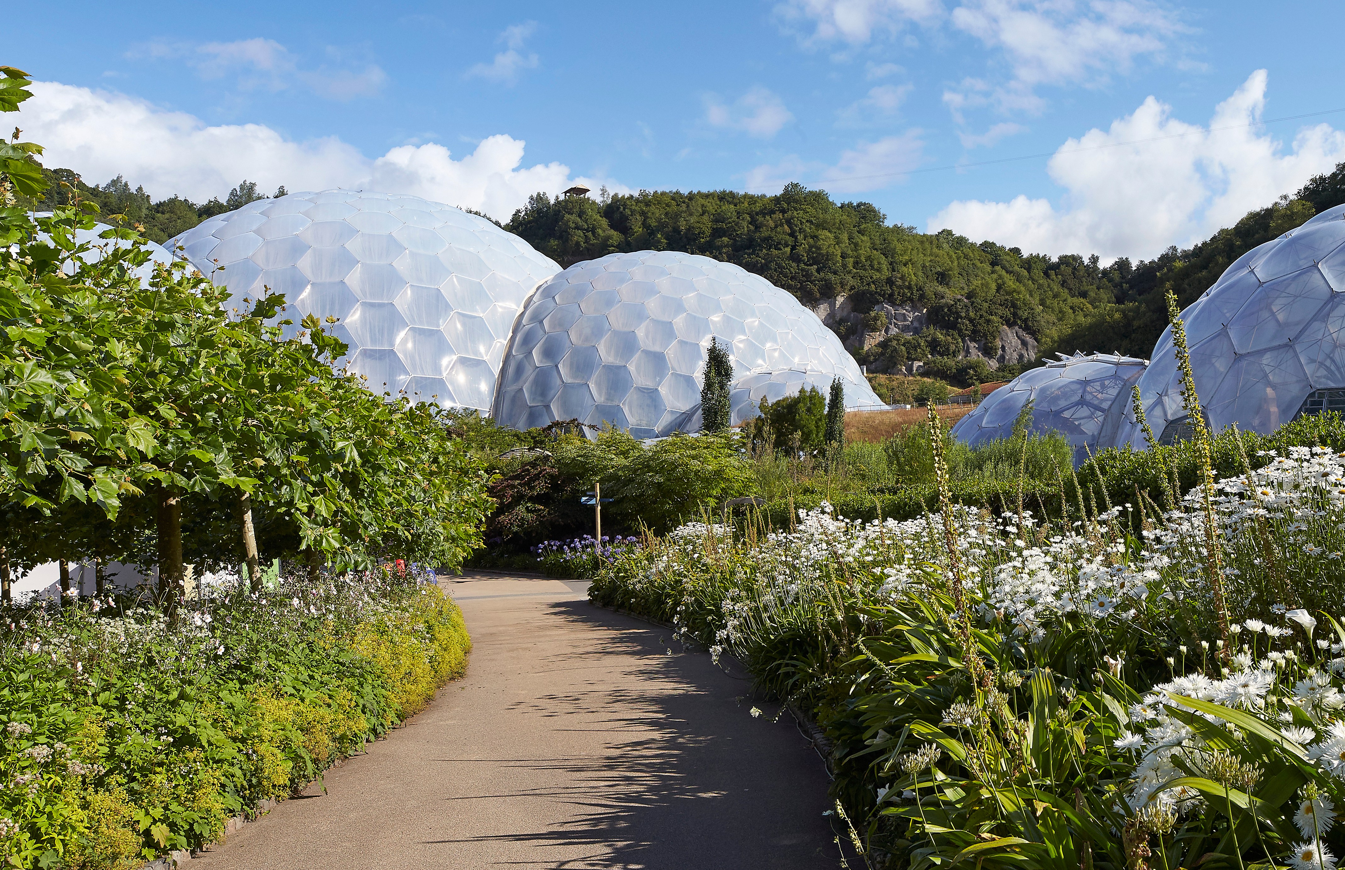
The Eden Project, Cornwall
HUFTON+CROW
Distance 23.8 miles
Start and end Start and end at Par Sands Beach. There is a train station in Par, PL24 2LT
The route The scenic “clay trails” are made up of a number of shorter routes. The first section of this ride is a four-mile trail beginning at the Par Sands Beach car park, following signs for National Route 2. This section of the route runs from the beach to the Eden Project, a vast botanical garden and eco-science centre, passing the railway station and the old river estuary marshes. Once you reach the Eden Project, continue on National Route 2 for five miles until you reach the Wheal Martyn Museum of China Clay Mining, which is worth a visit. This section of the route does have some slopes, but offers spectacular 360-degree views of St Austell Bay and the clay mines. Leaving Wheal Martyn, continue along National Route 2 heading towards St Austell. The route is just under two miles and takes in some interesting clay mining heritage features along the way. Return along the same route.
Lunch The Eden Project (edenproject.com) or Edie’s, Carlyon Bay (edies.restaurant)
Map sustrans.org.uk/clay-trails
6. The Caledonia Way, Connel Bridge to Portnacroish, Argyll and Bute 
Connel Bridge, spanning Loch Etive
ALAMY
Distance 28 miles
Start and end Connel Bridge, PA37 1SJ. There is a railway station at Connel Ferry, PA37 1PA
The route This trail follows a section of the scenic National Cycle Network Route 78, known as the Caledonia Way. This section between Connel Bridge (five miles northeast of Oban) and the tiny village of Portnacroish is almost entirely off-road, and is especially beautiful during the summer. Much of the path between the two is built along the former railway line which ran from Connel to the slate quarries near Ballachulish — and it has great views, hugging the coast for much of the way. When you reach Portnacroish on the shores of Loch Laich, you have the option to continue on the same path for a longer ride or, after taking in the views of Castle Stalker perched in the loch, head back to Connel Bridge the way you came.
Lunch The Creagan Inn and Distillery, near Appin (creaganinn.co.uk)
Map sustrans.org.uk/caledonia-way
7. Lancaster to Bull Beck Loop, Lancashire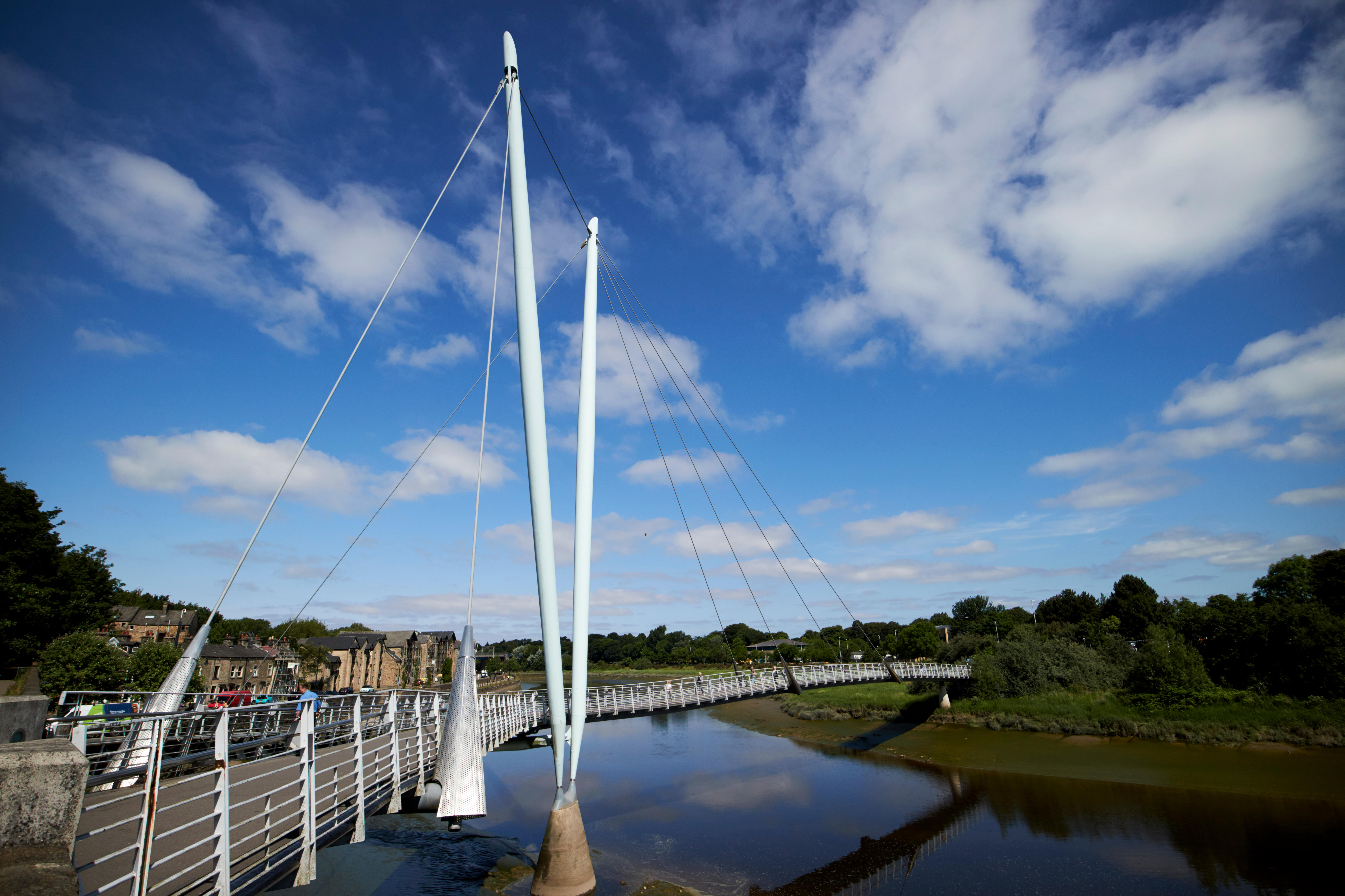
The Millennium Bridge over the River Lune
REFER TO SOURCE
Distance 21.5 miles
Start and end Lancaster train station, LA1 5NW
The route Beginning at Lancaster Station, take the traffic-free path that starts on West Road, following it round to the iconic Millennium Bridge, catching glimpses of parts of Lancaster Castle through the trees. Pick up National Cycle Network Route 6 as you cross the river, passing through Ryelands Park and along quiet roads to reach the Lancaster Canal at Hammerton Hall Lane. From here, head north along the peaceful canal to Rushley Drive, Hest Bank, then come off the towpath and follow National Cycle Network Route 700 (known as the Bay Cycle Way) along the coast, taking in views of Morecambe Promenade and passing the Eric Morecambe statue. After that, follow National Cycle Network Route 69 east to pick up the start of the Lune Valley Greenway — a traffic-free path along a disused railway line. Follow the greenway back to the Millennium Bridge in Lancaster, cross back over the river and continue east on Route 69 on a path beside the River Lune all the way to the village of Caton, with stunning views of the river (the bridges are grade II listed) and the Lune Valley. You will pass through the Forest of Bowland national landscape before arriving in Caton, where there are shops and a pub, and reaching Bull Beck picnic site at the end of the greenway. When ready, turn round and head back the way you came. Bikes can be hired from On Yer Bike Cycles, Lancaster (onyerbike.com).
Lunch The Quarterhouse, Lancaster (thequarterhouse.co.uk) or the Station Hotel, Caton (stationhotelcaton.co.uk)
More information sustrans.org.uk/lune
8. Wandle Trail, Greater London
Distance 19.5 miles
Start and end Start and end at Ram Street, Wandsworth SW18 1UB, not far from Wandsworth Town train station on Old York Road, SW18 1SU
The route National Cycle Network Route 20 contains two sections, Wandsworth to Carshalton and Pyecombe to Brighton. Wandsworth to Carshalton is known as the Wandle Trail, and is a wonderfully peaceful trail in south London — a quiet path alongside the chalk stream of the River Wandle. Begin by joining the trail on Ram Street and Garratt Lane, before reaching a quieter section of the cycling path. Travelling beside the river, you’ll pass more than ten parks and green spaces on the route, along with many cafés, pubs and restaurants for stop-offs, as well as Wandsworth Museum. When you reach Carshalton, return to Wandsworth along the same route.
Lunch The Alma, Wandsworth (almawandsworth.com)
9. Marriott’s Way, Norfolk
Marriott’s Way runs close to the River Wensum
ALAMY
Distance 29.8 miles
Start and end Norwich train station, NR1 1EF
The route The Marriott’s Way provides a lovely green corridor from the heart of Norwich into the surrounding countryside along a disused railway, following signs for National Cycle Network Route 1. Beginning close to the River Wensum in Norwich, it continues through farmland, woodland and water meadows. Look out for wildlife as you go — the closure of the railway has been good news for species such as jays, green woodpeckers and wrens, which thrive here. There’s a wide range of plant life, including primroses, wild strawberries and butterflies. Follow the route as far as Reepham, at which point you can turn back for the return journey. Bikes can be hired from Bikebox, Norwich (bikebox-online.co.uk).
Lunch Kings Arms, Reepham (kingsarmsreepham.com)
Map sustrans.org.uk/marriotts-way
10. Three Parks Trail, Caerphilly/Merthyr Tydfil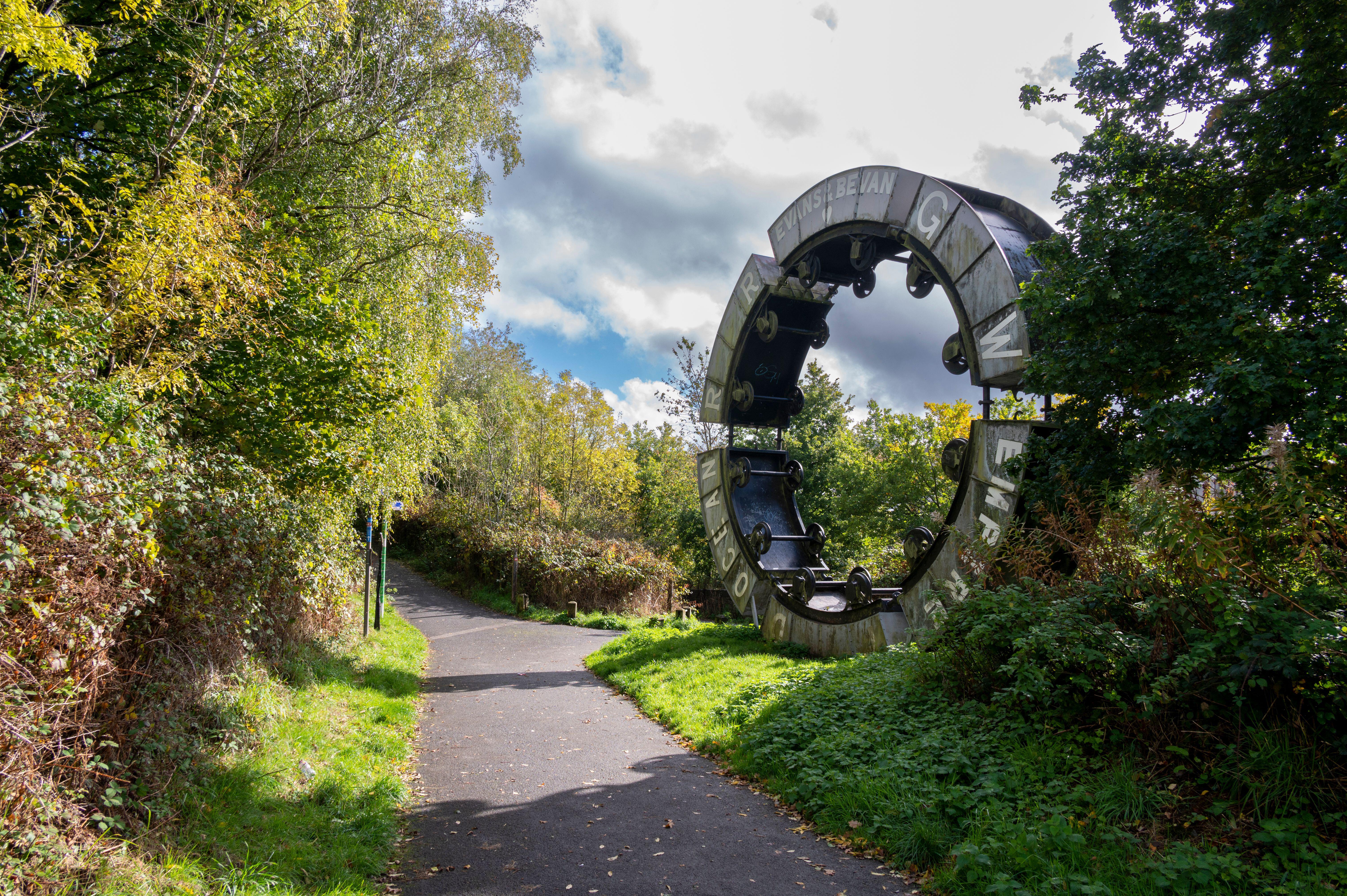
The mining memorial at Maesycwmmer, near Hengoed Viaduct
ALAMY
Distance 26 miles
Start and end Sirhowy Valley Country Park near Crosskeys (where there is a train station), NP11 7PS
The route Part of the mighty Celtic Trail, the Three Parks Trail on National Route 47 takes in three picturesque parks. Starting from the Sirhowy Valley Country Park near Crosskeys, the trail takes you over Hengoed’s impressive 16-arch listed viaduct. Look out for Wheel O’ Drams on your way — an 8m-high artwork and well-known landmark that represents the area’s industrial history. Continuing along the valley, you will pass through Parc Penallta, carved from a former coal pit. From the High Point Observatory there are spectacular views across Caerphilly. Make sure to look out for Sultan the Pit Pony, one of the UK’s largest figurative earth sculptures. At Trelewis, leave National Route 47 and follow 476 to Parc Taf Bargoed, formally a large mining area. The once black river is now a haven for dippers and wagtails, and the grassy riverbanks provide the perfect picnicking spot. The route also passes Rock UK Summit Centre, which offers activities such as kayaking and orienteering. Return the way you came.
Lunch The Islwyn Inn, Blackwood (islwyninn.co.uk)
Map sustrans.org.uk/three-parks
11. Viking Coastal Trail, Kent 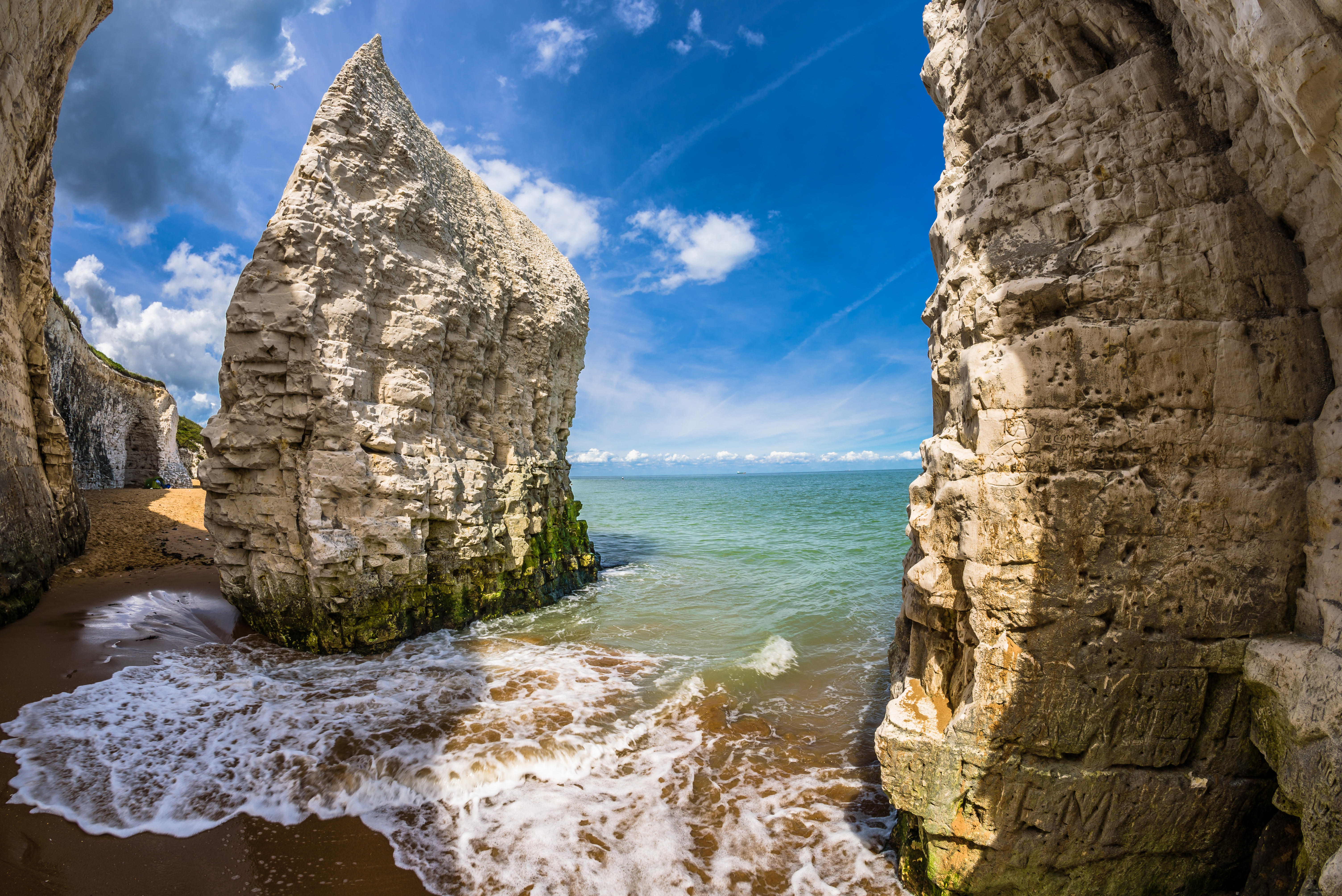
Botany Bay, near Margate and Broadstairs
ALAMY
Distance 32 miles
Start and end Starts and ends at Sandwich Road, Cliffsend village, CT12 5HX. The nearest station to the start is Thanet Parkway, CT12 5HN.
The route The Viking Coastal Trail on National Route 15 begins near Ramsgate alongside Sandwich and Pegwell Bay at Sandwich Road in the village of Cliffsend and follows coastal paths to link numerous bays and coves, taking you past Botany Bay Beach, through Margate, to the long stretch of sand at Minnis Bay Beach. From here you can turn around to come back the same way, or for a longer ride continue on for 3.5 miles to Reculver, with its country park, Reculver Towers and Roman Fort — imposing twin towers of the medieval church that dominate the skyline. Bikes can be hired from Kens Bike Shop, Margate, which offers a delivery service (kensbikes.co.uk).
Lunch The George and Heart House, Margate (georgeandheart.com)
12. Tweed Valley Loop, Tweeddale, Scottish Borders 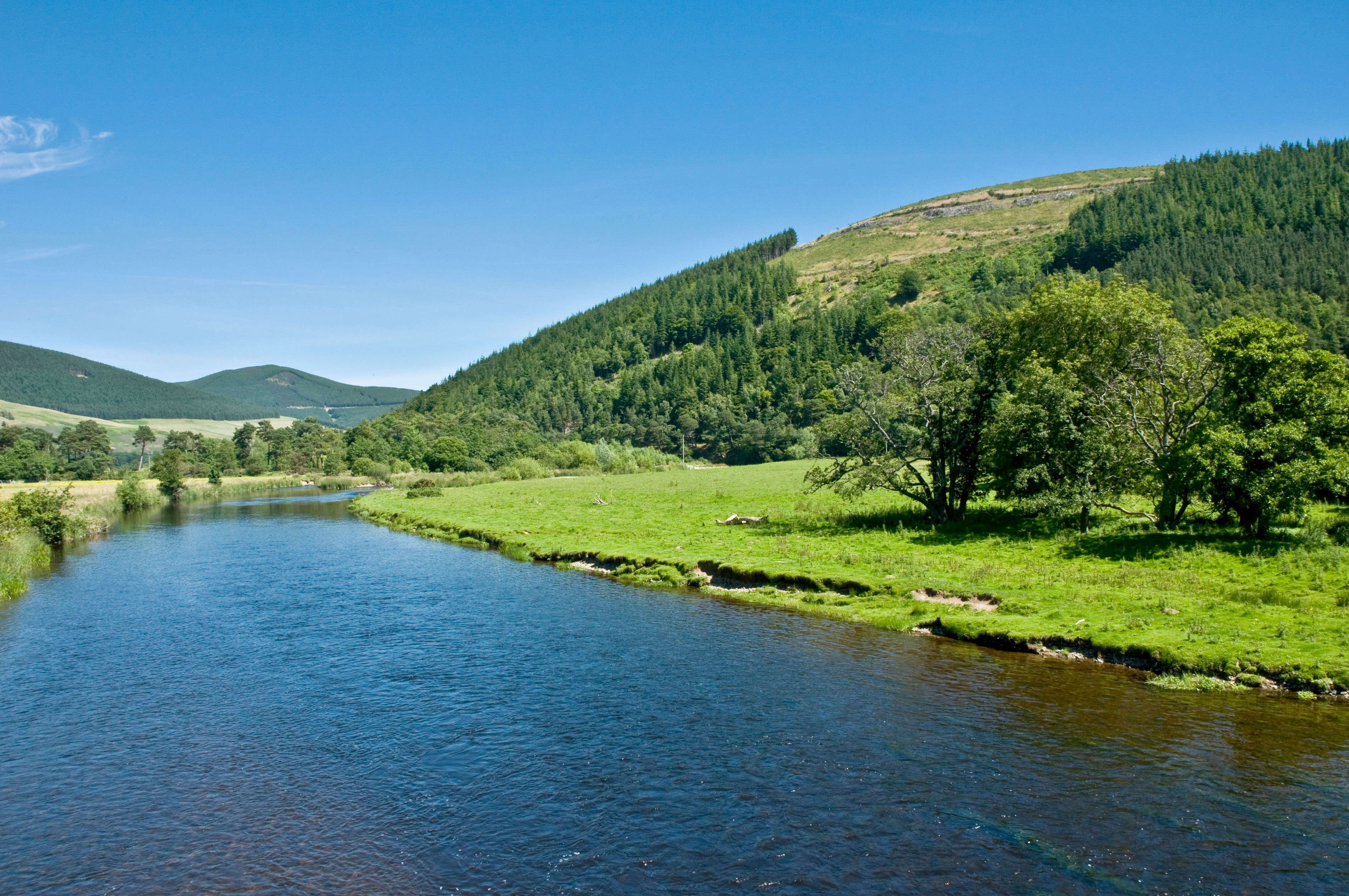
The River Tweed near Innerleithen
ALAMY
Distance 19 miles
Start and end Innerleithen, EH44 6NL
The route Starting in the small town of Innerleithen, this easy, picturesque loop meanders through the Tweed Valley and alongside the River Tweed, on a combination of quiet lanes and the Tweed Valley Railway Path — a beautiful, largely traffic-free link between Innerleithen and Peebles, part of National Cycle Network Route 1. From the start point in Innerleithen, join the Tweed Valley Railway Path heading east to Walkerburn. Once you’ve crossed the River Tweed, bear right, heading west along the quiet lane to the village of Traquair. At the war memorial turn right and follow the road through Cardrona and on to the pretty town of Peebles. Cross the river once again and you’ll rejoin the railway path heading east along the river back to Innerleithen.
Lunch There is a lovely café at the Kailzie Botanical Gardens near Peebles (courtyardcafeklz.com)
Map sustrans.org.uk/coasts-and-castles-south
13. Windrush Valley, Oxfordshire
Distance 36 miles
Start and end The top of Windrush Valley Road, Witney OX28 5AD
The route Transport yourself from the bustle of Witney to the quiet lanes of the Windrush Valley along National Route 57 in this trail through the beautiful Cotswold countryside. On your way to the market town of Northleach, you will pass close by the ruins of Minster Lovell Hall, once the home of Richard III’s henchman Lord Lovell, one of the richest men in England. From here you travel on to picturesque Burford, often referred to as the gateway to the Cotswolds, and home to a medieval bridge, old stone houses and Georgian and Tudor frontages. After leaving Burford, the route travels near to the 18th-century Barrington Park, before passing Windrush, and onto Sherborne, a 17th-century grandstand. Sherborne is also a working estate and has an abundance of wildlife, including fallow and roe deer. From here the route arrives in Northleach, a small unspoilt Cotswold town standing at the crossroads of the Roman Fosse Way. Here it is worth visiting the impressive church of St Peter and Paul, the finest example of the Cotswold perpendicular style, before returning to Witney via the same route. Bikes can be hired from Bainton Bikes, Oxford, which offers a delivery service (baintonbikes.com)
Lunch The Three Horseshoes, Witney (threehorseshoeswitney.co.uk), or there is a kiosk selling drinks and light lunches at the Sherborne Estate (nationaltrust.org.uk)
Map sustrans.org.uk/windrush-valley
14. Worcester to Droitwich Loop, Worcestershire
Distance 19 miles
Start and end Start and end at Diglis Bridge, Worcester WR2 4AY
The route This fantastic route takes you from the historic city of Worcester with its famous cathedral to Droitwich, known for its spa, medieval churches and half-timbered buildings. There are two different route options available to travel between them, using either National Route 45 or 46. You can either ride them individually or make a day of it and combine them to make a loop. Route 45 follows some quiet lanes and the towpath of the Worcester and Birmingham Canal to link Worcester and Droitwich on the eastern side. Route 46 provides an on-road alternative to the western side, leaving Worcester at the racecourse and heading towards the Droitwich Canal. Both routes are just under 10 miles and begin at Diglis Bridge. If riding this as a loop, heading into Droitwich on Route 46, you will meet the canal towpath, which takes you almost all of the way back to Worcester on Route 45.
Lunch The King Charles House, Worcester (thekingcharleshouse.co.uk)
15. Consett and Sunderland Railway Path, Durham/Tyne & Wear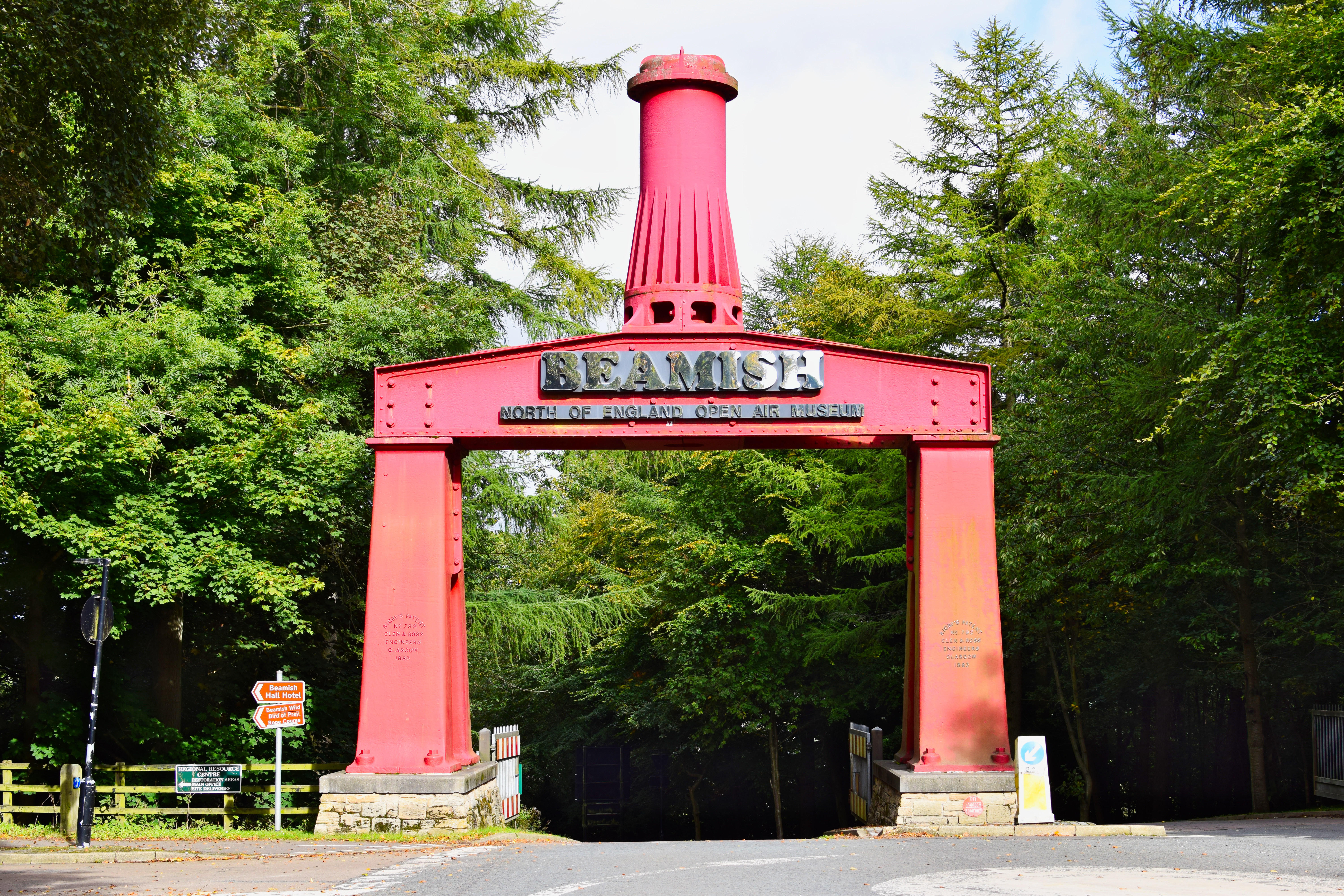
The entrance to Beamish Open Air Museum
ALAMY
Distance 25 miles
Start and end Rotary Way, Consett, DH8 7ND
The route Much of the Consett and Sunderland Railway Path follows the line of the former Stanhope & Tyne Railway. This was Britain’s first commercial railway, which was closed in 1985. Following National Route 7, it takes you from the village of Consett on quiet paths past the intriguingly named Hell Hole Wood — managed by the Woodland Trust and part of the Great North Community Forest — where you may spot red squirrels. You will also pass the Beamish Open Air Museum, a worthy stop, with its 19th-century manor house and early 20th-century town, colliery and railway station. Continue as far as Chester-le-Street, from which point you can turn around to make the return journey. Or, if you feel like a longer ride, the same route can be followed all the way to the coast (a further 12 miles), along the River Wear and on to the beach at Roker, stopping off on the way at the Wildfowl and Wetlands Trust Centre at Washington, home to large flocks of curlews and redshanks.
Lunch The South Causey Inn, Stanley (southcausey.co.uk)
16. Craigavon to Poyntzpass, Co Armagh/Co Down
Distance 27 miles
Start and end Boconnell Lane beside Craigavon golf course, BT66 6NG
From the start point in Craigavon, pick up National Cycle Network Route 9 and continue on to Bridge Street, Portadown. From here, the path follows the Newry Canal, hugging the Brackagh Nature Reserve, passing Lough Shark, and heading on all the way to Poyntzpass. There is the option to continue on towards Newry if you want to extend the ride or turn around from here and head back towards Craigavon and the start point. Bikes can be hired at South Lakes Watersports in Craigavon (getactiveabc.com).
Lunch Sinton’s at the Bridge, Scarva (sintonsatthebridge.com)
17. Hertfordshire Greenways (Wheathampstead to Ware)
Distance 30.4 miles
Start and end At the junction of Station Road, AL4 8BY, and Mount Road, AL4 8BX, in Wheathampstead. The nearest station to the starting point is at Harpenden, AL5 4SP, which is two and a half miles away.
The route The Ayot Greenway links Welwyn Garden City with Wheathampstead along a predominantly traffic-free route, following the former railway line that ran to Luton. Setting off from the start point, follow National Route 57, leading onto National Route 61 after Welwyn Garden City. Both incorporate the greenway. After passing through Welwyn, the route takes you onto the more rural Cole Green Way to Hertford. There are links at both ends of the route to take cyclists into Welwyn and Hertford town centres — and the link through Hertford joins the towpath along the River Lea, taking you to Ware and beyond (it is signposted through the town centre). After a well-earned break, get back in the saddle for the return journey.
Lunch The Millstream, Hertford (mcmullens.co.uk)
Map sustrans.org.uk/herts-greenways
18. Alloa to the Ochil Fault, Clackmannanshire
Distance 14.4 miles
Start and end Alloa Station, FK10 1BA
The route This circular route is a fantastic combination of history and nature — part of the epic Round the Inner Forth Cycle Route — and is perfect for beginners. Starting off at Alloa Station, follow the old railway line north (National Cycle Network Route 767) and take a short detour to the ruins of Sauchie Tower before continuing to Tillycoultry. From here, head west along Route 768, following the line of the Ochil Fault — a prominent geological feature, passing the small town of Alva en route to Menstrie, with panoramic views of the Ochil hills. Continue south along another disused railway line, passing the Cambus cooperage hub, before completing the circuit and arriving back in Alloa. Stop off to visit Alloa Harbour viewpoint and Alloa Tower before riding back to your original starting point.
Lunch Mocs Cafe, Alloa (01259 572387)
Map sustrans.org.uk/round-the-forth
19. Penzance to Hayle, Cornwall
St Michael’s Mount
ALAMY
Distance 19 miles
Start and end Penzance railway station, TR18 2LT
The route Following signs for National Cycle Network Route 3, this trail heads east to pick up the South West Coast Path, with splendid views of St Michael’s Mount. Continue on to the town of Marazion before heading inland to the RSPB Marazion Marsh nature reserve, home to a variety of wetland birds. From here the route heads through the tranquil village of St Erth and over the River Hayle, continuing along the beautiful riverside to the RSPB reserve at Hayle Estuary. Heading north towards Hayle, after 1.5 miles you’ll reach a traffic-free path with fine views over the north coast river estuary. This section takes you to the entrance of Hayle at Foundry Square, the gateway to the Cornish Mining World Heritage Site. Just off the square, the railway station is signposted and from there it’s a short cycle ride to King George V Memorial Walk, which has delightful gardens overlooking the tidal reservoir of Copperhouse Pool. Return the way you came.
Lunch Barbican Bistro, Penzance (barbicanbistro.com)
Map sustrans.org.uk/first-and-last-trail
20. Barnsley to Old Moor RSPB Reserve, South Yorkshire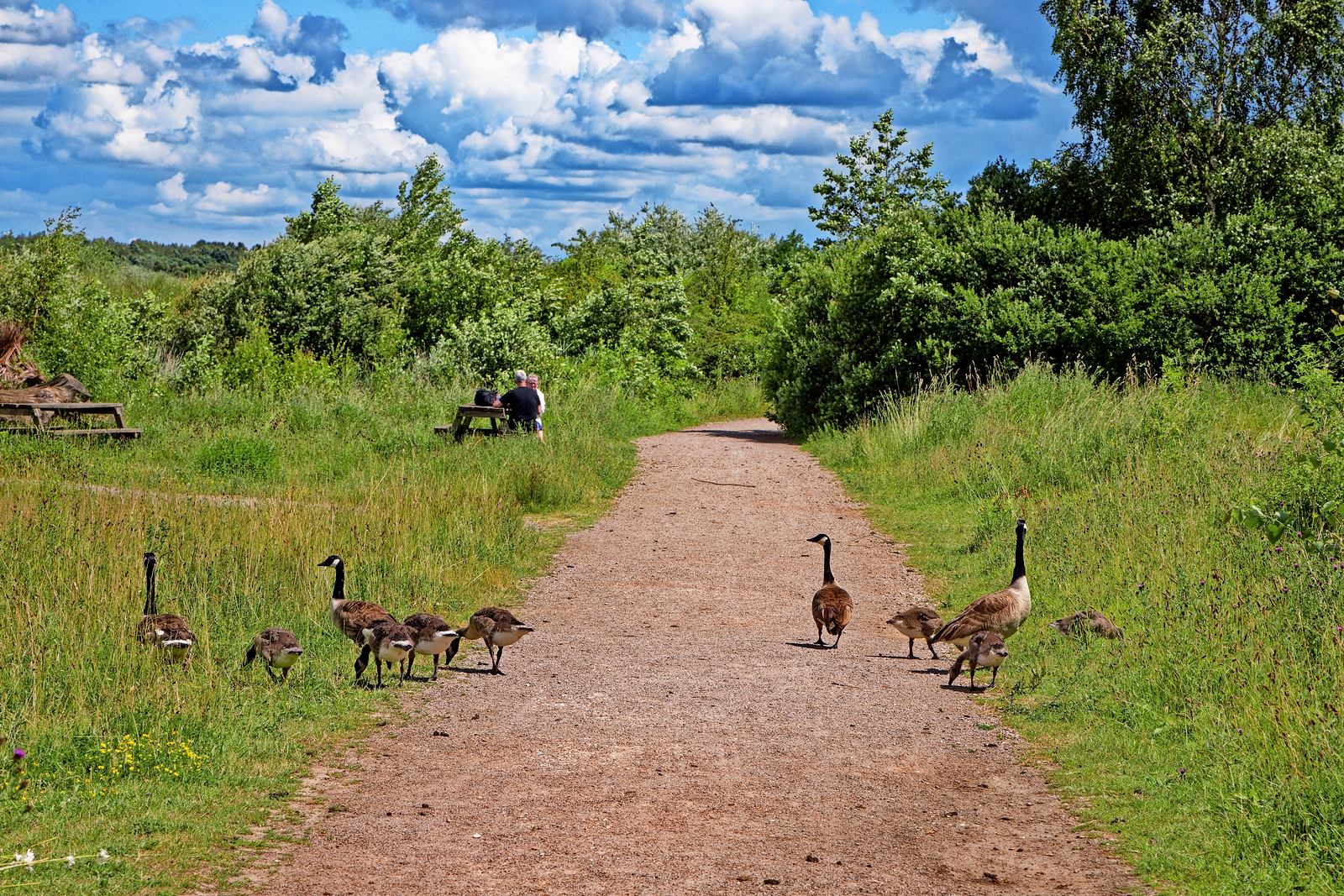
A family of geese at Old Moor Wetlands
ALAMY
Distance 11.8 miles
Start and end Barnsley train station, S71 1PB
The route This lovely route takes you from Barnsley on a traffic-free path to the RSPB Old Moor Reserve, which is teeming with birds and wildlife as well as wildflowers and butterflies at this time of year. Setting out from Barnsley train station, you follow a short on-road section before joining National Route 67. After travelling over the River Dove, this joins National Cycle Network Route 62. From here, the trail continues past Wombwell Recreation Ground before arriving at the RSPB nature reserve. The Old Moor reserve is a fantastic place for birdwatching — look out for kingfishers, lapwings and tree sparrows, and at dusk listen for the shrill calls of little owls. To return, retrace your journey to Barnsley.
Lunch There is a café at Old Moor RSPB Reserve (rspb.org.uk)