Flood alerts have been set in place for areas in Scotland as the Met Office issues a yellow weather alert.
18:26, 03 Sep 2025Updated 18:38, 03 Sep 2025
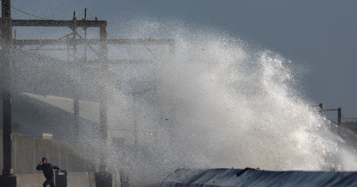
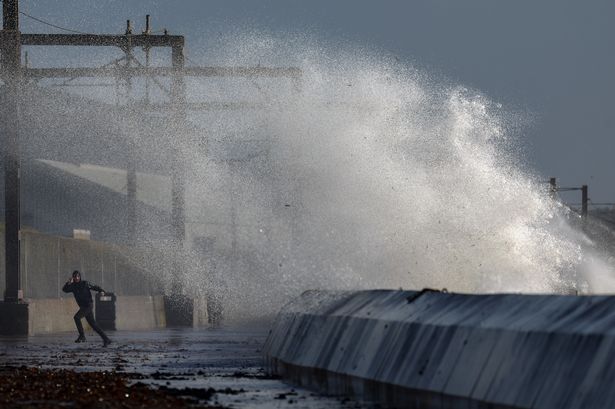 The Met Office has issued a yellow alert for various parts of Scotland as they will be hit with downpours(Image: 2024 Getty Images)
Flood alerts and yellow weather warnings have been issued as thunderstorms sweep across parts of the UK, bringing the threat of heavy rain, surface water flooding and travel disruption.
After weeks of fluctuating conditions and the hottest summer to date, today marked a sharp turn in the weather, with a noticeable chill settling over the country and downpours drenching multiple areas in Scotland.
The Met Office has placed a yellow warning for rain across north-east Scotland from 12pm to 9pm on Wednesday. Within the thunderstorm warning zone, some areas could see up to 30mm of rainfall in just one hour, increasing the risk of flash flooding.
Elsewhere in the rain warning area, widespread totals of 30mm are expected, while coastal locations could experience as much as 80mm, the Met Office said.
The areas affected are:
- Aberdeenshire and Aberdeen City
- Dundee and Angus
- Findhorn, Nairn, Moray and Speyside
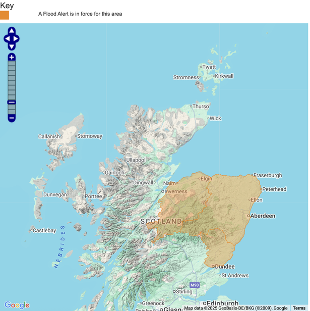 A flood alert is in place for these areas of Scotland (Image: Floodline/SEPA)
Ellie Glasyer, a Met Office meteorologist, explained: “If everything comes together and you see the right shower in the right place, you could see half a month’s rainfall within a couple of hours.”
“With the nature of a thunderstorm warning, and the nature of showers, not everywhere will see that much rainfall – some people might obviously not see any rainfall within that warning area.”
“But there is a chance that there could be some heavy downpours, and some hail and thunder mixed in with those showers, as well as some strong gusty winds and some lightning.”
By Wednesday afternoon, gusts of up to 45mph had already been recorded. The Met Office warned that the timing of the storms could cause issues for work commuters, with delays, transport disruption and hazardous driving conditions all likely.
The duty flood manager also urged the public to take extra care on the roads, saying: “We urge people not to drive though flood water – it is often deeper than it looks and just 30cm of flowing water is enough to float your car.”
Additionally the large cities of Glasgow and Edinburgh will be hit with downpours, as they are forecasted for a couple of hours of rain from mid-afternoon into the evening.
 Join the Daily Record WhatsApp community!
Get the latest news sent straight to your messages by joining our WhatsApp community today.
You’ll receive daily updates on breaking news as well as the top headlines across Scotland.
No one will be able to see who is signed up and no one can send messages except the Daily Record team.
All you have to do is click here if you’re on mobile, select ‘Join Community’ and you’re in!
If you’re on a desktop, simply scan the QR code above with your phone and click ‘Join Community’.
We also treat our community members to special offers, promotions, and adverts from us and our partners. If you don’t like our community, you can check out any time you like.
To leave our community click on the name at the top of your screen and choose ‘exit group’.
If you’re curious, you can read our Privacy Notice.
Despite the unsettled weather, forecasters say there is good news ahead. Weather maps suggest parts of Scotland could enjoy another burst of summer warmth next week.
According to WXCharts, which uses Met Desk data, temperatures could climb to 27C in the Borders on Monday, September 8. Warm conditions are also expected across Fife, Dundee, and Angus, lasting until at least Thursday, September 11.
Unlike this week, the spell is expected to remain largely dry, giving millions of Scots a final taste of summer before conditions return to seasonal norms.