Satellite imagery shows extent of Sudan landslidepublished at 10:48 British Summer Time
10:48 BST
Peter Mwai and Thomas Copeland
BBC Verify
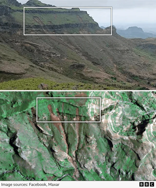
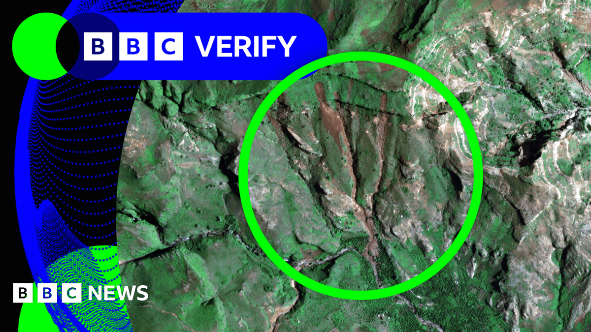
We have received high-quality satellite imagery showing the area hit by Sunday’s deadly landslide in a remote part of the Darfur region in western Sudan.
The images from the specialist satellite firm Maxar allow us to assess the scale and extent of the landslide.We have matched the satellite imagery to video and pictures of the aftermath that we previously verified as having been taken from a location south of Tarseen village in the Marra mountains.
According to Maxar’s analysis of the images “the debris flow/landslide damage did not appear to flow through any town centres in the vicinity. However, there is considerable debris in local washes and canyons”.
This corresponds with what BBC Verify has been seeing in aftermath footage shared on social media. It also raises questions about how many people died, given the armed group in control of the area has insisted that more than 1,000 people were killed.
UN officials estimate at least 370 people died but have said it is hard to assess the scale of the incident or the exact death toll as the location is hard to reach.
Aid workers from several agencies are expected to get to the affected the area today.
We’ll bring you more on what we’ve learned from the satellite imagery during the day.