
The next week is predicted to be “unsettled” for Wales, but there is a silver lining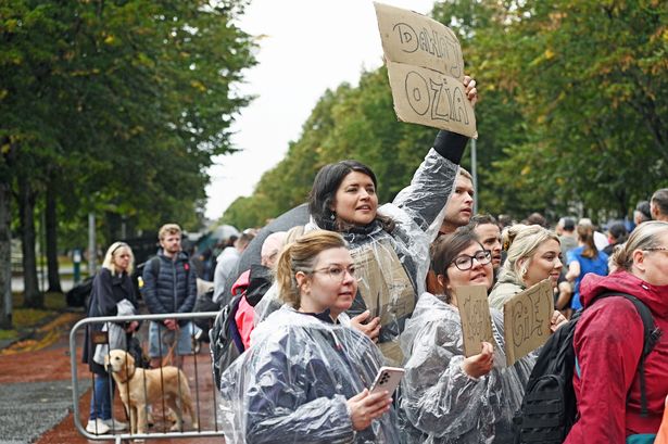 Runners battled rain today as they raced through Cardiff for the annual 10k run(Image: Richard Swingler)
It has very much felt like autumn has arrived this weekend, with a showery Sunday including some heavy rain showers and windy spells, depending where you were in Wales. But what is to come in the days ahead?
The Met Office forecasts more “unsettled” towards the middle of next week but there is some longer term potential for good news with “longer spells of drier weather” possible by the end of the month.
The Met Office say showers will continue on Sunday evening, with overnight rain mainly limited to coastal stretches. Tonight will also be cooler than Saturday, but will still stay “rather mild”. It comes after the Met Office issued two days of severe thunderstorm warnings across Wales.
Natural Resources Wales has issued a flood alert for the Carmarthenshire coast between Pendine and Hendy, east of Llanelli urging people to be “careful” on beaches.
It reads: “There is a risk of flooding as a result of the combination of the high tides and weather conditions for the high tide at 7pm on Sunday 7th September.
“Flooding of low-lying land and roads is expected. Be careful on beaches, coastal footpaths, roads, low lying land and close to the estuary. We will continue to monitor the situation.”
Monday will be “a day of sunshine and showers.” The west of Wales will likely see the “most frequent and heaviest” showers, according to the Met Office.
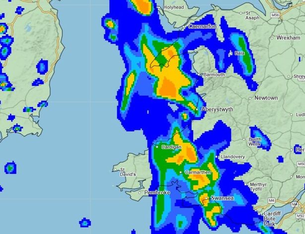 Rain will cover a large part of Wales by 4pm on Wednesday(Image: Met Office)
Looking ahead, the forecast reads: “An unsettled middle of the week with showery rain moving eastwards on Tuesday, followed by a mix of sunshine and showers on Wednesday and Thursday. Temperatures remaining near to average.”
The Met Office’s long range forecast from Friday, September 12 to Sunday, September 21 warns of an “unsettled” start but adds that there will be some “longer spells of drier weather” developing later on.
The full forecast says: “This period is likely to start out unsettled, with low pressure dominating the pattern. This will mean showers or longer spells of rain will affect most of the UK at times. Some heavy rain or showers are expected in places, most often in the west and north.
“Thunderstorms and hail are also possible, as are some spells of strong winds, especially if any deep areas of low pressure develop and affect the UK.
“Later in the period, there may be some longer spells of drier weather that develop, especially towards the south, with more in the way of sunshine due to higher pressure. Temperatures will likely be close to average or slightly below overall, but may rise above at times in any drier, sunnier spells.”
Get daily breaking news updates on your phone by joining our WhatsApp community here. We occasionally treat members to special offers, promotions and ads from us and our partners. See our Privacy Notice.