Wet weather is on its way
11:20, 18 Oct 2025Updated 11:20, 18 Oct 2025
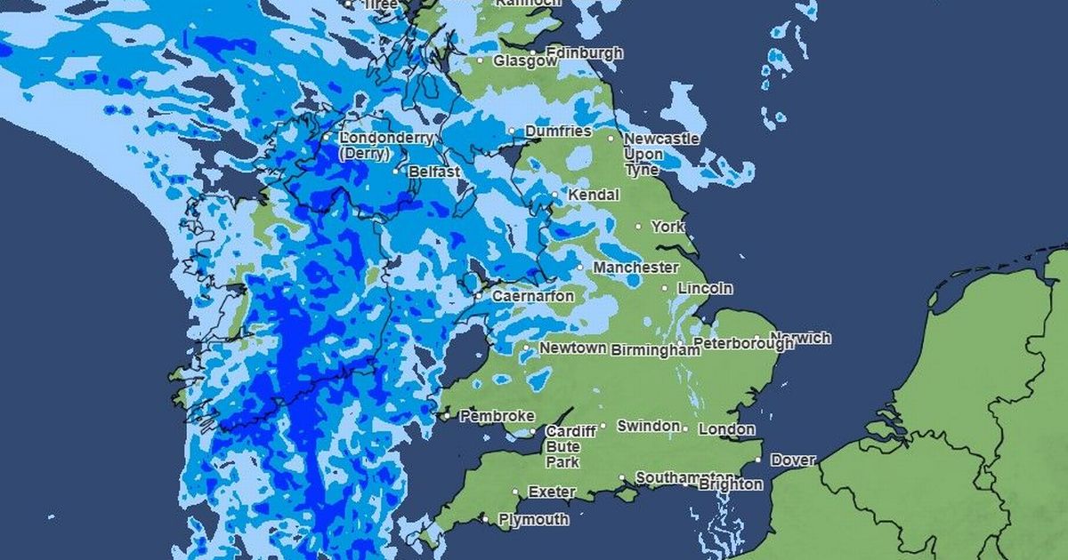
 A wall of rain is expected to hit the UK this weekend
It has been another largely cloudy and grey Saturday (October 18) so far, with some light showers in places.
However, according to the Met Office forecast, there is a chance of brighter skies in some parts with even “hazy sunny spells for a time”.
While it’s slightly warmer than Friday with a maximum temperature expected to be around 14C.
In more coastal regions of the North West, the winds will start picking up. But things will change as wet weather is on its way.
Join the Manchester Evening News WhatsApp group HERE
Tonight will be mainly dry during the first part of the evening, with showery outbreaks of rain expected later.
According to the latest Met Office weather maps, a wall of rain can be seen hitting parts of Wales and Northern Ireland later in the evening.
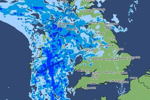
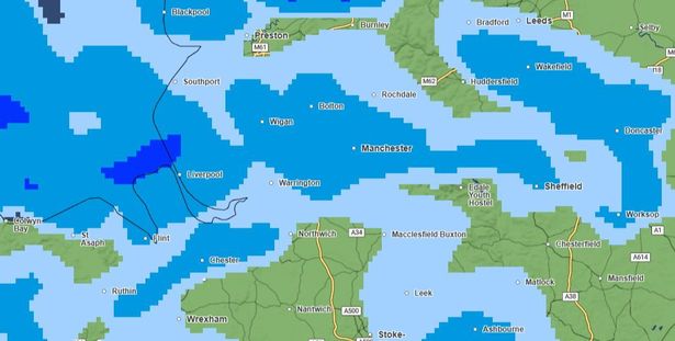 Rain, heavy in places, expected across Greater Manchester in the early hours of Sunday morning
The wall of rain will continue North-Eastwards and expected to reach Greater Manchester around 9pm.
The Met Office says the North West will become increasingly wet and windy overnight with some heavier rain in the early hours.
Minimum temperatures will be around 8C.
Sunday is expected to continue cloudy and windy throughout the morning with periods of heavy rain in places.
However, winds will likely ease through the afternoon with the rain easing off by the evening. Maximum temperature 15C.
So what’s in store for the early part of next week?
The Met Office says: “Sunshine and heavy showers on Monday, then drier with fewer showers on Tuesday.
“Staying changeable on Wednesday with a chance of rain later. Often breezy with temperatures around average.”