
Warmer climes and raised temperatures are set to be replaced by a snow bomb spanning as much as 18 hours.
06:02, 07 Apr 2025Updated 16:01, 07 Apr 2025
 Warmer climes and raised temperatures are set to be replaced by a snow bomb spanning as much as 18 hours.
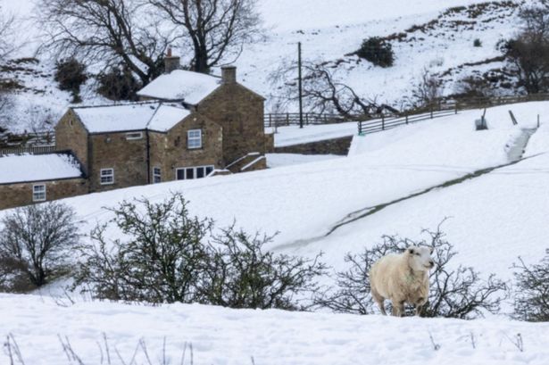
The UK faces 18 hours of snowfall next week – as the hottest day of the year is banished and replaced by freezing, biting air from the Atlantic. Warmer climes and raised temperatures are set to be replaced by a snow bomb spanning as much as 18 hours.
Snow maps and charts, projected using Met Desk data on the WX Charts website, show the snow front arriving in the UK at around 6am on Monday, April 14, and sticking around until midnight on Tuesday, April 15.
Snow could hit depths of around 1cm before beginning to creep down to the English border and into Northumberland. Looking ahead from Monday 14 April to Sunday 20 April, the BBC Weather team has warned “uncertainty remains”.
READ MORE Cat owners in England urged not to let pets out alone in April
It adds: “Towards and beyond the middle of April, the long-range weather forecast models continue to differ. Some continue to show a persistent high pressure signal over the far north and north-west of Europe with an ongoing colder risk.
“In view of this, a mostly drier and calmer trend could prevail. Temperatures might be slightly above average but could still drop below average at times, bringing a slight risk of overnight frosts.
“A number of long-term forecast models are sticking with a stronger low-pressure signal in the eastern North Atlantic or close to the UK, which would point to above average temperatures. As a result, rather wet and windy conditions may return and possibly persist during this week.”
Its Monday 21 April to Sunday 4 May outlook predicts a “possibly drier and calmer” period, adding: “As we move closer to May, the predicted weather conditions are subject to a great deal of uncertainty. Nevertheless, it is more likely that the influence of high pressure will prevail or return to some extent, with largely dry conditions and slightly less wind.
“There is a chance that low pressure systems could still affect parts of the UK intermittently, bringing more precipitation and stronger winds. Next update: Next Tuesday’s update could clarify the risk of a cold snap later on and also provide more insights about a persistent dry pattern.”