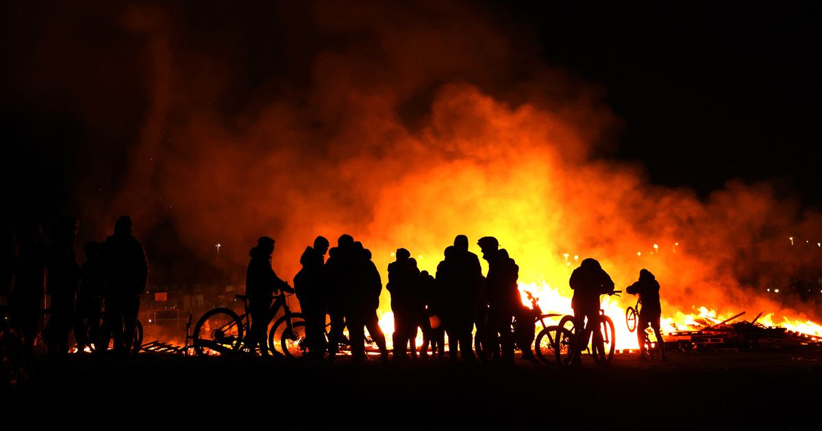
The dispersal orders give police officers the powers to arrest a person if they return to an area they have been asked to leave Police have been given extra powers to tackle trouble on Bonfire Night(Image: Liverpool Echo)
Police have been given extra powers across large parts of Merseyside to tackle trouble on Bonfire Night. A total of 11 dispersal zones have been issued in Merseyside today, November 5, including in Knowsley and Sefton.
The dispersal orders give police officers the powers to arrest a person if they return to an area they have been asked to leave. It means officers will be able to disperse anyone who has contributed or is likely to contribute to behaviour likely to cause members of the public in the locality, harassment, alarm and distress. Any person who has been directed to leave the area described and returns within the specified time period will be committing an arrestable offence.
Each of the four zones in Knowsley will be in place from 3pm today until 3pm on Friday, November 7.
Five of the seven zones in Sefton – including Aintree, Crosby, Hatton Hill, Maghull and Netherton – will be in place from 3pm today, until 10pm on Thursday, November 6.
In Southport and Formby, the orders will be in place from 4pm today until 4pm tomorrow.
Knowsley
Huyton Town Centre: The dispersal zone in Huyton Town Centre covers the boundaries of Lathom Road, Asda Stores and car park, Huyton Lane, Archway Road, Ellison Grove, Poplar Bank, Derby Road, Huyton Hey Road.
Halewood: This dispersal zones covers the A562 Higher Road, New Hutte Lane, Torrington Drive and all roads and closes off it. Blackburne Drive, Boundary Drive, Portway, Hillfoot Avenue, Speke Road, Greenacre Road, Mackets Lane, Lydiate Lane, Church Road, Cartbridge Lane, Greensbridge Lane and all estates off it, Lower Road, Finch Lane, Higher Road.
Whiston: Boundaries of Fox’s Bank Lane, Blundells Lane, Old Lane. Warrington Road, Holt Lane, Two Butt Lane, Scotchbarn Lane, Sinclair Avenue, Warrington Road, Ash Grove, Kingsway, Fazakerley Road, Saunders Avenue, Dragon Lane, Paradise Lane, Bishop Drive, Halsnead Avenue, Windy Arbour Road, M62 Roundabout, Cronton Road and all roads and cul-de sacs in and around that locality.
Kirkby: Boundaries are County Road, Headbolt Lane, Pingwood Lane, Shevington’s Lane, Bank Lane, Prescot Road, Glovers Brow, Kirkby Row, Valley Road and Bewley Drive.
The zones have been put in place due to the amount of ASB calls and incidents of criminal damage normally associated with the Bonfire night period.
Knowsley neighbourhood Inspector David Hassett said: “Dispersal zones are a valuable tool which we know work.
“We know people living in Knowsley want us to take positive action and this is what we are doing. We would ask our communities to continue to support us in our work and let us know who is responsible for criminal damage and ASB in their area so we can help put a stop to it.”
Sefton
Aintree: This dispersal order covers the M57, A59 Switch Island, Northern Perimeter Road, Copy Lane, Browns Lane, Edward Jenner Ave, Heysham Road, Mersey Rail Kirkby railway, Melling Road, Leeds to Liverpool Canal up to M57 including Old Roan and Aintree Railway Stations.
Crosby: This dispersal order covers Crosby Village/Alexandra Park/Coronation Park/Ramblers/Northern Club/Moorside Park area as shown on the map. The zone will cover the area bounded by Moor Lane, Forefield Lane, Moorside Park, Liverpool Road, Coronation Road.
Hatton Hill: This dispersal order covers Hatton Hill Park and surrounding areas as shown on the map. The zone will cover the area bounded by Boundary Road, Sterrix Lane, Gorsey Lane, Leeds to Liverpool Canal, Rimrose Brook, Cambridge Road, A565 Crosby Rd South, Peel Rd, Norton Street, Knowsley Road, Linacre Lane, A5038 Netherton Way.
Maghull: This dispersal order covers Green Lane, Dodds Lane, Ormonde Drive, Broadwood Avenue, Hall Lane, Old Hall Road, Moss Lane.
Netherton: This dispersal order covers Northern Perimeter Road, Copy Lane, Dunnings Bridge Road, Park Lane West, Barnfield Close, Swifts Lane, St Nicholas Drive, Fleetwoods Lane, Buckley Hill Lane.
Southport: This dispersal order covers Marine Drive, Esplanade, Promenade, Coronation Walk, Portland Street, Talbot Street, Eastbank Street, Virginia Street, Southport railway station, Hall Street, Hawkshead Street, Queens Road, Park Road, Park Road West, Promenade, Fairway.
Formby: This dispersal order covers Long Lane footpath, Church Road, Liverpool Road, Altcar Lane, Hoggs Hill Lane, the railway line, Kirklake Road, Woodlands Road, Wicks Lane, Freshfield Road.
Sefton neighbourhood policing Inspector Kenneth Sumner said: “These zones are in place due to the number of calls we receive about incidents of antisocial behaviour and criminal damage over the Bonfire Night period.
“We know from past history that the dispersal zones are effective in removing groups of people gathering in certain areas and preventing incidents of ASB and we know that our communities appreciate when they see high visibility police patrols on the streets.
“As always our ask of parents and guardians is to please speak to your children teenagers and warn them against engaging in antisocial or criminal behaviour including letting off fireworks in public.”
To report anti-social behaviour or criminal behaviour can contact Merseyside Police social media desk via X @MerPolCC or on Facebook ‘Merseyside Police Contact Centre’. You can also report information via the website: https://www.merseyside.police.uk/ro/report/ocr/af/how-to-report-a-crime/ or call 101.
Operation Banger is Merseyside Police’s response to the Halloween and Bonfire Night period.
For more on the operation and Dispersal Zones, visit: Sharp Decrease in Antisocial Behaviour in Merseyside on First Night of Operation Banger | Merseyside Police