A battle between a giant Scandinavian ‘anticyclone’ and the Atlantic will plunge Britain back under a stubborn autumn gloom.
Wind, rain and freakishly high temperatures will give way this weekend to easterly gusts driving a weather ‘switch around’.
Low pressure to the west and high pressure to the north will draw battle lines as Britain is smothered by a dome of mist and fog.
Days of torrential rain ploughing moisture into the atmosphere will drive a gloomy, murky run into winter.
Met Office meteorologist Alex Deakin said: “Over the course of the weekend, we are potentially going to see a bit of a switch around.
“By the time we get to Saturday, there will be lighter rains and misty mornings.
“There is a lot of moisture from the rainfall this week, so we will have misty and murky conditions.
“We have this scrap over the weekend, and we are kind of stuck in the middle, and there will be some outbreaks of showery rain and the potential for morning mist and fog as things turn cooler.”

Wind, rain and freakishly high temperatures will give way to easterly gusts as cold nudges from the east
|
WX CHARTS
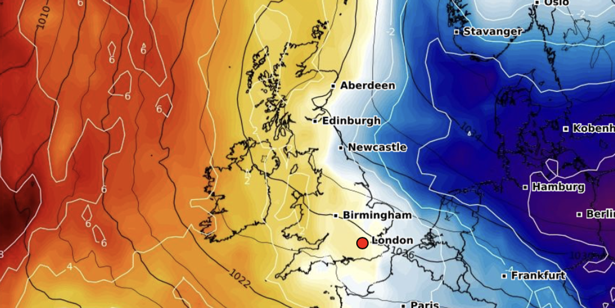
High pressure, the driver of the ‘anticyclonic gloom’ that shrouded Britain in grey at the start of autumn, is set to return.
A weak jet stream will keep Atlantic storms at bay, while temperatures drop from this week’s 17C highs.
Deakin said: “It looks a bit drier, the jet stream is much weaker, allowing higher pressure to build from the east and we will have a battleground going on.
“Most likely is a Scandinavian high, with the winds coming in from the southeast, and if this were summer, we would be looking at some very high temperatures.
“High pressure will sit to the north of the UK, and that will allow us to drag in some easterly winds, and that would allow it to turn a little bit cooler, especially in easterly areas close to the sea.”

The UK is predicted to sit under a pressure dome
|
WX CHARTS
Thermometers will yo-yo from 17C at the end of this week to single figures in the approach to mid-month.
Vanishing warmth will drive mist and fog, which if high pressure builds, will hover beneath a dome of falling winds.
Britons are warned not to put away winter coats with the current T-shirt weather set to fizzle.
Jim Dale, meteorologist for British Weather Services and social commentator, said: “After the weekend, we are probably going to see a change back to a northerly, and this will mean that temperatures will fall.
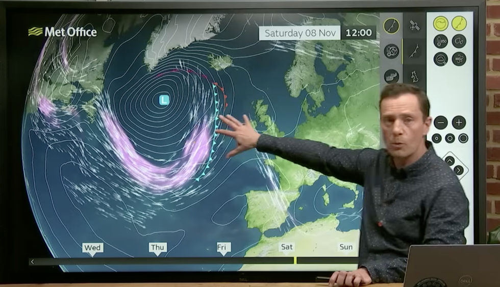
Met Office meteorologist describes the looping jet stream keeping storms to the west
|
MET OFFICE
“We will see an end to the hit teens and many places will drop back to freezing or below, overnight.
“With high pressure building, there will be a risk of morning fog and mist.”
Meanwhile, scientists warn an ‘Arctic tug of war’ may be the next menace to blight Britain’s changing climate.
Melting Polar sea ice could change the steer of the jet stream, driving slower but more frequent storms.
Report author Dr Steph Hay from the University of Exeter said: “The daily winter weather of Britain and Ireland is mainly driven by the Atlantic jet stream, whose future position and strength is influenced by the difference in temperature between the tropics and the Arctic.”