Snow maps have forecast the first sprinkling of the winter next week, and meteorologists have claimed the snowfall could continue for days on end, as temperatures drop to freezing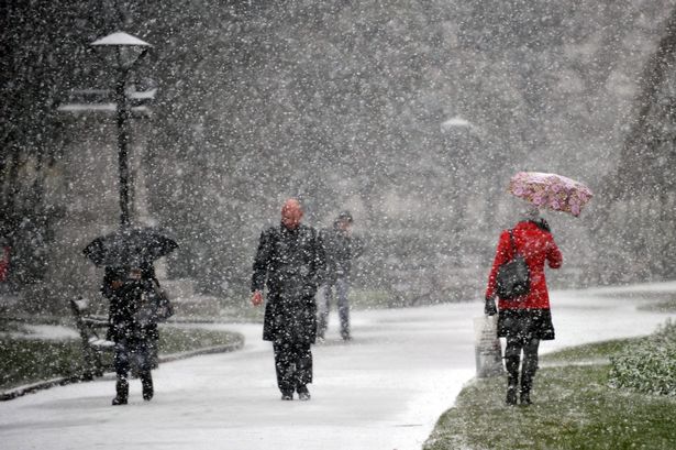 Flurries of snow could hit Britain next week in some regions(Image: PA stock image)
Snow has been forecast to hit the UK by next weekend, with northern regions most likely to wake up to snowfall.
The first snow of the winter season is yet to officially land, but meteorologists forecast a dusting from Friday next week. Assuming the snowfall does come, it could even last for three to four days, it’s been claimed.
It’s been a record-breaking mild October and start of November, but the Met Office has also forecasted a chillier week upcoming. There’s a greater chance of overnight frost from the middle of the month, it said.
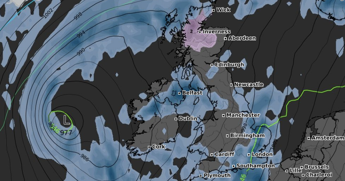
Weather maps forecasted the first snow to fall at about 6pm on Friday November 14. Just a few centimetres were forecast in northern Scotland, particularly around Inverness.
But, the snow could ultimately stretch as far south as northern England, according to British Weather Services’ senior meteorologist, Jim Dale.
READ MORE: UK snow forecast as ’10cm per hour’ to fall in Arctic blast lasting five daysREAD MORE: UK weather: Snow to hit three nations with up to 56cm forecast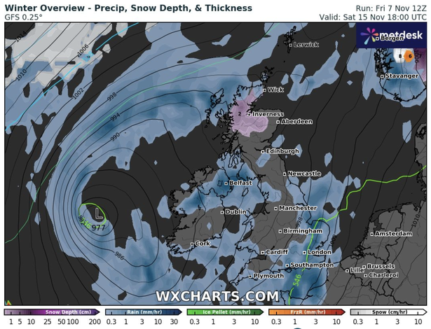 Snow was forecast in the most northern parts of the UK next week(Image: WXCHARTS)
He told the Mirror: “Snow is likely incoming by this time next week [for the north].
“It’s early days, but from next Friday onwards it could snow for three to four days. Obviously the mountains of Scotland get first pick; but Northern Ireland & parts of northern England are also in the frame.
“A lot of water to flow under the bridge just now, but our one to 10 day severe weather warning service will reflect it in detail on Sunday, if it’s all still on.”
At the same time, temperatures could drop to below freezing from Friday next week. Glasgow and Aberdeen were both forecast to reach -1C on Friday night, whereas the south of England could still expect about 6C heading into Monday morning.
Meanwhile, the Met Office forecasted frost and overnight fog heading into the middle of the month. It said hill snow was possible toward the end of November.
The Met Office’s long range forecast for November 12 to November 21 read: “The start of this period is likely to be largely unsettled and mostly mild, with bands or areas of rain moving across most parts of the UK, although tending to be focused more on western and possibly southern parts.
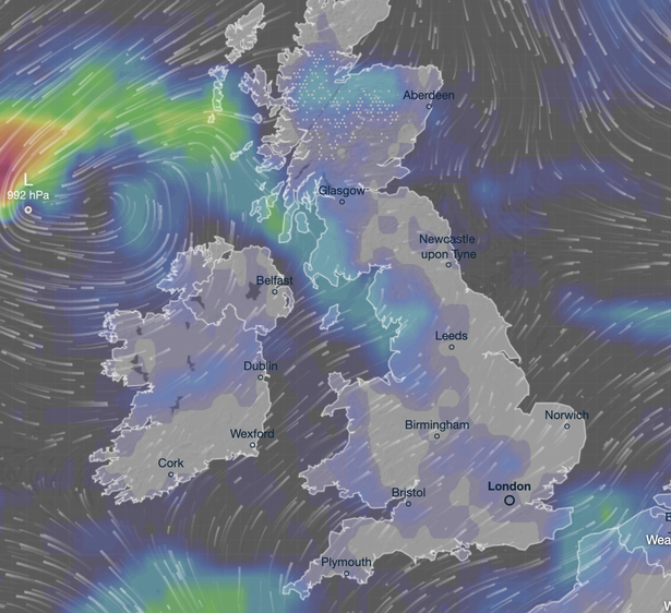 It would be the first official snowfall of the winter season in the UK(Image: Ventusky)
“Locally strong winds may also accompany the rain at times. Some drier spells are also likely, the best of these probably towards the east and possibly the north.
“Where skies are clear and winds light overnight, frost and fog are likely, the fog slow to clear. From around the middle of the month, we may see a transition towards more generally drier weather across the UK, and with this it is likely to turn a little cooler overall, with a greater risk of overnight frost.”