People around the UK are being told to expect plummeting temperatures and hundreds of miles of snow in the coming days, with weather forecasters warning Brits to be prepared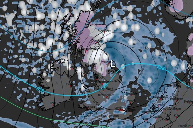 Scotland and the north of England are expected to suffer most of the snowfall
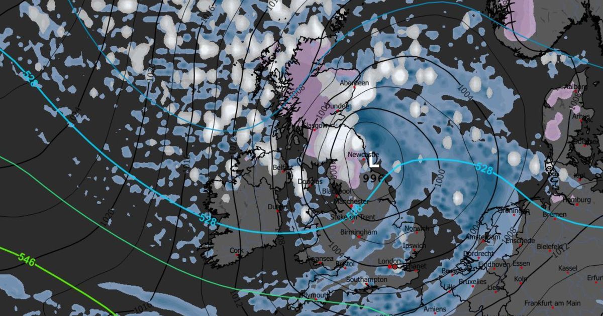
Britain is bracing for a dramatic winter onslaught as weather charts point to a colossal 420-mile wall of snow expected to sweep across large swathes of the UK, just as temperatures plummet towards -7 °C or lower.
Dramatic new graphs of how snow will batter England, Scotland, Wales, and Northern Ireland have been released, and show which areas will be hit the most.
The WXCharts maps, which use MetDesk data, forecasts Scotland and the north of England will have the deepest snowfall in the UK, with the east and south east of England, as well as London, also getting some of the white stuff around November 20.
Glasgow, Aberdeen, Edinburgh, and the likes of Newcastle, Blackpool, Manchester, and Belfast are among the cities named on the map which will receive between four and eight inches of snow.
READ MORE: AA warns drivers of 3 ‘crucial’ car checks to do before setting off in winterREAD MORE: Met Office issues urgent 24-hour storm warning as Brits face deluge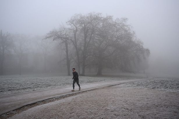 Brits are being told to brace for cold weather(Image: AFP via Getty Images)
Similarly, Scotland is expected to face the coldest temperatures in the coming week, averaging in the minuses, while the temperature gets warmer as you travel down the UK.
Northern Ireland and the north of England are predicted to have temperatures anywhere between 4°C and 8°C towards the end of the week, while London and the south of England could get up to 13°C.
According to the Met Office, while the exact timing and depth of snowfall remain subject to the usual uncertainty, cold air from the north and east combined with moist weather fronts mean a significant snow risk is very real.
Forecasters say the earlier impact will be felt in Scotland and northern England. The Highlands, Aberdeenshire, the Pennines, Cumbria, and North Yorkshire are identified as likely zones for heavier snowfall, with lighter accumulations possible further south and west.
An expert snapshot from the forecaster notes that overnight temperatures in the north could drop below freezing, upping the odds of precipitation falling as snow rather than rain.
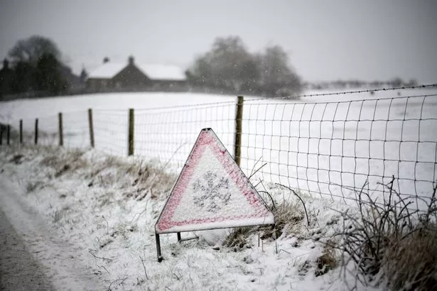 Plummeting temperatures and freezing conditions are coming to the UK this week
Snow forecasting in the UK is tricky, but the Met Office outlines key ingredients as a very cold surface air, moisture-laden fronts, and the freezing level dropping close to ground level.
In this scenario, a band of moisture could sweep in from the Atlantic or North Sea, meet the bitterly cold air mass and then produce a long arc of snow extending potentially hundreds of miles.
Travel disruption is also likely, with roads and railways facing delays or closures, especially in areas of heavier snowfall. Residents are being told to ready themselves by clearing drives and paths, checking up on vulnerable neighbours, and ensuring they’ve adequate heating and storm supplies.
While the Met Office’s long-range outlook remains cautious and emphasises uncertainty, it does highlight an increased probability of a cold northerly flow with wintry showers and overnight frost.