The Met Office says ‘persistent’ bands of showers are expected in the coming days as multiple flood warnings have already been issued The forecast for next week shows more heavy rain(Image: Met Office)
The Met Office has forecast a run of unsettled weather in Wales over the weekend and into next week, as multiple flood warnings are already in place. The national meteorological service says “persistent” bands of showers are expected Saturday, with an unsettled start ahead for Sunday too.
Heavy rain and strong winds are also expected to persist into next week. After a showery day on Monday, attention turns to a potentially deep area of low pressure to the southwest of the UK.
Deputy chief meteorologist Steven Keates says: “A deepening area of low pressure will approach the UK from the southwest later on Monday, bringing with it heavy rain and strong winds, which are likely to affect the UK between late Monday and early Wednesday.”
Natural Resources Wales also has six flood warnings, and 26 flood alerts in place across Wales on Saturday morning.
The flood warnings are affecting the following areas:
- Low lying property along the coast from Beach Parade north through the harbour to Aeron Coast caravan park on the outskirts of the town, including the fire station and Glan y Mor housing complex
- Kiln Park caravan site, the B4318 road at Clicketts Lane, Gumfreston Road and the minor road Trefloyne Lane
- The A487 road and property in the vicinity of the Duke of Edinburgh public house and Newgale campsite
- Static and mobile caravans and site buildings at Carmarthen Bay Holiday Village, Kidwelly
- The Beach Hotel, post office and adjacent property, up to Pendine Sands caravan park, as well as the main A4066 Pendine to Amroth coast road, Pendine
- Property adjacent to the River Towy at Carmarthen Quay downstream of the A484 road bridge
How it looks Saturday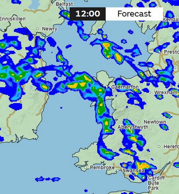 (Image: Met Office)
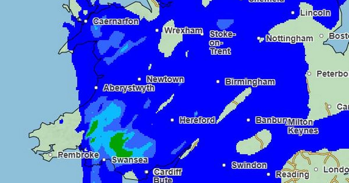
The Met Office says: “Heavy rain from overnight lingers into Saturday, particularly across northeastern parts of Scotland. Elsewhere, many places will see blustery showers and a brisk south to southwesterly wind.
“Bands of showers will be most persistent across south Wales and southwest England, and some of these will be heavy, with the odd rumble of thunder. The ground in some of these areas is already saturated, so any extra heavy downpours will be far from welcome, potentially leading to tricky travel conditions and localised surface water issues.
“The best chance of any dry weather will be across parts of Northern Ireland, northeast England and southeast Scotland. Temperatures will be near normal to rather mild, tempered by brisk winds in the south.
“As Saturday draws to a close, attention turn to the next weather system gathering to the west.
“This system is set to bring almost a repeat performance, with another weather front extending across the country from west to east.”
The outlook for Sunday
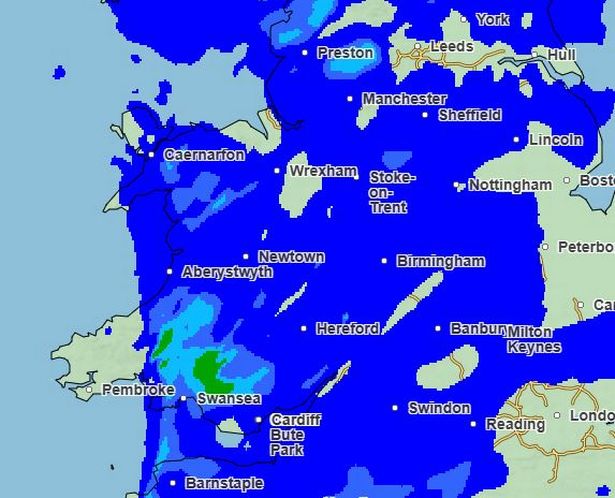
Weather maps show a wet start to the day with heavy rain across the whole of Wales. This is the weather map for noon.
 (Image: Met Office)
The forecast says: “Sunday begins on an unsettled note for many, with a band of rain arching its way northeastward and spreading steadily across most of the UK.
“This rain will be persistent for a time, especially in the north, but will clear to leave a drier end to the day across much of England, Wales and Northern Ireland.”
The specific Wales forecast for Sunday says: “A damp and cloudy start, as a band of rain continues to spread northeastwards through much of the day, bringing heavy and prolonged bursts.
“Strong winds persist for coastal regions. Maximum temperature 13 °C.”
Looking ahead to next week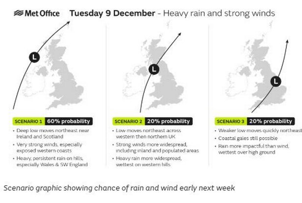 (Image: Met Office)
Deputy chief meteorologist Steven Keates explained: “A deepening area of low pressure will approach the UK from the southwest later on Monday, bringing with it heavy rain and strong winds, which are likely to affect the UK between late Monday and early Wednesday.“At present, the exact track, depth, and timings of this low are uncertain, which makes it harder to determine where will be most impacted by strong winds and/or heavy rain.
“This system has the potential to cause disruption, and severe weather warnings are likely to be issued over the weekend as details become clearer.
“We therefore urge people to keep up-to-date with the latest Met Office forecast.”
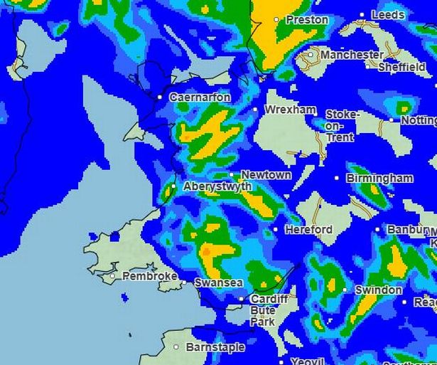
This is the weather map for 9am on Tuesday:
 (Image: Met Office)
The Met Office forecast for Wales from Monday to Wednesday says: “A brighter day on Monday, though occasional blustery showers likely.
“A heavy rain band brings wet and windy conditions on Tuesday, with coastal gales possible. Turning showery again on Wednesday.”