
Some areas could see persistent snowfall starting from December 20. (Image: PA)
New snow maps indicate that a significant portion of Scotland could experience continuous snowfall for at least nine consecutive days.
Persistent snow is predicted to start falling in north-west Scotland from December 20, according to the latest forecasts from WXCharts, based on data from MetDesk. The maps suggest that areas such as the Highlands, Grampian Mountains and the Cairngorms could be blanketed with heavy snow in the lead-up to Christmas Day.
This increases the likelihood of a white Christmas for Scotland, the most recent of which was in 2021. The last widespread white Christmas across the UK occurred in 2010, and the current maps show no snow forecast for England, Wales or Northern Ireland during the festive period.
Snow is expected to be concentrated in north-west Scotland from December 20 to 23, before spreading more broadly across Scotland. From midday on Christmas Eve, the snow is predicted to move further east, with central and eastern Scotland, including Aberdeen and Glasgow, experiencing wintry conditions.
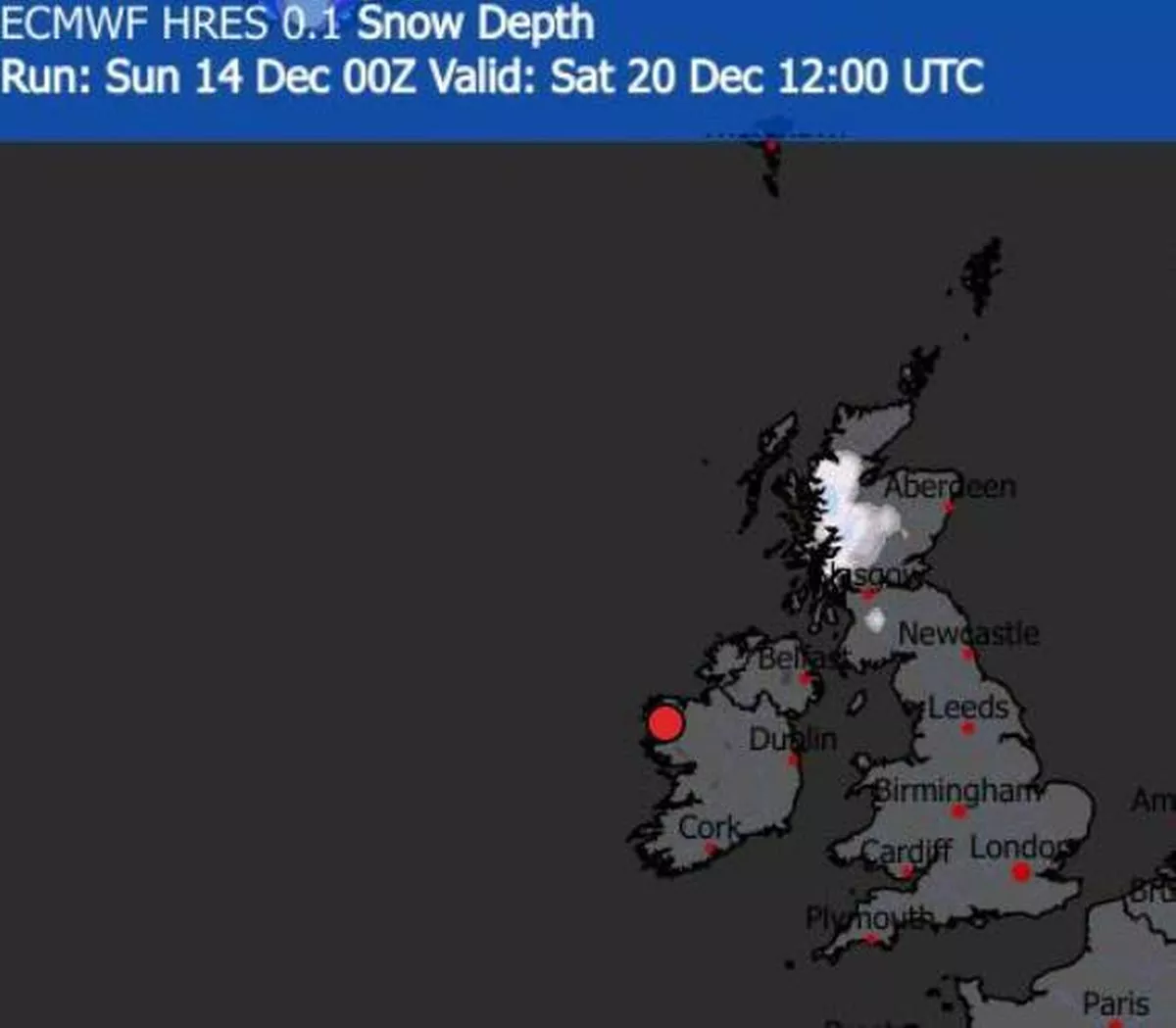 Snow map for December 20
Snow appears set to continue falling in parts of Scotland on Christmas Day. On Boxing Day, snowflakes are anticipated to cover central and eastern parts of Scotland more extensively, reports the Mirror.
From December 27 onwards, snow seems likely to be restricted to north-west Scotland.
Which ares could see snow at Christmas
Highland.
Aberdeenshire.
Moray.
Perth and Kinross.
Angus
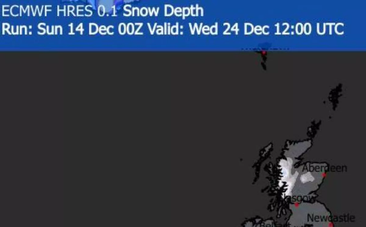 Snow map for December 24
In its extended forecast for 19th to 28th December, the Met Office predicts: “Showers or longer spells of rain are likely to continue at first for many parts of the country, perhaps heavy at times, but gradually over the weekend the weather is expected to become more settled. Scotland and Northern Ireland are likely to see this change first, with spells of rain perhaps slower to clear further across the south.”
As we head into the week commencing Christmas Day, the Met Office anticipates that “high pressure is expected to become more widely established”, ushering in calmer weather, chillier temperatures, overnight frosts and morning fog.
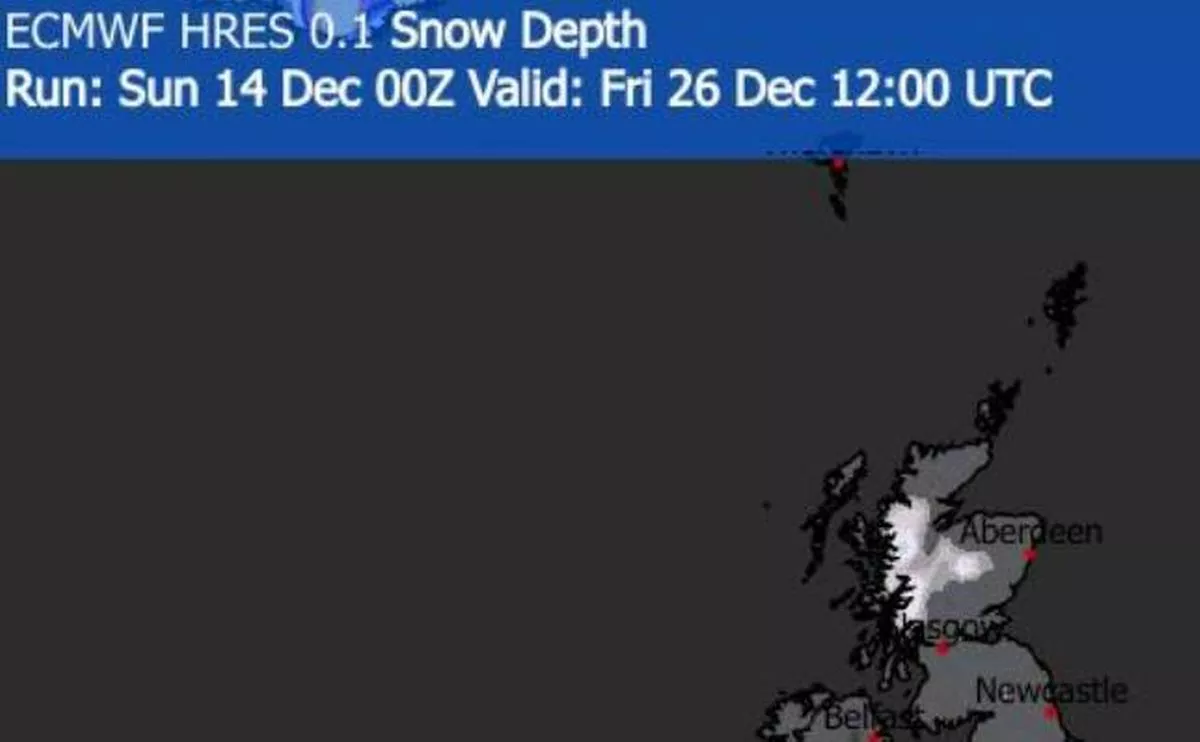 Snow map for December 26