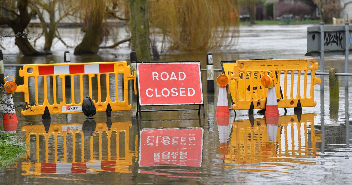
The Environment Agency is warning that property flooding is possible High water levels are possible in certain areas(Image: Surrey Live / Darren Pepe)
Surrey residents have been warned to expect flooding as the Environment Agency issues a ‘flood warning’ for parts of the county.
The warning has been given for the River Wey at Elstead and Eashing. This means that people along the waterway, in Godalming, Elstead and Charleshill will likely have experienced or be experiencing flooding.
Property and roads may be affected, especially in the Elstead Mill and Eashing areas.
The warning means that those in the affected area take steps to protect themselves such as moving to higher ground or the upper flood of a building, put flood protection equipment in place and turn off the gas, electricity and water in their home if it’s safe.
Rising river levels have been caused by Thursday’s (December 18) rainfall. Currently these levels are rising and at around 1.69m, just short of the 1.74m level where property flooding becomes possible.
While no more rain is forecast for Friday (December 19) river levels will continue to rise throughout the day, as the rainfall from Thursday nights makes its way through the system.
However, without further downpours the levels should then peak and slowly fall.
As well as this flood warning several flood alerts have also been issued for Surrey. This is the step before a warning and means that flooding is possible. These have been given for:
- Chertsey Bourne – including Virginia Water, Thorpe Green and Chertsey and the Moat at Thorpe.
- Cranleigh Waters – including Elmbridge, Shamley Green and Bramley and the Littlemead Brook including Cranleigh.
- Hoe Stream – including Woking.
- River Blackwater and The Cove Brook – including Badshot Lea, Aldershot, Farnborough, Camberley, Sandhurst, Eversley, Bramshill and Swallowfield, and the Cove Brook at Farnborough and Cove.
- River Lox – from Chiddingfold to Drungewick, including the Loxwood Stream.
- Rivers Eden and Eden Brook and Kent Ditch – from Blindley Heath to Penshurst including Edenbridge and Hever.
- Tillingbourne – including Chilworth and Shalford.
- Upper Arun – The Rivers Arun, North River, Kird and Par Brook.
- Upper River Medway – from Forest Row to Penshurst, including Ashurst.
- Upper River Wey – including Alton, Farnham, Bordon, Frensham, Tilford, Godalming, Guildford and Peasmarsh.
People should avoid using low lying footpaths near these areas.
There has already been disruption caused by the flooding. On Thursday (December 18) the road under the railway bridge on Trumps Green Road flooded causing police to re-route traffic.