More snow has been forecast for the region
Further snowfall is expected in the UK(Image: )
Snow could fall across areas of the Midlands within weeks.
Large parts of the UK saw heavy snowfall last week thanks to Storm Goretti.
But that might not have been the last of the wintry weather, with further snow now forecast.
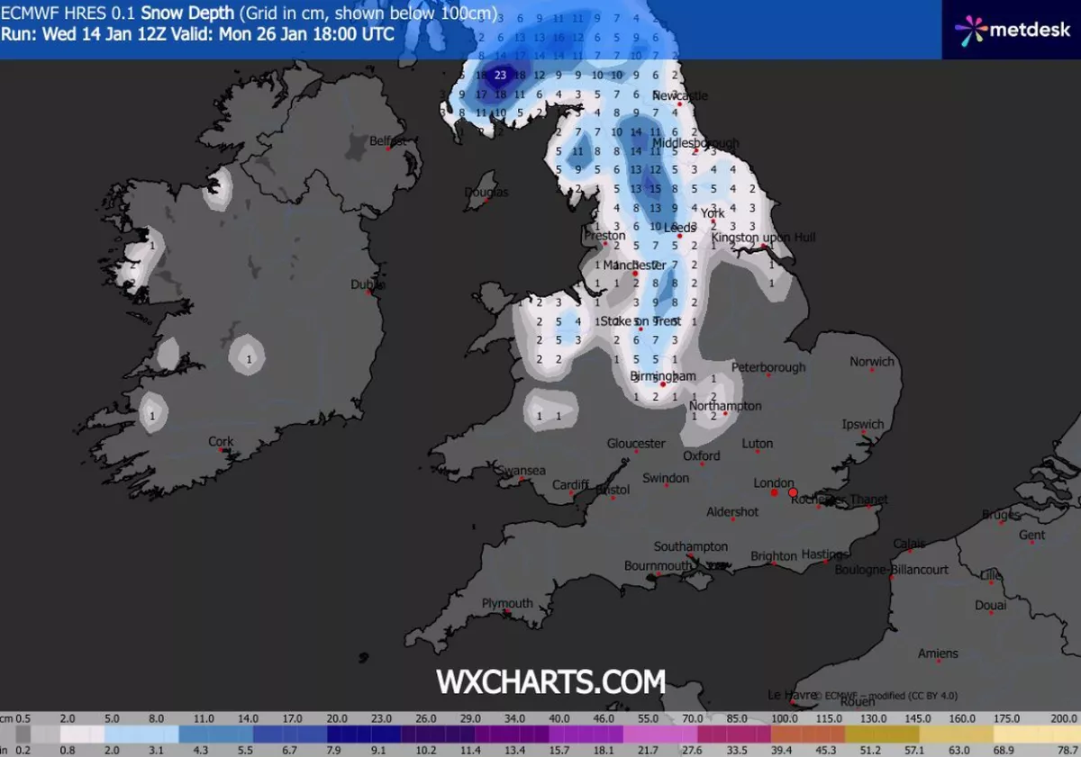
According to maps from WX Charts, snow will initially fall across parts of Scotland and Wales on Monday, January 26.
Within hours, snowfall is expected to move towards the north of England, as well as the Midlands.
READ MORE: Met Office names 23 UK areas at risk of 50mm of rain as weather warning issued
Weather maps indicate that most of Scotland and northern England will be seeing flurries by 6pm.
Birmingham looks set to get five inches of snow, along with Stoke-on-Trent.
Up to 7 inches of snow could also fall in surrounding areas, according to WX Charts.

Snow is forecast for Monday, January 26(Image: WX Charts)
In its long-range forecast for Monday, January 19, to Wednesday, Janaury 29, the Met Office said: “Throughout this period, the UK will see a battle between Atlantic weather systems attempting to arrive from the west while high pressure and colder conditions attempt to exert some influence from the east.
“Initially, milder Atlantic air is expected to dominate.
“This should maintain changeable conditions with showers or longer spells of rain for most.
“The wettest weather in western parts of the country, drier in the east.
“Temperatures overall likely to be around average. Later in the period, there is an increased chance that conditions will turn colder.
“This aspect of the forecast is still somewhat uncertain but the potential transition to colder weather also increases the chance of snow across parts of the country.”
Don’t miss the biggest and breaking stories by signing up to the BirminghamLive newsletter here.
