Weather forecasts from Metdesk show a wall of snow is set to sweep across the UK in the coming days with several major cities due to be hit with flurries of the white stuff
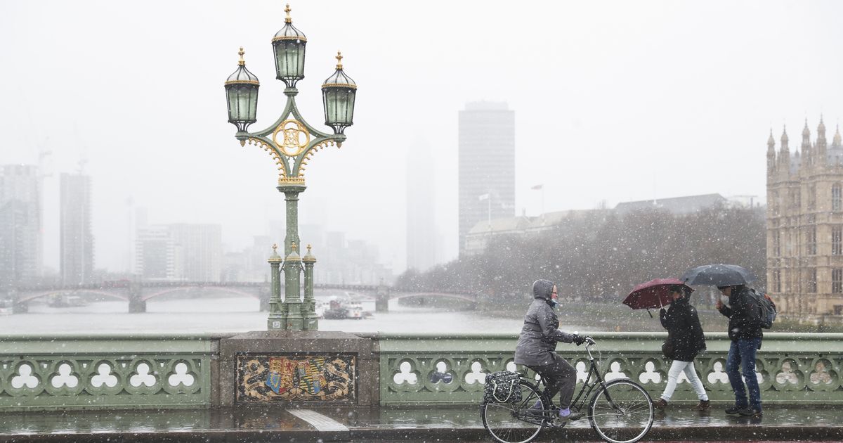
Snow falls in London as the capital is hit by bad weather (file photo)(Image: Rex Features)
UK cities are set to be blanketed in the coming days as a wall of snow is set to sweep across the UK burying several metropolitan areas, including London, in drifts.
Weather forecasts from Metdesk show that the week after next a weather front is due to sweep across the whole of the UK, from east to west bringing blizzard conditions to many areas.
The weather is set to make landfall around noon on Thursday January 29 and pummel Brits both north and south, according to weather charts from WXCharts.com.
The band of rain and snow is predicted to move east across the UK over the course of the day, turning almost entirely to snow by 6pm in the evening, blanketing a 531 mile stretch from Exmoor to Kearvaig in Scotland.
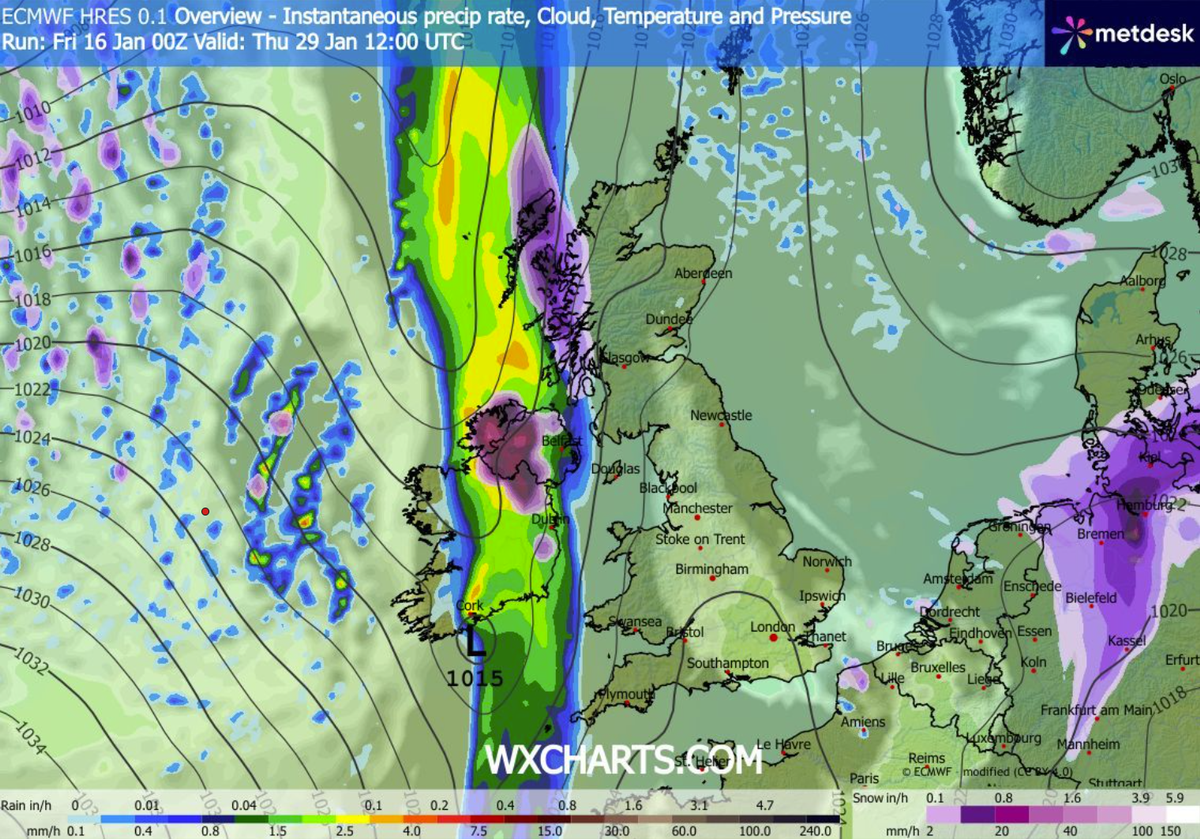
Thurs 29 Jan 12:00(Image: )
Bristol, Cardiff, Birmingham, Manchester and Glasgow are all in the firing line with several centimetres an hour forecast to fall across Britain.
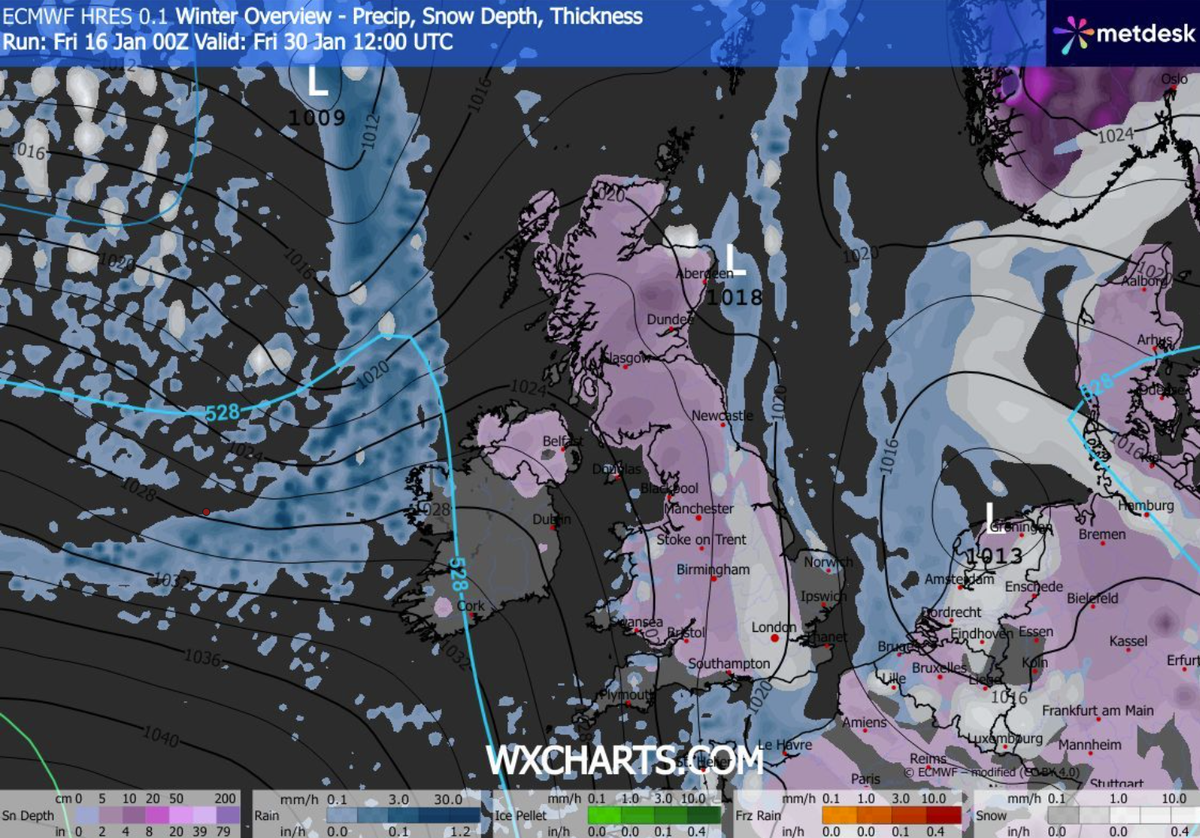
By noon on Friday January 30 the charts show that the dense band of snow will have passed over the UK but localised blizzards will continue, notably over London.
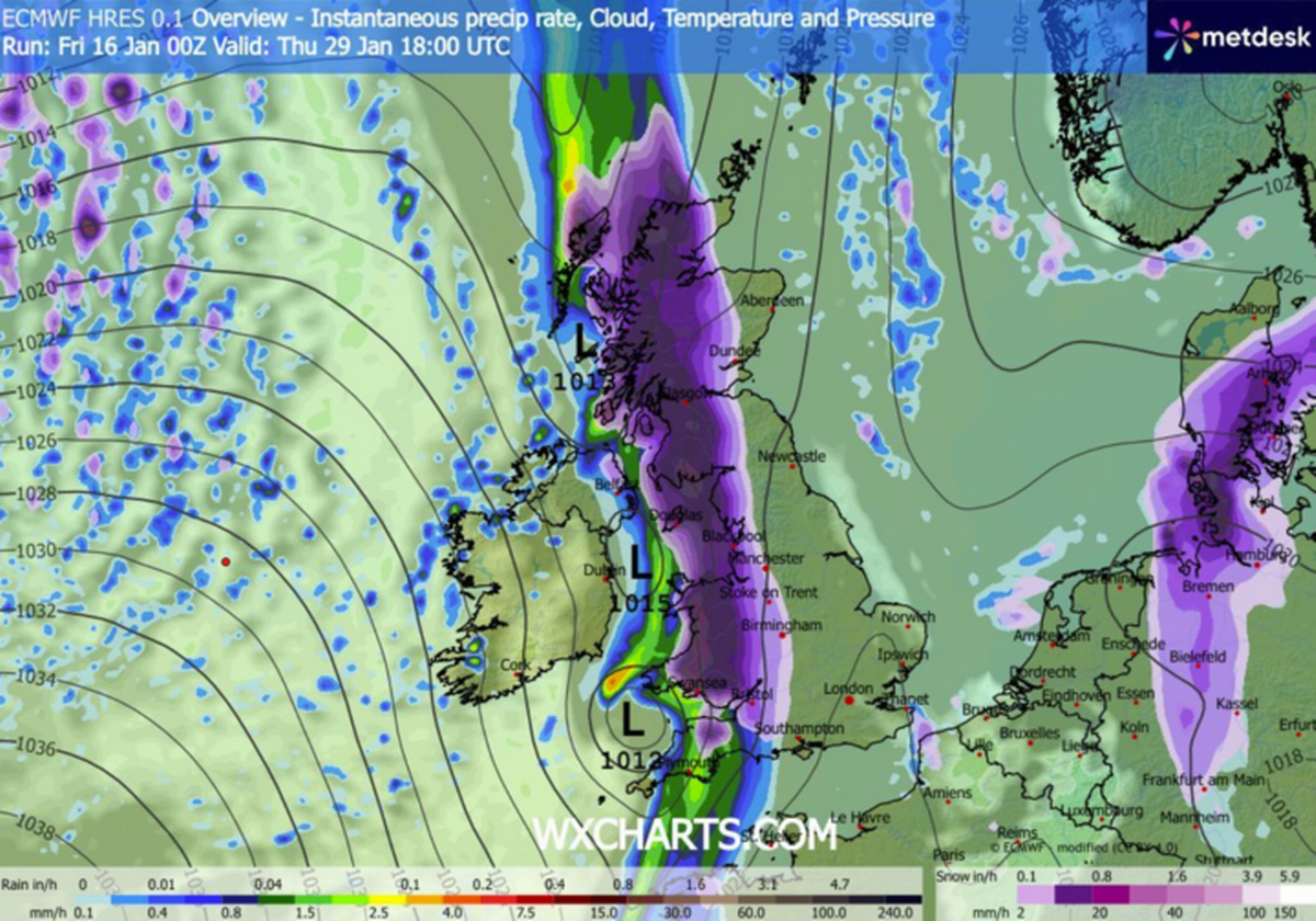
Thurs 29 Jan 18:00(Image: )
The map shows a band of snow covering the nation’s capital with a centimetre or two per hour predicted to be falling.
Meanwhile a separate map for the same period showing snow depth sees most of the UK blanketed by noon on January 30 with snow continuing to fall over London.
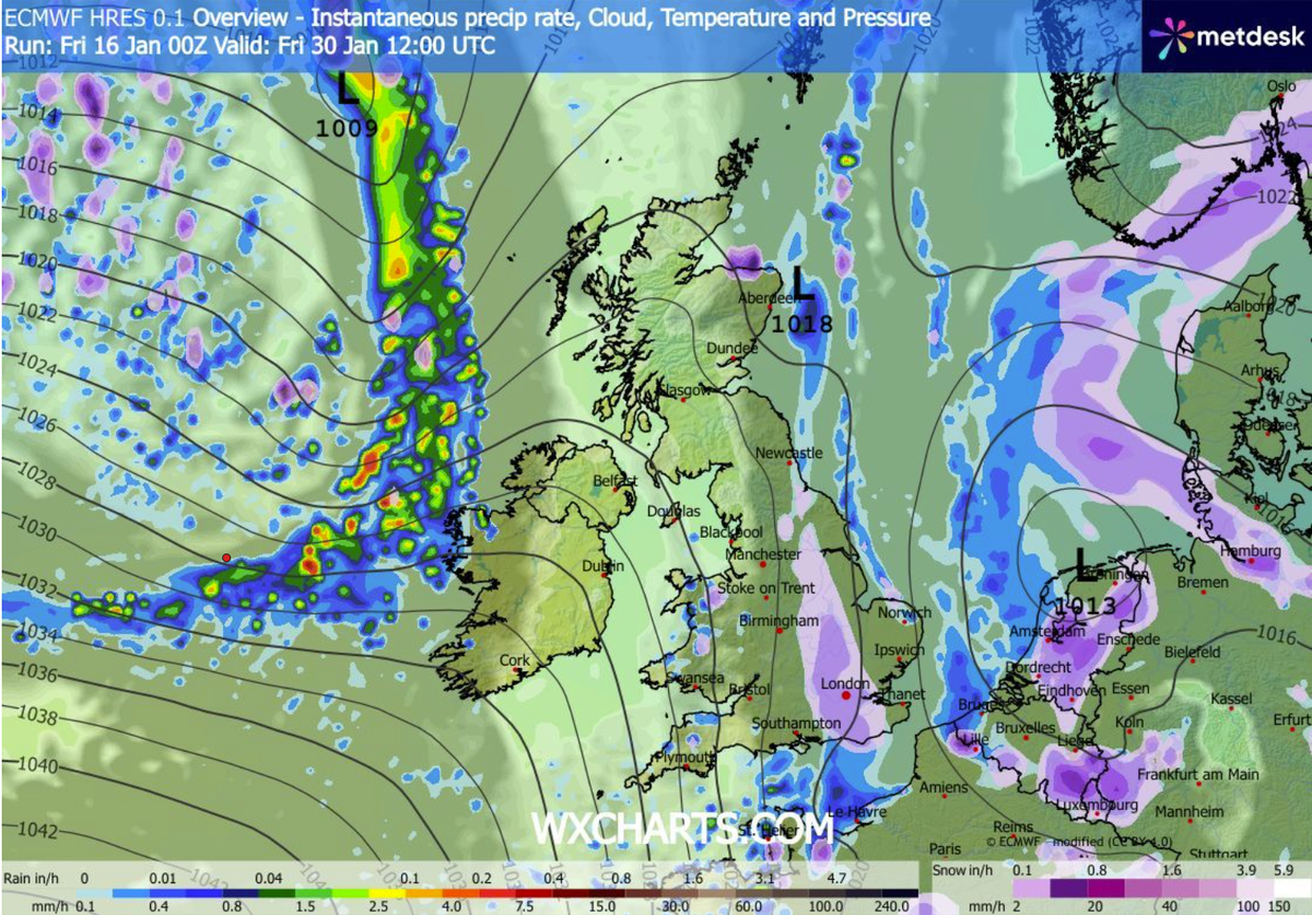
Fri 30 Jan 12:00(Image: )
The final chart, showing snow depth across the UK shows that as far south as Southampton we could be seeing up to 2-3cm of snow on the ground, including in and around London. With the coverage getting deeper over high ground and further north.
The deepest drifts are forecast in the eastern Highlands of Scotland with snow as deep as 51cm (20 inches) collecting there.
Fri 30 Jan 12:00 snow(Image: )
Meanwhile the long range forecast from the Met Office for Wednesday January 21 to Friday January 30 warned of an increased chance of snow across parts of the country.
“Throughout this period, the UK will see a battle between Atlantic weather systems attempting to arrive from the west while high pressure and colder conditions attempt to exert some influence from the east,” the forecast said.
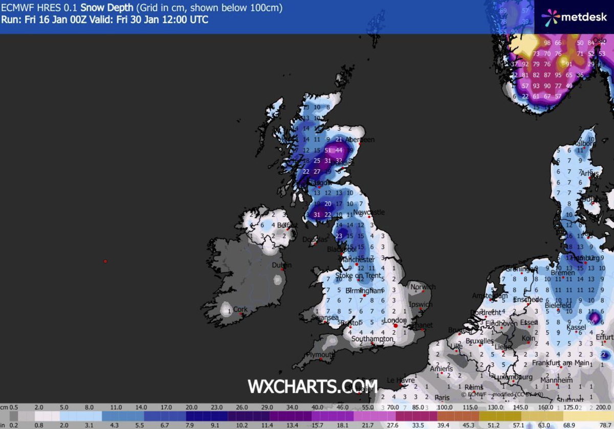
Fri 30 Jan 12:00 snow depth(Image: )
“Atlantic air is expected to dominate. This should maintain often cloudy, changeable conditions with showers or longer spells of rain for most. The wettest weather in western parts of the country, drier in the east. Temperatures overall likely to be around average with some night frosts in clearer areas.
“Later in the period, there is an increased chance that conditions will turn colder. This aspect of the forecast is still somewhat uncertain but the potential transition to colder weather also increases the chance of snow across parts of the country.”