Weather maps show Birmingham in the firing line as blizzard conditions are forecast to sweep across the UK with several centimetres per hour predicted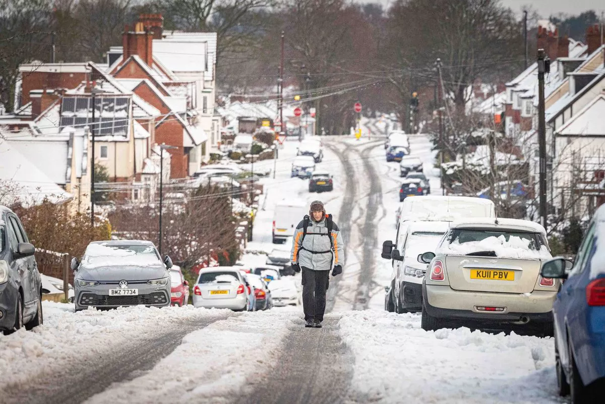
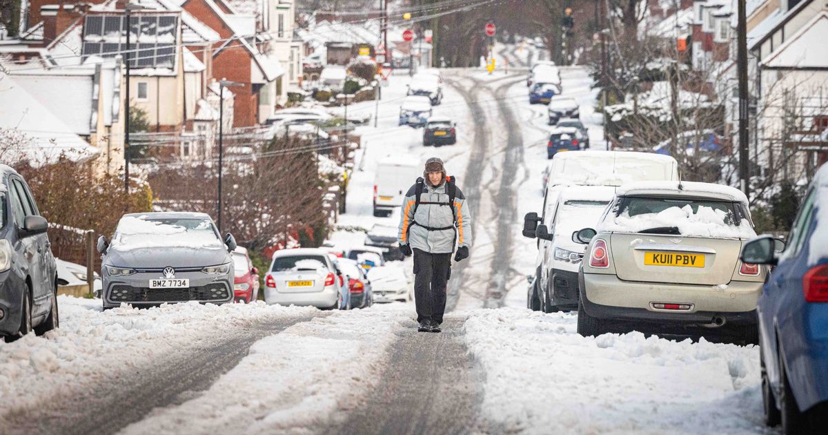
Pineapple Rd, Kings Heath [file image](Image: Nick Wilkinson/Birmingham Live)
UK cities are bracing for a snowstorm in the coming days as forecasts predict a deluge of snow set to engulf several UK areas.
Weather predictions from Metdesk indicate that a weather front is due to traverse the entire UK the week after next, bringing blizzard conditions to numerous regions from east to west.
The inclement weather is expected to hit around midday on Thursday, January 29 battering Brits both up north and down south, according to weather charts from WXCharts.com..
The swath of rain and snow is forecasted to shift eastwards across the UK throughout the day, morphing almost entirely into snow by 6pm, covering a 531-mile stretch from Exmoor to Kearvaig in Scotland.
Cities such as Bristol, Cardiff, Birmingham, Manchester, and Glasgow are all in the crosshairs, with several centimetres per hour predicted to descend across Britain, reports the Mirror.
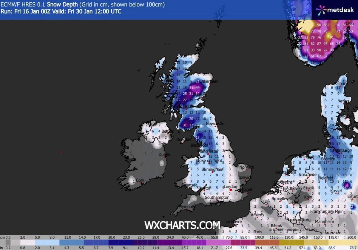
Fri 30 Jan 12:00 snow depth(Image: )
By midday on Friday, January 30, the charts suggest that the thick band of snow will have traversed the UK, but localised blizzards will persist, particularly over London.
The map depicts a band of snow enveloping the nation’s capital, with an estimated one or two centimetres falling per hour.
Simultaneously, a separate map for the same period illustrating snow depth shows most of the UK covered in snow by noon on 30 January, with snowfall continuing over London.
The final map, illustrating snow accumulation throughout the UK, indicates that locations as far south as Southampton might experience between 2-3cm of snowfall on the ground, encompassing the London area. Coverage intensifies across elevated terrain and towards northern regions.
The heaviest deposits are anticipated in Scotland’s eastern Highlands, where drifts could reach 51cm (20 inches).
The Met Office’s extended outlook for Wednesday 21 January through Friday 30 January highlighted an elevated probability of snowfall in various areas.
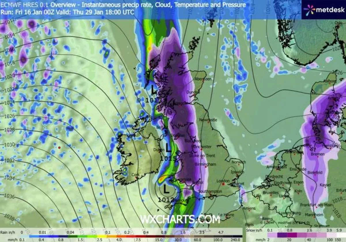
Thurs 29 Jan 18:00(Image: )
“Throughout this period, the UK will see a battle between Atlantic weather systems attempting to arrive from the west while high pressure and colder conditions attempt to exert some influence from the east,” the forecast said.
“Atlantic air is expected to dominate. This should maintain often cloudy, changeable conditions with showers or longer spells of rain for most. The wettest weather in western parts of the country, drier in the east. Temperatures overall likely to be around average with some night frosts in clearer areas.
“Later in the period, there is an increased chance that conditions will turn colder. This aspect of the forecast is still somewhat uncertain but the potential transition to colder weather also increases the chance of snow across parts of the country.”